Manatí elevation
Manatí (Las Tunas), Cuba elevation is 14 meters and Manatí elevation in feet is 46 ft above sea level [src 1]. Manatí is a seat of a second-order administrative division (feature code) with elevation that is 55 meters (180 ft) smaller than average city elevation in Cuba.
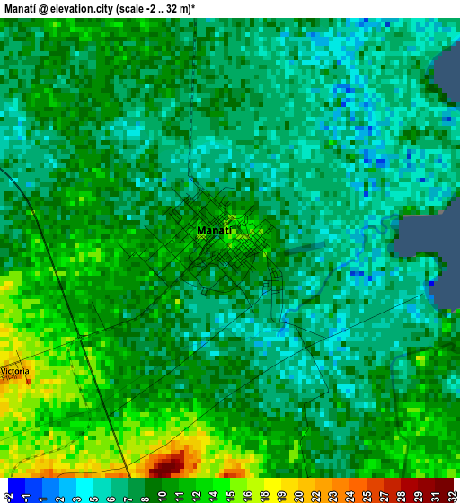
Below is the Elevation map of Manatí, which displays elevation range with different colors. Scale of the first map is from -2 to 32 m (-7 to 105 ft) with average elevation of 9 meters (=30 ft) [note 1]
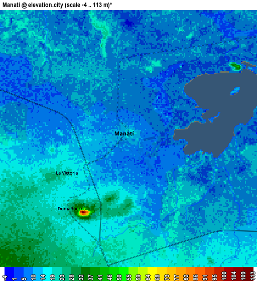
These maps also provides idea of topography and contour of this city, they are displayed at different zoom levels. More info about maps, scale and edge coordinates you can find below images.
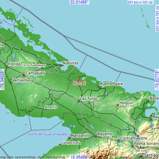
| \ | Map #1 | Map #2 | Topo.Map |
| Scale [m] | -2..32 m | -4..113 m | × |
| Scale [ft] | -7..105 ft | -13..371 ft | × |
| Average | 9 m = 30 ft | 11.5 m = 38 ft | × |
| Width | 9.1 km = 5.7 mi | 18.21 km = 11.3 mi | 291.3 km = 181 mi |
| Height | 9.1 km = 5.7 mi | 18.21 km = 11.3 mi | 291.3 km = 181 mi |
| ↑Max Latitude | 21.351635° | 21.392558° | 22.61486° |
| Latitude at center | 21.3107° | 21.3107° | 21.3107° |
| ↓Min Latitude | 21.269754° | 21.228796° | 19.99486° |
| ← Min Longitude | -76.977975° | -77.021921° | -78.34028° |
| Longitude center | -76.93403° | -76.93403° | -76.93403° |
| →Max Longitude | -76.890085° | -76.846139° | -75.52778° |
Nearby cities:
Cities around Manatí sort by population:
• Las Tunas elevation 91 m
38.8 km,  182°
182°
• Puerto Padre 26 m
36.6 km,  110°
110°
• Nuevitas 27 m
43.1 km,  307°
307°
• Jesús Menéndez 13 m
50 km, 109°
• Jobabo 53 m
57.6 km,  218°
218°
• Guáimaro 84 m
51.8 km,  236°
236°
• Río Cauto 12 m
83.5 km, 178°
• Minas 66 m
72.7 km,  285°
285°
• Colombia 64 m
62.4 km,  234°
234°
• Jobabo 93 m
76 km,  119°
119°
• Sibanicú 92 m
61.9 km,  262°
262°
• Calixto 87 m
43.9 km,  171°
171°
Multilingual:
 En español:
Manatí elevación 14 m.
 En France:
Manatí élévation 14 m.


Sources and notes:
- [note 1] Map square and city borders are not equal. Map elevation data is calculated only from area inside that square.
- [src 1] Elevation data from geonames database provided with same terms of usage.
- [src 2] The elevation map of Manatí is generated using elevation data from NASA's 3 arcsec (90m) resolution SRTM data.
- [src 3] Base (background) map © OpenStreetMap contributors tiles are generated by Geofabrik and OpenTopoMap.
Copyright & License:
This Manatí Elevation Map is licensed under CC BY-SA. You may reuse any part from this page, if you give a proper credit by linking to this URL:
 More info on terms of use page.