Juntas elevation
Juntas (Guanacaste, Abangares), Costa Rica elevation is 154 meters and Juntas elevation in feet is 505 ft above sea level [src 1]. Juntas is a populated place (feature code) with elevation that is 586 meters (1923 ft) smaller than average city elevation in Costa Rica.
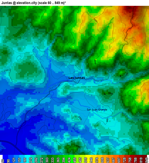
Below is the Elevation map of Juntas, which displays elevation range with different colors. Scale of the first map is from 60 to 849 m (197 to 2785 ft) with average elevation of 279.4 meters (=917 ft) [note 1]
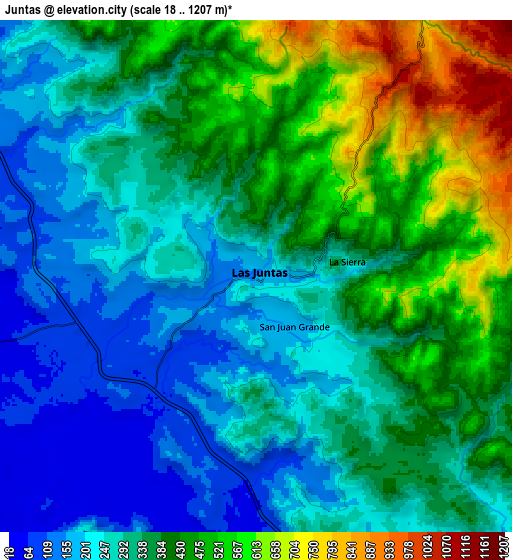
These maps also provides idea of topography and contour of this city, they are displayed at different zoom levels. More info about maps, scale and edge coordinates you can find below images.
| \ | Map #1 | Map #2 | Topo.Map |
| Scale [m] | 60..849 m | 18..1207 m | × |
| Scale [ft] | 197..2785 ft | 59..3960 ft | × |
| Average | 279.4 m = 917 ft | 348.2 m = 1142 ft | × |
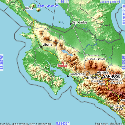
| Width | 9.62 km = 6 mi | 19.23 km = 11.9 mi | 307.7 km = 191.2 mi |
| Height | 9.62 km = 6 mi | 19.23 km = 11.9 mi | 307.7 km = 191.2 mi |
| ↑Max Latitude | 10.324127° | 10.367358° | 11.6614° |
| Latitude at center | 10.28089° | 10.28089° | 10.28089° |
| ↓Min Latitude | 10.237647° | 10.194399° | 8.89432° |
| ← Min Longitude | -85.003455° | -85.047401° | -86.36576° |
| Longitude center | -84.95951° | -84.95951° | -84.95951° |
| →Max Longitude | -84.915565° | -84.871619° | -83.55326° |
Nearby cities:
Cities around Juntas sort by population:
• Puntarenas elevation 9 m
36.4 km,  158°
158°
• Chacarita 7 m
38.5 km,  149°
149°
• Cañas 86 m
22.6 km,  317°
317°
• Esparza 214 m
45.3 km,  134°
134°
• Tilarán 545 m
20.7 km,  357°
357°
• Miramar 339 m
32.7 km, 129°
• Bagaces 84 m
42.3 km,  310°
310°
• La Fortuna 256 m
40.3 km,  58°
58°
• Pocosol 370 m
38.7 km,  75°
75°
• Fortuna 437 m
51 km,  328°
328°
• Nandayure 11 m
38.1 km,  223°
223°
• Zapotal 421 m
48.6 km,  230°
230°
Multilingual:
 En español:
Juntas elevación 154 m.
 En France:
Juntas élévation 154 m.


Sources and notes:
- [note 1] Map square and city borders are not equal. Map elevation data is calculated only from area inside that square.
- [src 1] Elevation data from geonames database provided with same terms of usage.
- [src 2] The elevation map of Juntas is generated using elevation data from NASA's 3 arcsec (90m) resolution SRTM data.
- [src 3] Base (background) map © OpenStreetMap contributors tiles are generated by Geofabrik and OpenTopoMap.
Copyright & License:
This Juntas Elevation Map is licensed under CC BY-SA. You may reuse any part from this page, if you give a proper credit by linking to this URL:
 More info on terms of use page.