Guamo elevation
Guamo (Tolima), Colombia elevation is 323 meters and Guamo elevation in feet is 1060 ft above sea level [src 1]. Guamo is a seat of a second-order administrative division (feature code) with elevation that is 826 meters (2710 ft) smaller than average city elevation in Colombia.
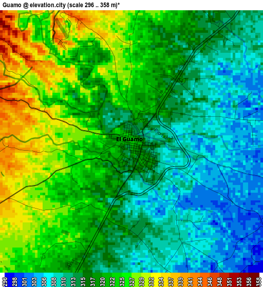
Below is the Elevation map of Guamo, which displays elevation range with different colors. Scale of the first map is from 296 to 358 m (971 to 1175 ft) with average elevation of 318.4 meters (=1045 ft) [note 1]
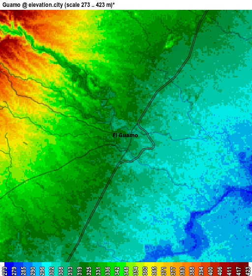
These maps also provides idea of topography and contour of this city, they are displayed at different zoom levels. More info about maps, scale and edge coordinates you can find below images.
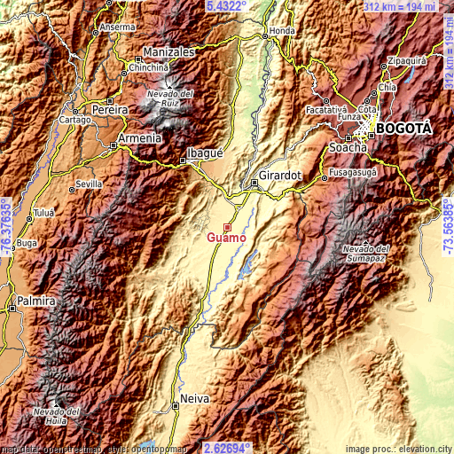
| \ | Map #1 | Map #2 | Topo.Map |
| Scale [m] | 296..358 m | 273..423 m | × |
| Scale [ft] | 971..1175 ft | 896..1388 ft | × |
| Average | 318.4 m = 1045 ft | 323.8 m = 1062 ft | × |
| Width | 9.75 km = 6.1 mi | 19.5 km = 12.1 mi | 311.9 km = 193.8 mi |
| Height | 9.75 km = 6.1 mi | 19.5 km = 12.1 mi | 311.9 km = 193.8 mi |
| ↑Max Latitude | 4.074615° | 4.118448° | 5.4322° |
| Latitude at center | 4.03078° | 4.03078° | 4.03078° |
| ↓Min Latitude | 3.986942° | 3.943102° | 2.62694° |
| ← Min Longitude | -75.014045° | -75.057991° | -76.37635° |
| Longitude center | -74.9701° | -74.9701° | -74.9701° |
| →Max Longitude | -74.926155° | -74.882209° | -73.56385° |
Nearby cities:
Cities around Guamo sort by population:
• Espinal elevation 323 m
16.2 km,  35°
35°
• Chicoral 409 m
20.6 km,  356°
356°
• Purificación 305 m
19.6 km,  167°
167°
• Saldaña 311 m
12.3 km,  203°
203°
• La Chamba 294 m
11.3 km,  92°
92°
• Ortega 393 m
29.8 km,  249°
249°
• Carmen de Apicalá 315 m
30.6 km,  64°
64°
• San Luis 478 m
17.9 km,  309°
309°
• Cunday 457 m
31 km,  83°
83°
• Valle de San Juan 588 m
24.8 km,  318°
318°
• Suárez 292 m
15.5 km, 82°
• Coello 298 m
29.8 km,  15°
15°
Multilingual:
 En español:
Guamo elevación 323 m.
 En France:
Guamo élévation 323 m.


Sources and notes:
- [note 1] Map square and city borders are not equal. Map elevation data is calculated only from area inside that square.
- [src 1] Elevation data from geonames database provided with same terms of usage.
- [src 2] The elevation map of Guamo is generated using elevation data from NASA's 3 arcsec (90m) resolution SRTM data.
- [src 3] Base (background) map © OpenStreetMap contributors tiles are generated by Geofabrik and OpenTopoMap.
Copyright & License:
This Guamo Elevation Map is licensed under CC BY-SA. You may reuse any part from this page, if you give a proper credit by linking to this URL:
 More info on terms of use page.