Miranda elevation
Miranda (Cauca), Colombia elevation is 972 meters and Miranda elevation in feet is 3189 ft above sea level [src 1]. Miranda is a seat of a second-order administrative division (feature code) with elevation that is 177 meters (581 ft) smaller than average city elevation in Colombia.
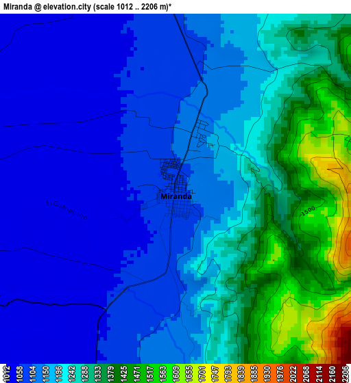
Below is the Elevation map of Miranda, which displays elevation range with different colors. Scale of the first map is from 1012 to 2206 m (3320 to 7238 ft) with average elevation of 1200.1 meters (=3937 ft) [note 1]
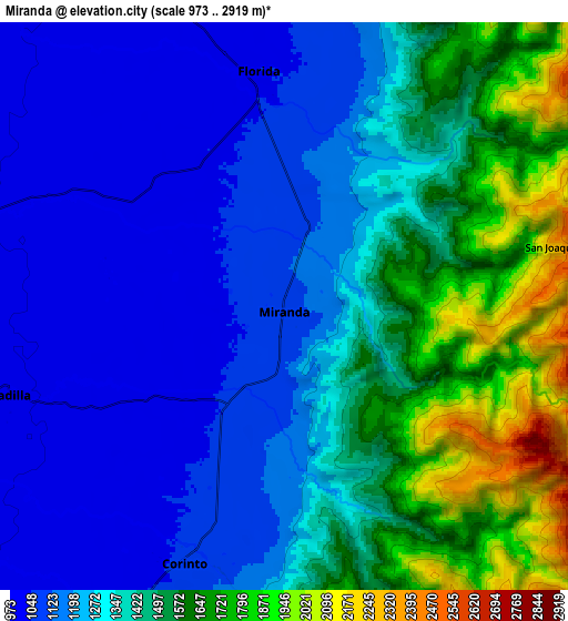
These maps also provides idea of topography and contour of this city, they are displayed at different zoom levels. More info about maps, scale and edge coordinates you can find below images.
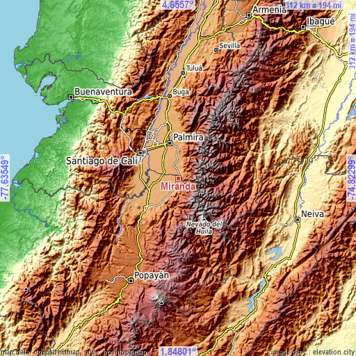
| \ | Map #1 | Map #2 | Topo.Map |
| Scale [m] | 1012..2206 m | 973..2919 m | × |
| Scale [ft] | 3320..7238 ft | 3192..9577 ft | × |
| Average | 1200.1 m = 3937 ft | 1353.5 m = 4441 ft | × |
| Width | 9.76 km = 6.1 mi | 19.51 km = 12.1 mi | 312.2 km = 194 mi |
| Height | 9.76 km = 6.1 mi | 19.51 km = 12.1 mi | 312.2 km = 194 mi |
| ↑Max Latitude | 3.296704° | 3.340575° | 4.6557° |
| Latitude at center | 3.25283° | 3.25283° | 3.25283° |
| ↓Min Latitude | 3.208955° | 3.165077° | 1.84801° |
| ← Min Longitude | -76.273185° | -76.317131° | -77.63549° |
| Longitude center | -76.22924° | -76.22924° | -76.22924° |
| →Max Longitude | -76.185295° | -76.141349° | -74.82299° |
Nearby cities:
Cities around Miranda sort by population:
• Palmira elevation 1005 m
32.9 km,  345°
345°
• Puerto Tejada 969 m
20.9 km,  263°
263°
• Florida 1043 m
7.7 km,  355°
355°
• Jamundí 972 m
34 km,  271°
271°
• Pradera 1054 m
18.8 km, 354°
• Candelaria 977 m
21.6 km,  322°
322°
• Corinto 1059 m
9.6 km,  202°
202°
• Caloto 1095 m
31.2 km,  219°
219°
• Padilla 992 m
10.1 km,  248°
248°
• Toribío 1700 m
33.4 km,  187°
187°
• Villa Rica 971 m
27.3 km, 251°
• Guachené 997 m
22.5 km,  233°
233°
Multilingual:
 En español:
Miranda elevación 972 m.
 En France:
Miranda élévation 972 m.


Sources and notes:
- [note 1] Map square and city borders are not equal. Map elevation data is calculated only from area inside that square.
- [src 1] Elevation data from geonames database provided with same terms of usage.
- [src 2] The elevation map of Miranda is generated using elevation data from NASA's 3 arcsec (90m) resolution SRTM data.
- [src 3] Base (background) map © OpenStreetMap contributors tiles are generated by Geofabrik and OpenTopoMap.
Copyright & License:
This Miranda Elevation Map is licensed under CC BY-SA. You may reuse any part from this page, if you give a proper credit by linking to this URL:
 More info on terms of use page.