Moñitos elevation
Moñitos (Córdoba, Tierralta), Colombia elevation is 44 meters and Moñitos elevation in feet is 144 ft above sea level [src 1]. Moñitos is a populated place (feature code) with elevation that is 1105 meters (3625 ft) smaller than average city elevation in Colombia.
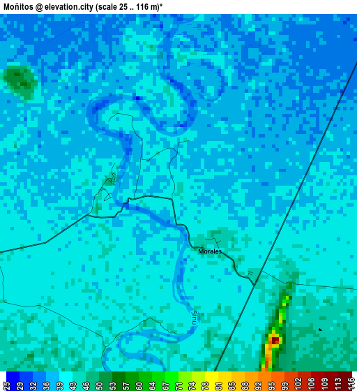
Below is the Elevation map of Moñitos, which displays elevation range with different colors. Scale of the first map is from 25 to 116 m (82 to 381 ft) with average elevation of 39.5 meters (=130 ft) [note 1]
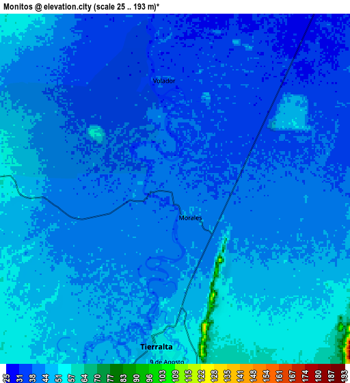
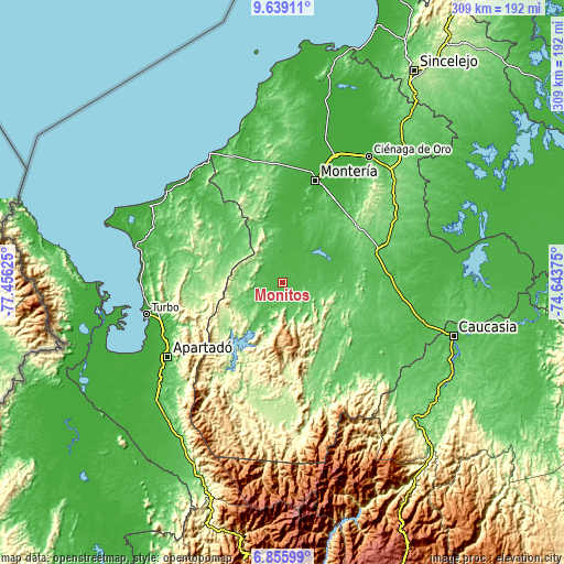
These maps also provides idea of topography and contour of this city, they are displayed at different zoom levels. More info about maps, scale and edge coordinates you can find below images.
| \ | Map #1 | Map #2 | Topo.Map |
| Scale [m] | 25..116 m | 25..193 m | × |
| Scale [ft] | 82..381 ft | 82..633 ft | × |
| Average | 39.5 m = 130 ft | 42.4 m = 139 ft | × |
| Width | 9.67 km = 6 mi | 19.34 km = 12 mi | 309.5 km = 192.3 mi |
| Height | 9.67 km = 6 mi | 19.34 km = 12 mi | 309.5 km = 192.3 mi |
| ↑Max Latitude | 8.293488° | 8.336971° | 9.63911° |
| Latitude at center | 8.25° | 8.25° | 8.25° |
| ↓Min Latitude | 8.206507° | 8.163009° | 6.85599° |
| ← Min Longitude | -76.093945° | -76.137891° | -77.45625° |
| Longitude center | -76.05° | -76.05° | -76.05° |
| →Max Longitude | -76.006055° | -75.962109° | -74.64375° |
Nearby cities:
Cities around Moñitos sort by population:
• Montería elevation 19 m
58.4 km,  18°
18°
• Planeta Rica 88 m
54.2 km,  70°
70°
• Tierralta 51 m
8.6 km,  186°
186°
• San Carlos 15 m
71.9 km,  32°
32°
• San Pedro de Urabá 141 m
36 km,  274°
274°
• Valencia 62 m
11 km, 274°
• San Carlos 27 m
66.2 km, 33°
• Canalete 103 m
50.3 km,  340°
340°
• Pueblo Nuevo 122 m
65.8 km,  64°
64°
• Canalete 51 m
63.1 km, 340°
• Buenavista 66 m
62.6 km,  92°
92°
• Puerto Libertador 112 m
57.9 km,  133°
133°
Multilingual:
 En español:
Moñitos elevación 44 m.
 En France:
Moñitos élévation 44 m.


Sources and notes:
- [note 1] Map square and city borders are not equal. Map elevation data is calculated only from area inside that square.
- [src 1] Elevation data from geonames database provided with same terms of usage.
- [src 2] The elevation map of Moñitos is generated using elevation data from NASA's 3 arcsec (90m) resolution SRTM data.
- [src 3] Base (background) map © OpenStreetMap contributors tiles are generated by Geofabrik and OpenTopoMap.
Copyright & License:
This Moñitos Elevation Map is licensed under CC BY-SA. You may reuse any part from this page, if you give a proper credit by linking to this URL:
 More info on terms of use page.