San Pedro de Urabá elevation
San Pedro de Urabá (Antioquia, San Pedro de Uraba), Colombia elevation is 141 meters and San Pedro de Urabá elevation in feet is 463 ft above sea level [src 1]. San Pedro de Urabá is a seat of a second-order administrative division (feature code) with elevation that is 1008 meters (3307 ft) smaller than average city elevation in Colombia.
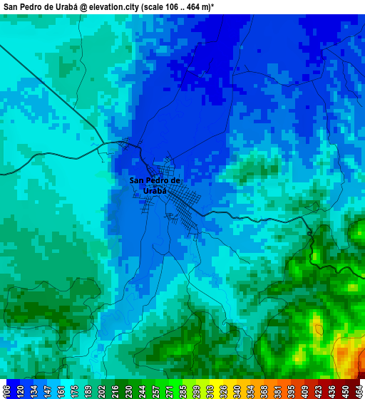
Below is the Elevation map of San Pedro de Urabá, which displays elevation range with different colors. Scale of the first map is from 106 to 464 m (348 to 1522 ft) with average elevation of 171.4 meters (=562 ft) [note 1]
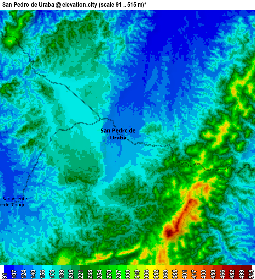
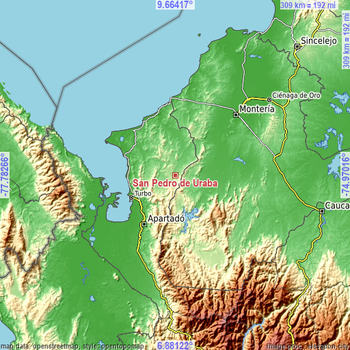
These maps also provides idea of topography and contour of this city, they are displayed at different zoom levels. More info about maps, scale and edge coordinates you can find below images.
| \ | Map #1 | Map #2 | Topo.Map |
| Scale [m] | 106..464 m | 91..515 m | × |
| Scale [ft] | 348..1522 ft | 299..1690 ft | × |
| Average | 171.4 m = 562 ft | 185.4 m = 608 ft | × |
| Width | 9.67 km = 6 mi | 19.34 km = 12 mi | 309.4 km = 192.3 mi |
| Height | 9.67 km = 6 mi | 19.34 km = 12 mi | 309.5 km = 192.3 mi |
| ↑Max Latitude | 8.318635° | 8.362116° | 9.66417° |
| Latitude at center | 8.27515° | 8.27515° | 8.27515° |
| ↓Min Latitude | 8.23166° | 8.188165° | 6.88122° |
| ← Min Longitude | -76.420355° | -76.464301° | -77.78266° |
| Longitude center | -76.37641° | -76.37641° | -76.37641° |
| →Max Longitude | -76.332465° | -76.288519° | -74.97016° |
Nearby cities:
Cities around San Pedro de Urabá sort by population:
• Apartadó elevation 31 m
51.5 km,  212°
212°
• Turbo 6 m
43.7 km,  242°
242°
• Tierralta 51 m
36.7 km,  107°
107°
• Carepa 38 m
65 km, 207°
• Necoclí 4 m
48.4 km,  290°
290°
• San Juan de Urabá 22 m
56.4 km,  342°
342°
• Valencia 62 m
25.1 km,  94°
94°
• Arboletes 10 m
64.2 km,  355°
355°
• Moñitos 44 m
36 km, 94°
• Canalete 103 m
48.4 km,  23°
23°
• Los Córdobas 10 m
68.9 km,  2°
2°
• Canalete 51 m
58.7 km,  14°
14°
Multilingual:
 En español:
San Pedro de Urabá elevación 141 m.
 En France:
San Pedro de Urabá élévation 141 m.
 Auf Deutsch:
San Pedro de Urabá höhe über dem Meeresspiegel ist 141 m.
 На русском:
San Pedro de Urabá высота над уровнем моря 141 м
Sources and notes:
- [note 1] Map square and city borders are not equal. Map elevation data is calculated only from area inside that square.
- [src 1] Elevation data from geonames database provided with same terms of usage.
- [src 2] The elevation map of San Pedro de Urabá is generated using elevation data from NASA's 3 arcsec (90m) resolution SRTM data.
- [src 3] Base (background) map © OpenStreetMap contributors tiles are generated by Geofabrik and OpenTopoMap.
Copyright & License:
This San Pedro de Urabá Elevation Map is licensed under CC BY-SA. You may reuse any part from this page, if you give a proper credit by linking to this URL:
 More info on terms of use page.