Payandé elevation
Payandé (Tolima, San Luis), Colombia elevation is 700 meters and Payandé elevation in feet is 2297 ft above sea level [src 1]. Payandé is a populated place (feature code) with elevation that is 449 meters (1473 ft) smaller than average city elevation in Colombia.
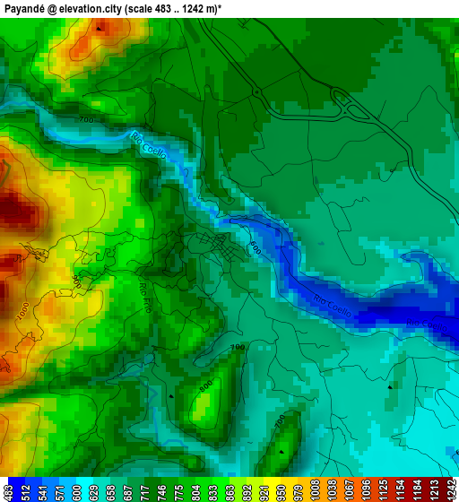
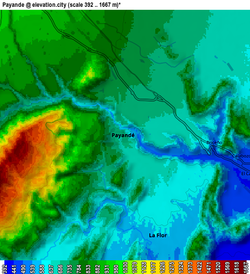
Below is the Elevation map of Payandé, which displays elevation range with different colors. Scale of the first map is from 483 to 1242 m (1585 to 4075 ft) with average elevation of 739.4 meters (=2426 ft) [note 1]
These maps also provides idea of topography and contour of this city, they are displayed at different zoom levels. More info about maps, scale and edge coordinates you can find below images.
| \ | Map #1 | Map #2 | Topo.Map |
| Scale [m] | 483..1242 m | 392..1667 m | × |
| Scale [ft] | 1585..4075 ft | 1286..5469 ft | × |
| Average | 739.4 m = 2426 ft | 768.5 m = 2521 ft | × |
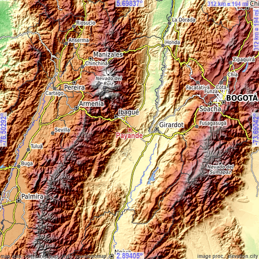
| Width | 9.74 km = 6.1 mi | 19.49 km = 12.1 mi | 311.8 km = 193.7 mi |
| Height | 9.74 km = 6.1 mi | 19.49 km = 12.1 mi | 311.8 km = 193.7 mi |
| ↑Max Latitude | 4.34132° | 4.385138° | 5.69837° |
| Latitude at center | 4.2975° | 4.2975° | 4.2975° |
| ↓Min Latitude | 4.253677° | 4.209851° | 2.89405° |
| ← Min Longitude | -75.140615° | -75.184561° | -76.50292° |
| Longitude center | -75.09667° | -75.09667° | -75.09667° |
| →Max Longitude | -75.052725° | -75.008779° | -73.69042° |
Nearby cities:
Cities around Payandé sort by population:
• Ibagué elevation 1229 m
21.7 km,  316°
316°
• Espinal 323 m
28.7 km,  124°
124°
• Flandes 285 m
31.1 km,  91°
91°
• Chicoral 409 m
15.7 km,  125°
125°
• Coello 1303 m
24.8 km,  298°
298°
• Rovira 867 m
17.2 km,  247°
247°
• San Luis 478 m
18.3 km,  179°
179°
• Doima 603 m
19.7 km,  43°
43°
• Laureles 1724 m
25.4 km,  260°
260°
• Valle de San Juan 588 m
11.2 km,  191°
191°
• Nariño 264 m
31.9 km,  69°
69°
• Coello 298 m
22 km, 92°
Multilingual:
 En español:
Payandé elevación 700 m.
 En France:
Payandé élévation 700 m.


Sources and notes:
- [note 1] Map square and city borders are not equal. Map elevation data is calculated only from area inside that square.
- [src 1] Elevation data from geonames database provided with same terms of usage.
- [src 2] The elevation map of Payandé is generated using elevation data from NASA's 3 arcsec (90m) resolution SRTM data.
- [src 3] Base (background) map © OpenStreetMap contributors tiles are generated by Geofabrik and OpenTopoMap.
Copyright & License:
This Payandé Elevation Map is licensed under CC BY-SA. You may reuse any part from this page, if you give a proper credit by linking to this URL:
 More info on terms of use page.