Riofrío elevation
Riofrío (Valle del Cauca), Colombia elevation is 942 meters and Riofrío elevation in feet is 3091 ft above sea level [src 1]. Riofrío is a seat of a second-order administrative division (feature code) with elevation that is 207 meters (679 ft) smaller than average city elevation in Colombia.
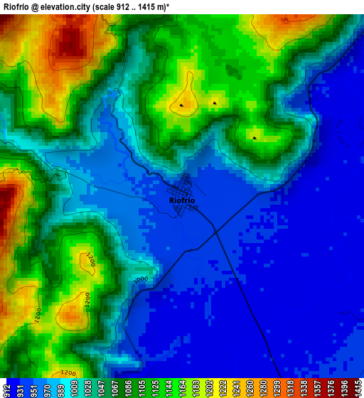
Below is the Elevation map of Riofrío, which displays elevation range with different colors. Scale of the first map is from 912 to 1415 m (2992 to 4642 ft) with average elevation of 1039.3 meters (=3410 ft) [note 1]
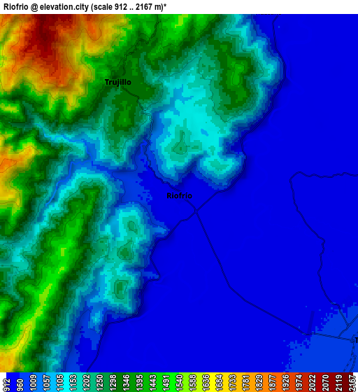
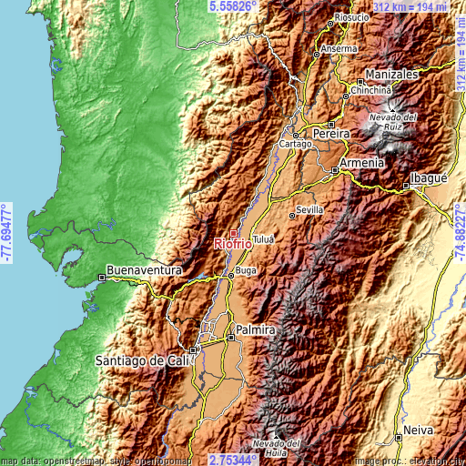
These maps also provides idea of topography and contour of this city, they are displayed at different zoom levels. More info about maps, scale and edge coordinates you can find below images.
| \ | Map #1 | Map #2 | Topo.Map |
| Scale [m] | 912..1415 m | 912..2167 m | × |
| Scale [ft] | 2992..4642 ft | 2992..7110 ft | × |
| Average | 1039.3 m = 3410 ft | 1139.8 m = 3740 ft | × |
| Width | 9.75 km = 6.1 mi | 19.49 km = 12.1 mi | 311.9 km = 193.8 mi |
| Height | 9.75 km = 6.1 mi | 19.49 km = 12.1 mi | 311.9 km = 193.8 mi |
| ↑Max Latitude | 4.200928° | 4.244754° | 5.55826° |
| Latitude at center | 4.1571° | 4.1571° | 4.1571° |
| ↓Min Latitude | 4.113269° | 4.069436° | 2.75344° |
| ← Min Longitude | -76.332465° | -76.376411° | -77.69477° |
| Longitude center | -76.28852° | -76.28852° | -76.28852° |
| →Max Longitude | -76.244575° | -76.200629° | -74.88227° |
Nearby cities:
Cities around Riofrío sort by population:
• Tuluá elevation 974 m
13.1 km,  127°
127°
• Guadalajara de Buga 979 m
28.5 km,  182°
182°
• Zarzal 921 m
35.7 km,  42°
42°
• Roldanillo 945 m
32.1 km,  27°
27°
• Andalucía 958 m
13.6 km,  83°
83°
• Darien 1521 m
33.2 km,  220°
220°
• Bugalagrande 948 m
16 km,  67°
67°
• Yotoco 956 m
34.6 km,  197°
197°
• Trujillo 1314 m
7 km,  330°
330°
• San Pedro 988 m
19.3 km,  159°
159°
• Bolívar 931 m
23.3 km, 29°
• Calimita 1542 m
35.6 km, 221°
Multilingual:
 En español:
Riofrío elevación 942 m.
 En France:
Riofrío élévation 942 m.


Sources and notes:
- [note 1] Map square and city borders are not equal. Map elevation data is calculated only from area inside that square.
- [src 1] Elevation data from geonames database provided with same terms of usage.
- [src 2] The elevation map of Riofrío is generated using elevation data from NASA's 3 arcsec (90m) resolution SRTM data.
- [src 3] Base (background) map © OpenStreetMap contributors tiles are generated by Geofabrik and OpenTopoMap.
Copyright & License:
This Riofrío Elevation Map is licensed under CC BY-SA. You may reuse any part from this page, if you give a proper credit by linking to this URL:
 More info on terms of use page.