San Martín elevation
San Martín (Meta), Colombia elevation is 425 meters and San Martín elevation in feet is 1394 ft above sea level [src 1]. San Martín is a seat of a second-order administrative division (feature code) with elevation that is 724 meters (2375 ft) smaller than average city elevation in Colombia.
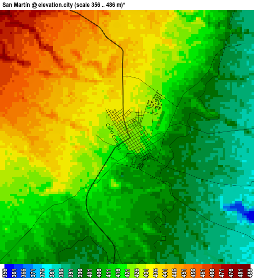
Below is the Elevation map of San Martín, which displays elevation range with different colors. Scale of the first map is from 356 to 486 m (1168 to 1594 ft) with average elevation of 417.5 meters (=1370 ft) [note 1]
These maps also provides idea of topography and contour of this city, they are displayed at different zoom levels. More info about maps, scale and edge coordinates you can find below images.
| \ | Map #1 | Map #2 | Topo.Map |
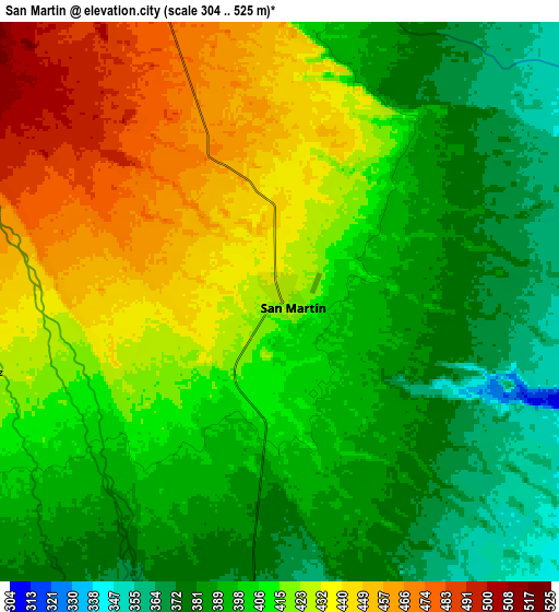
| Scale [m] | 356..486 m | 304..525 m | × |
| Scale [ft] | 1168..1594 ft | 997..1722 ft | × |
| Average | 417.5 m = 1370 ft | 408.9 m = 1342 ft | × |
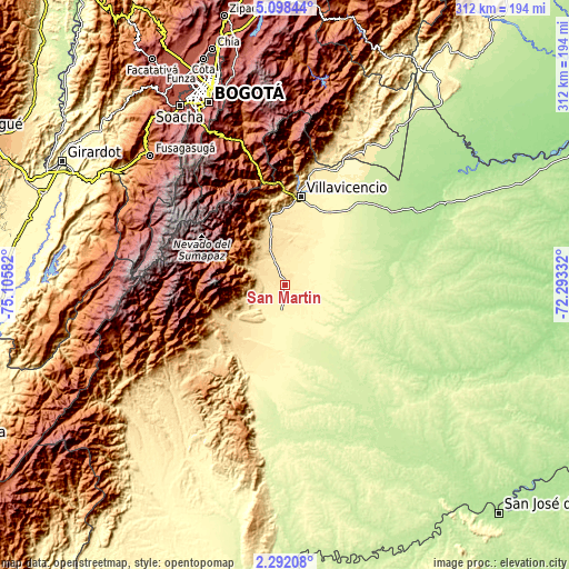
| Width | 9.75 km = 6.1 mi | 19.5 km = 12.1 mi | 312 km = 193.9 mi |
| Height | 9.75 km = 6.1 mi | 19.5 km = 12.1 mi | 312.1 km = 193.9 mi |
| ↑Max Latitude | 3.740223° | 3.784073° | 5.09844° |
| Latitude at center | 3.69637° | 3.69637° | 3.69637° |
| ↓Min Latitude | 3.652515° | 3.608658° | 2.29208° |
| ← Min Longitude | -73.743515° | -73.787461° | -75.10582° |
| Longitude center | -73.69957° | -73.69957° | -73.69957° |
| →Max Longitude | -73.655625° | -73.611679° | -72.29332° |
Nearby cities:
Cities around San Martín sort by population:
• Villavicencio elevation 441 m
50.2 km,  9°
9°
• Acacías 530 m
33 km,  348°
348°
• Granada 336 m
16.7 km,  182°
182°
• Lejanías 689 m
40.5 km,  242°
242°
• Guamal 522 m
21.7 km,  340°
340°
• Fuente de Oro 301 m
27.4 km,  161°
161°
• San Juan de Arama 438 m
41.1 km,  207°
207°
• El Castillo 350 m
18.2 km,  215°
215°
• Cubarral 589 m
19.1 km,  305°
305°
• San Carlos de Guaroa 224 m
50.6 km,  88°
88°
• Castilla La Nueva 417 m
14.6 km,  4°
4°
• El Dorado 548 m
15.8 km,  287°
287°
Multilingual:
 En español:
San Martín elevación 425 m.
 En France:
San Martín élévation 425 m.
 Auf Deutsch:
San Martín höhe über dem Meeresspiegel ist 425 m.

Sources and notes:
- [note 1] Map square and city borders are not equal. Map elevation data is calculated only from area inside that square.
- [src 1] Elevation data from geonames database provided with same terms of usage.
- [src 2] The elevation map of San Martín is generated using elevation data from NASA's 3 arcsec (90m) resolution SRTM data.
- [src 3] Base (background) map © OpenStreetMap contributors tiles are generated by Geofabrik and OpenTopoMap.
Copyright & License:
This San Martín Elevation Map is licensed under CC BY-SA. You may reuse any part from this page, if you give a proper credit by linking to this URL:
 More info on terms of use page.