San Onofre elevation
San Onofre (Sucre), Colombia elevation is 37 meters and San Onofre elevation in feet is 121 ft above sea level [src 1]. San Onofre is a seat of a second-order administrative division (feature code) with elevation that is 1112 meters (3648 ft) smaller than average city elevation in Colombia.
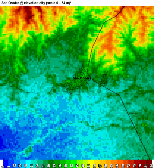
Below is the Elevation map of San Onofre, which displays elevation range with different colors. Scale of the first map is from 6 to 84 m (20 to 276 ft) with average elevation of 31.4 meters (=103 ft) [note 1]
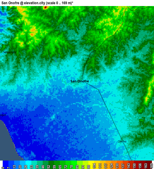
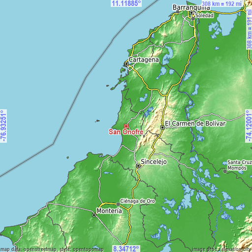
These maps also provides idea of topography and contour of this city, they are displayed at different zoom levels. More info about maps, scale and edge coordinates you can find below images.
| \ | Map #1 | Map #2 | Topo.Map |
| Scale [m] | 6..84 m | 0..169 m | × |
| Scale [ft] | 20..276 ft | 0..554 ft | × |
| Average | 31.4 m = 103 ft | 38.4 m = 126 ft | × |
| Width | 9.63 km = 6 mi | 19.26 km = 12 mi | 308.2 km = 191.5 mi |
| Height | 9.63 km = 6 mi | 19.26 km = 12 mi | 308.2 km = 191.5 mi |
| ↑Max Latitude | 9.77917° | 9.822474° | 11.11885° |
| Latitude at center | 9.73586° | 9.73586° | 9.73586° |
| ↓Min Latitude | 9.692545° | 9.649224° | 8.34712° |
| ← Min Longitude | -75.570205° | -75.614151° | -76.93251° |
| Longitude center | -75.52626° | -75.52626° | -75.52626° |
| →Max Longitude | -75.482315° | -75.438369° | -74.12001° |
Nearby cities:
Cities around San Onofre sort by population:
• El Carmen de Bolívar elevation 153 m
44.5 km,  92°
92°
• Santiago de Tolú 10 m
24.3 km,  194°
194°
• María la Baja 15 m
36.9 km,  41°
41°
• San Jacinto 235 m
45.5 km,  77°
77°
• San Pablo 14 m
45.1 km, 38°
• Ovejas 255 m
40 km,  125°
125°
• Tolú Viejo 68 m
33.1 km,  163°
163°
• Palmito 38 m
44.9 km,  182°
182°
• San Cristóbal 89 m
33.9 km,  62°
62°
• Colosó 138 m
32.9 km,  144°
144°
• Chalán 289 m
31.5 km, 131°
• Coveñas 1 m
40.7 km,  204°
204°
Multilingual:
 En español:
San Onofre elevación 37 m.
 En France:
San Onofre élévation 37 m.
 Auf Deutsch:
San Onofre höhe über dem Meeresspiegel ist 37 m.

Sources and notes:
- [note 1] Map square and city borders are not equal. Map elevation data is calculated only from area inside that square.
- [src 1] Elevation data from geonames database provided with same terms of usage.
- [src 2] The elevation map of San Onofre is generated using elevation data from NASA's 3 arcsec (90m) resolution SRTM data.
- [src 3] Base (background) map © OpenStreetMap contributors tiles are generated by Geofabrik and OpenTopoMap.
Copyright & License:
This San Onofre Elevation Map is licensed under CC BY-SA. You may reuse any part from this page, if you give a proper credit by linking to this URL:
 More info on terms of use page.