Sibaté elevation
Sibaté (Cundinamarca), Colombia elevation is 2684 meters and Sibaté elevation in feet is 8806 ft above sea level [src 1]. Sibaté is a seat of a second-order administrative division (feature code) with elevation that is 1535 meters (5036 ft) bigger than average city elevation in Colombia.
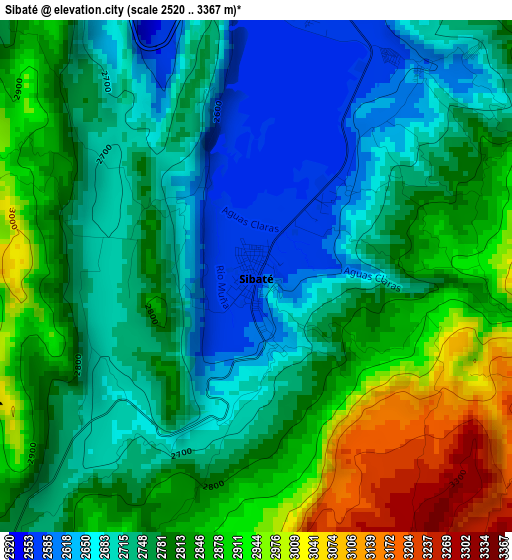
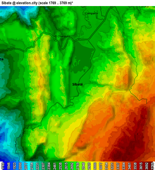
Below is the Elevation map of Sibaté, which displays elevation range with different colors. Scale of the first map is from 2520 to 3367 m (8268 to 11047 ft) with average elevation of 2788 meters (=9147 ft) [note 1]
These maps also provides idea of topography and contour of this city, they are displayed at different zoom levels. More info about maps, scale and edge coordinates you can find below images.
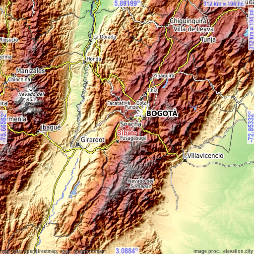
| \ | Map #1 | Map #2 | Topo.Map |
| Scale [m] | 2520..3367 m | 1769..3769 m | × |
| Scale [ft] | 8268..11047 ft | 5804..12365 ft | × |
| Average | 2788 m = 9147 ft | 2817.2 m = 9243 ft | × |
| Width | 9.74 km = 6.1 mi | 19.49 km = 12.1 mi | 311.7 km = 193.7 mi |
| Height | 9.74 km = 6.1 mi | 19.48 km = 12.1 mi | 311.8 km = 193.7 mi |
| ↑Max Latitude | 4.535349° | 4.579155° | 5.89199° |
| Latitude at center | 4.49154° | 4.49154° | 4.49154° |
| ↓Min Latitude | 4.447728° | 4.403914° | 3.0884° |
| ← Min Longitude | -74.303515° | -74.347461° | -75.66582° |
| Longitude center | -74.25957° | -74.25957° | -74.25957° |
| →Max Longitude | -74.215625° | -74.171679° | -72.85332° |
Nearby cities:
Cities around Sibaté sort by population:
• Bogotá elevation 2582 m
23.7 km,  56°
56°
• Soacha 2565 m
10.9 km,  25°
25°
• Fusagasugá 1717 m
20.8 km,  213°
213°
• Funza 2548 m
25.6 km,  11°
11°
• Mosquera 2544 m
24.1 km, 7°
• Silvania 1459 m
17.1 km,  235°
235°
• Pasca 2183 m
21 km,  192°
192°
• Chipaque 2438 m
24.5 km,  102°
102°
• San Antonio del Tequendama 1541 m
17.2 km,  323°
323°
• Tena 1430 m
23.8 km, 321°
• El Colegio 1052 m
22.6 km,  296°
296°
• Granada 2279 m
10.8 km,  287°
287°
Multilingual:
 En español:
Sibaté elevación 2684 m.
 En France:
Sibaté élévation 2684 m.


Sources and notes:
- [note 1] Map square and city borders are not equal. Map elevation data is calculated only from area inside that square.
- [src 1] Elevation data from geonames database provided with same terms of usage.
- [src 2] The elevation map of Sibaté is generated using elevation data from NASA's 3 arcsec (90m) resolution SRTM data.
- [src 3] Base (background) map © OpenStreetMap contributors tiles are generated by Geofabrik and OpenTopoMap.
Copyright & License:
This Sibaté Elevation Map is licensed under CC BY-SA. You may reuse any part from this page, if you give a proper credit by linking to this URL:
 More info on terms of use page.