Hami elevation
Hami (Xinjiang), China elevation is 762 meters and Hami elevation in feet is 2500 ft above sea level [src 1]. Hami is a populated place (feature code) with elevation that is 204 meters (669 ft) bigger than average city elevation in China.
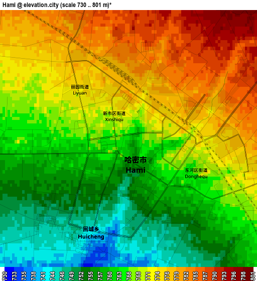
Below is the Elevation map of Hami, which displays elevation range with different colors. Scale of the first map is from 730 to 801 m (2395 to 2628 ft) with average elevation of 767.1 meters (=2517 ft) [note 1]
These maps also provides idea of topography and contour of this city, they are displayed at different zoom levels. More info about maps, scale and edge coordinates you can find below images.
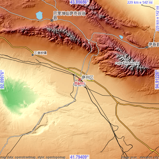
| \ | Map #1 | Map #2 | Topo.Map |
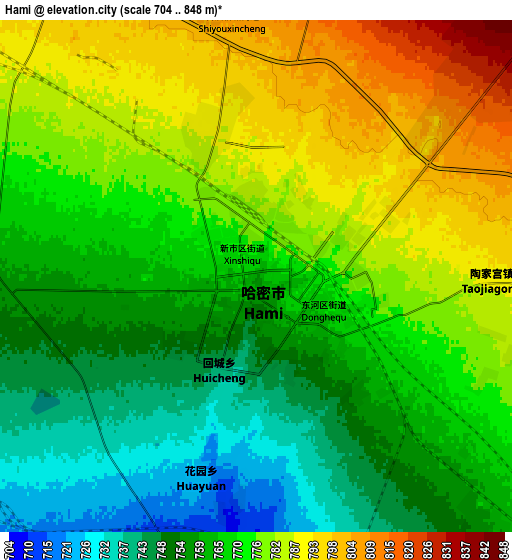
| Scale [m] | 730..801 m | 704..848 m | × |
| Scale [ft] | 2395..2628 ft | 2310..2782 ft | × |
| Average | 767.1 m = 2517 ft | 769.6 m = 2525 ft | × |
| Width | 7.17 km = 4.5 mi | 14.33 km = 8.9 mi | 229.3 km = 142.5 mi |
| Height | 7.17 km = 4.5 mi | 14.33 km = 8.9 mi | 229.3 km = 142.5 mi |
| ↑Max Latitude | 42.866148° | 42.898349° | 43.85656° |
| Latitude at center | 42.83393° | 42.83393° | 42.83393° |
| ↓Min Latitude | 42.801695° | 42.769444° | 41.79409° |
| ← Min Longitude | 93.462065° | 93.418119° | 92.09976° |
| Longitude center | 93.50601° | 93.50601° | 93.50601° |
| →Max Longitude | 93.549955° | 93.593901° | 94.91226° |
Nearby cities:
Cities around Hami sort by population:
• Dangchengwan elevation 3277 m
392.3 km,  160°
160°
• Hongliuwan 1681 m
362.7 km,  168°
168°
• Yuanquan 1178 m
321.9 km,  143°
143°
• Shazhou 1144 m
314.8 km, 162°
• Mori 1238 m
289.6 km,  292°
292°
• Shanshan 367 m
269.1 km,  270°
270°
• Yiwu 1681 m
107 km,  64°
64°
• Barkol 1630 m
94.1 km,  334°
334°
Multilingual:
 En español:
Hami elevación 762 m.
 En France:
Hami élévation 762 m.


Sources and notes:
- [note 1] Map square and city borders are not equal. Map elevation data is calculated only from area inside that square.
- [src 1] Elevation data from geonames database provided with same terms of usage.
- [src 2] The elevation map of Hami is generated using elevation data from NASA's 3 arcsec (90m) resolution SRTM data.
- [src 3] Base (background) map © OpenStreetMap contributors tiles are generated by Geofabrik and OpenTopoMap.
Copyright & License:
This Hami Elevation Map is licensed under CC BY-SA. You may reuse any part from this page, if you give a proper credit by linking to this URL:
 More info on terms of use page.