Turpan elevation
Turpan (Xinjiang), China elevation is 41 meters and Turpan elevation in feet is 135 ft above sea level [src 1]. Turpan is a seat of a third-order administrative division (feature code) with elevation that is 517 meters (1696 ft) smaller than average city elevation in China.
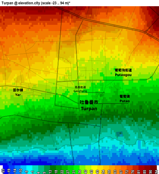
Below is the Elevation map of Turpan, which displays elevation range with different colors. Scale of the first map is from -23 to 94 m (-75 to 308 ft) with average elevation of 35.3 meters (=116 ft) [note 1]
These maps also provides idea of topography and contour of this city, they are displayed at different zoom levels. More info about maps, scale and edge coordinates you can find below images.
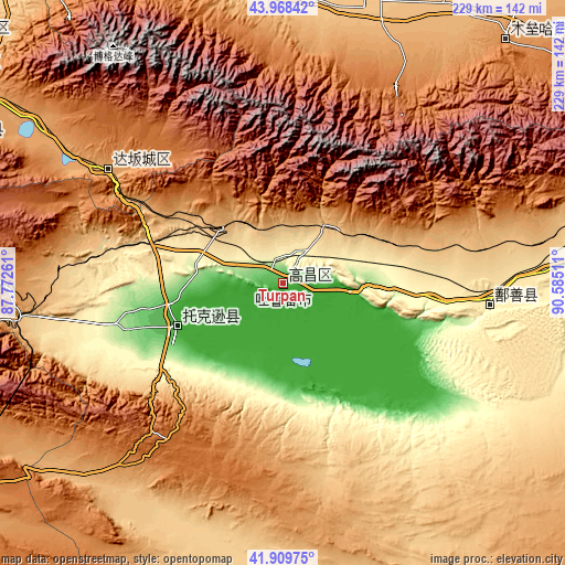
| \ | Map #1 | Map #2 | Topo.Map |
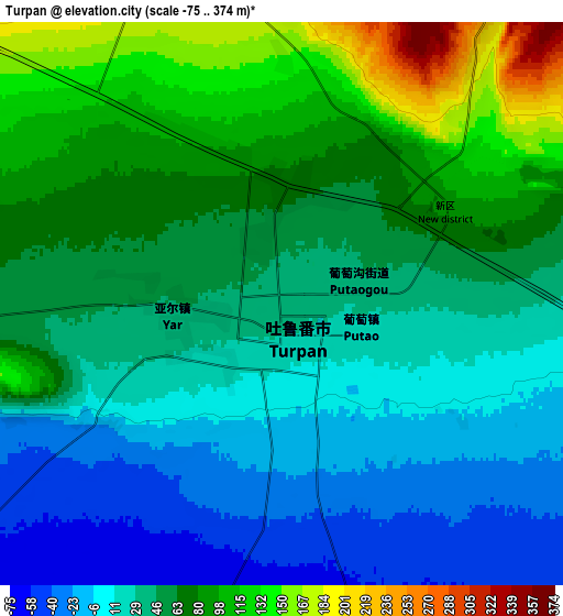
| Scale [m] | -23..94 m | -75..374 m | × |
| Scale [ft] | -75..308 ft | -246..1227 ft | × |
| Average | 35.3 m = 116 ft | 48.7 m = 160 ft | × |
| Width | 7.15 km = 4.4 mi | 14.31 km = 8.9 mi | 228.9 km = 142.2 mi |
| Height | 7.15 km = 4.4 mi | 14.31 km = 8.9 mi | 228.9 km = 142.2 mi |
| ↑Max Latitude | 42.979849° | 43.01199° | 43.96842° |
| Latitude at center | 42.94769° | 42.94769° | 42.94769° |
| ↓Min Latitude | 42.915515° | 42.883323° | 41.90975° |
| ← Min Longitude | 89.134915° | 89.090969° | 87.77261° |
| Longitude center | 89.17886° | 89.17886° | 89.17886° |
| →Max Longitude | 89.222805° | 89.266751° | 90.58511° |
Nearby cities:
Cities around Turpan sort by population:
• Ürümqi elevation 862 m
159 km,  306°
306°
• Gumudi 633 m
165.3 km, 312°
• Beijinglu 809 m
162.7 km, 307°
• Shuimogou 867 m
158.4 km, 308°
• Yangzi Jianglu 912 m
158 km, 305°
• Xingfulu 916 m
155.4 km, 306°
• Mori 1238 m
127.4 km,  40°
40°
• Qitai 759 m
124.4 km,  15°
15°
• Jimsar 786 m
115.5 km,  355°
355°
• Shanshan 367 m
84 km,  96°
96°
• Dabancheng 1107 m
83.3 km,  303°
303°
• Toksun 5 m
47 km,  248°
248°
Multilingual:
 En español:
Turfán elevación 41 m.
 En France:
Tourfan élévation 41 m.


Sources and notes:
- [note 1] Map square and city borders are not equal. Map elevation data is calculated only from area inside that square.
- [src 1] Elevation data from geonames database provided with same terms of usage.
- [src 2] The elevation map of Turpan is generated using elevation data from NASA's 3 arcsec (90m) resolution SRTM data.
- [src 3] Base (background) map © OpenStreetMap contributors tiles are generated by Geofabrik and OpenTopoMap.
Copyright & License:
This Turpan Elevation Map is licensed under CC BY-SA. You may reuse any part from this page, if you give a proper credit by linking to this URL:
 More info on terms of use page.