Burang elevation
Burang (Tibet), China elevation is 3892 meters and Burang elevation in feet is 12769 ft above sea level [src 1]. Burang is a seat of a third-order administrative division (feature code) with elevation that is 3334 meters (10938 ft) bigger than average city elevation in China.
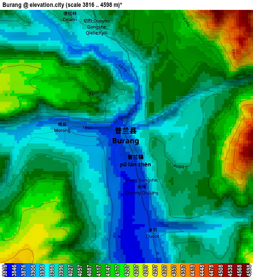
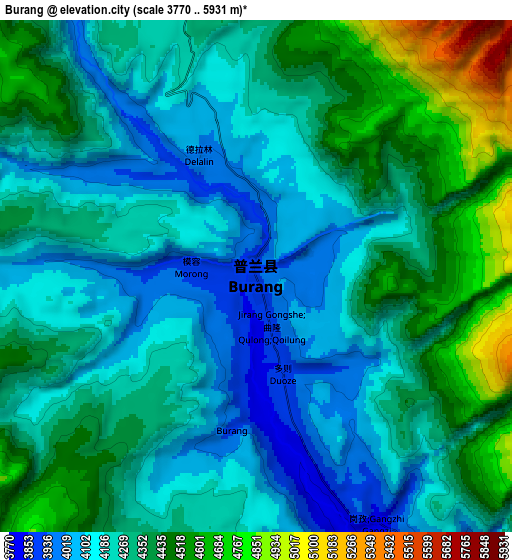
Below is the Elevation map of Burang, which displays elevation range with different colors. Scale of the first map is from 3816 to 4598 m (12520 to 15085 ft) with average elevation of 4053.5 meters (=13299 ft) [note 1]
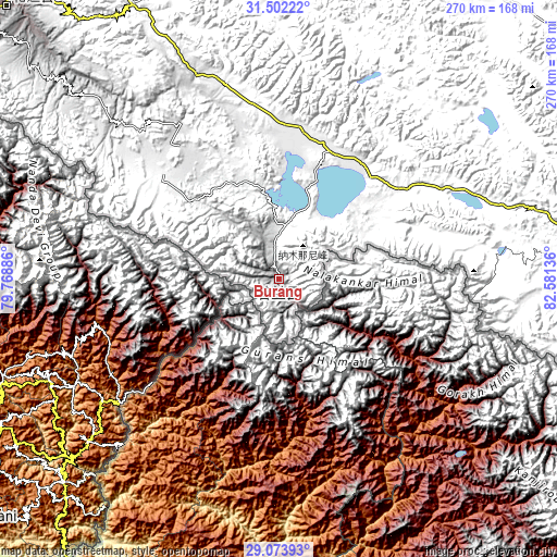
These maps also provides idea of topography and contour of this city, they are displayed at different zoom levels. More info about maps, scale and edge coordinates you can find below images.
| \ | Map #1 | Map #2 | Topo.Map |
| Scale [m] | 3816..4598 m | 3770..5931 m | × |
| Scale [ft] | 12520..15085 ft | 12369..19459 ft | × |
| Average | 4053.5 m = 13299 ft | 4295.8 m = 14094 ft | × |
| Width | 8.44 km = 5.2 mi | 16.88 km = 10.5 mi | 270 km = 167.8 mi |
| Height | 8.44 km = 5.2 mi | 16.88 km = 10.5 mi | 270 km = 167.8 mi |
| ↑Max Latitude | 30.333527° | 30.371448° | 31.50222° |
| Latitude at center | 30.29559° | 30.29559° | 30.29559° |
| ↓Min Latitude | 30.257639° | 30.219673° | 29.07393° |
| ← Min Longitude | 81.131165° | 81.087219° | 79.76886° |
| Longitude center | 81.17511° | 81.17511° | 81.17511° |
| →Max Longitude | 81.219055° | 81.263001° | 82.58136° |
Nearby cities:
Cities around Burang sort by population:
• Rutog elevation 4253 m
376.3 km,  337°
337°
• Luring 4500 m
361.4 km,  52°
52°
• Zhadong 4559 m
296.9 km,  103°
103°
• Shiquanhe 4278 m
265.7 km, 337°
• Geji 4519 m
233.5 km,  359°
359°
• Toding 3729 m
186.1 km,  315°
315°
Multilingual:
 En español:
Burang elevación 3892 m.
 En France:
Burang élévation 3892 m.


Sources and notes:
- [note 1] Map square and city borders are not equal. Map elevation data is calculated only from area inside that square.
- [src 1] Elevation data from geonames database provided with same terms of usage.
- [src 2] The elevation map of Burang is generated using elevation data from NASA's 3 arcsec (90m) resolution SRTM data.
- [src 3] Base (background) map © OpenStreetMap contributors tiles are generated by Geofabrik and OpenTopoMap.
Copyright & License:
This Burang Elevation Map is licensed under CC BY-SA. You may reuse any part from this page, if you give a proper credit by linking to this URL:
 More info on terms of use page.