Bayan elevation
Bayan (Heilongjiang), China elevation is 135 meters and Bayan elevation in feet is 443 ft above sea level [src 1]. Bayan is a seat of a third-order administrative division (feature code) with elevation that is 423 meters (1388 ft) smaller than average city elevation in China.
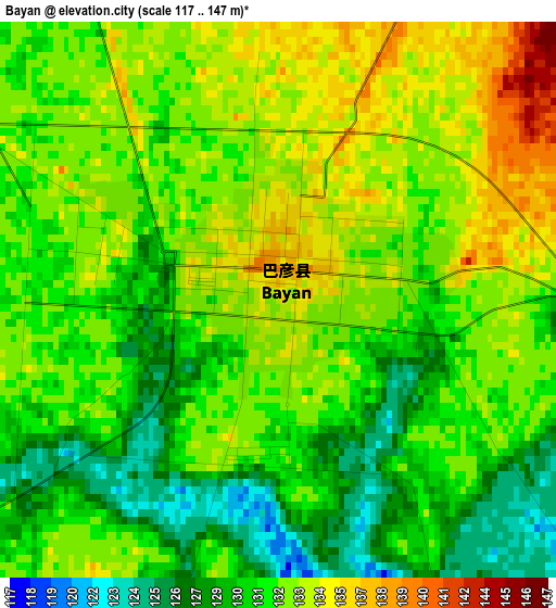
Below is the Elevation map of Bayan, which displays elevation range with different colors. Scale of the first map is from 117 to 147 m (384 to 482 ft) with average elevation of 131.5 meters (=431 ft) [note 1]
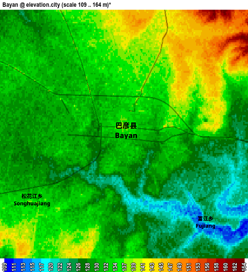
These maps also provides idea of topography and contour of this city, they are displayed at different zoom levels. More info about maps, scale and edge coordinates you can find below images.
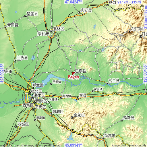
| \ | Map #1 | Map #2 | Topo.Map |
| Scale [m] | 117..147 m | 109..164 m | × |
| Scale [ft] | 384..482 ft | 358..538 ft | × |
| Average | 131.5 m = 431 ft | 132.4 m = 434 ft | × |
| Width | 6.78 km = 4.2 mi | 13.56 km = 8.4 mi | 216.9 km = 134.8 mi |
| Height | 6.78 km = 4.2 mi | 13.56 km = 8.4 mi | 216.9 km = 134.8 mi |
| ↑Max Latitude | 46.106037° | 46.136497° | 47.04247° |
| Latitude at center | 46.07556° | 46.07556° | 46.07556° |
| ↓Min Latitude | 46.045066° | 46.014556° | 45.09141° |
| ← Min Longitude | 127.354455° | 127.310509° | 125.99215° |
| Longitude center | 127.3984° | 127.3984° | 127.3984° |
| →Max Longitude | 127.442345° | 127.486291° | 128.80465° |
Nearby cities:
Cities around Bayan sort by population:
• Harbin elevation 140 m
68.3 km,  237°
237°
• Suihua 183 m
69.9 km,  333°
333°
• Acheng 139 m
67.4 km,  208°
208°
• Hulan 128 m
62.5 km,  260°
260°
• Lanxi 164 m
88.3 km,  283°
283°
• Binzhou 167 m
36.4 km,  170°
170°
• Shanhecun 143 m
100 km,  113°
113°
• Tonghe 107 m
104.4 km,  96°
96°
• Yanshou 159 m
99.9 km,  133°
133°
• Qing’an 189 m
89.5 km,  5°
5°
• Dayou 181 m
69.9 km, 333°
• Mulan 115 m
51.3 km, 106°
Multilingual:
 En español:
Bayan elevación 135 m.
 En France:
Bayan élévation 135 m.


Sources and notes:
- [note 1] Map square and city borders are not equal. Map elevation data is calculated only from area inside that square.
- [src 1] Elevation data from geonames database provided with same terms of usage.
- [src 2] The elevation map of Bayan is generated using elevation data from NASA's 3 arcsec (90m) resolution SRTM data.
- [src 3] Base (background) map © OpenStreetMap contributors tiles are generated by Geofabrik and OpenTopoMap.
Copyright & License:
This Bayan Elevation Map is licensed under CC BY-SA. You may reuse any part from this page, if you give a proper credit by linking to this URL:
 More info on terms of use page.