Chaihe elevation
Chaihe (Heilongjiang), China elevation is 229 meters and Chaihe elevation in feet is 751 ft above sea level [src 1]. Chaihe is a seat of a fourth-order administrative division (feature code) with elevation that is 329 meters (1079 ft) smaller than average city elevation in China.
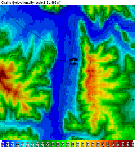
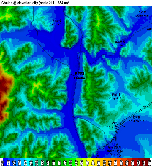
Below is the Elevation map of Chaihe, which displays elevation range with different colors. Scale of the first map is from 212 to 466 m (696 to 1529 ft) with average elevation of 285.9 meters (=938 ft) [note 1]
These maps also provides idea of topography and contour of this city, they are displayed at different zoom levels. More info about maps, scale and edge coordinates you can find below images.
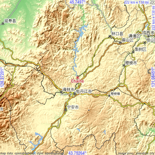
| \ | Map #1 | Map #2 | Topo.Map |
| Scale [m] | 212..466 m | 211..654 m | × |
| Scale [ft] | 696..1529 ft | 692..2146 ft | × |
| Average | 285.9 m = 938 ft | 298.3 m = 979 ft | × |
| Width | 6.94 km = 4.3 mi | 13.88 km = 8.6 mi | 222.1 km = 138 mi |
| Height | 6.94 km = 4.3 mi | 13.88 km = 8.6 mi | 222 km = 137.9 mi |
| ↑Max Latitude | 44.790996° | 44.822174° | 45.7497° |
| Latitude at center | 44.7598° | 44.7598° | 44.7598° |
| ↓Min Latitude | 44.728588° | 44.697358° | 43.75264° |
| ← Min Longitude | 129.634315° | 129.590369° | 128.27201° |
| Longitude center | 129.67826° | 129.67826° | 129.67826° |
| →Max Longitude | 129.722205° | 129.766151° | 131.08451° |
Nearby cities:
Cities around Chaihe sort by population:
• Mudanjiang elevation 242 m
20.6 km,  197°
197°
• Fendou 223 m
108.6 km,  62°
62°
• Hailin 255 m
31.2 km,  227°
227°
• Linkou 274 m
74.3 km,  38°
38°
• Bamiantong 264 m
68.6 km,  75°
75°
• Lishu 237 m
87.8 km,  65°
65°
• Mashan 272 m
83.1 km,  53°
53°
• Ning’an 259 m
49.2 km, 200°
• Xianfeng 241 m
21.4 km, 196°
• Xiangyang 244 m
20.6 km, 202°
• Xin’an 233 m
20.4 km,  191°
191°
• Yangming 234 m
18.7 km, 194°
Multilingual:
 En español:
Chaihe elevación 229 m.
 En France:
Chaihe élévation 229 m.


Sources and notes:
- [note 1] Map square and city borders are not equal. Map elevation data is calculated only from area inside that square.
- [src 1] Elevation data from geonames database provided with same terms of usage.
- [src 2] The elevation map of Chaihe is generated using elevation data from NASA's 3 arcsec (90m) resolution SRTM data.
- [src 3] Base (background) map © OpenStreetMap contributors tiles are generated by Geofabrik and OpenTopoMap.
Copyright & License:
This Chaihe Elevation Map is licensed under CC BY-SA. You may reuse any part from this page, if you give a proper credit by linking to this URL:
 More info on terms of use page.