Wuchang elevation
Wuchang (Heilongjiang), China elevation is 193 meters and Wuchang elevation in feet is 633 ft above sea level [src 1]. Wuchang is a seat of a third-order administrative division (feature code) with elevation that is 365 meters (1198 ft) smaller than average city elevation in China.
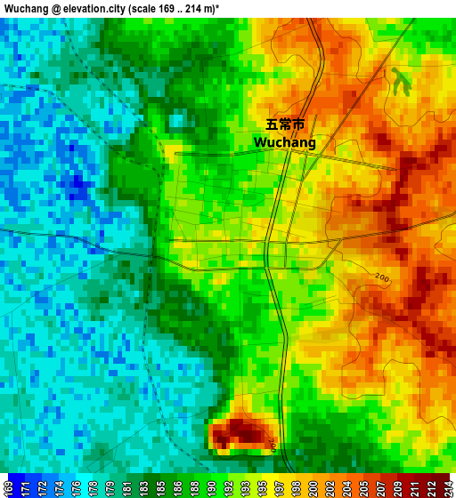
Below is the Elevation map of Wuchang, which displays elevation range with different colors. Scale of the first map is from 169 to 214 m (554 to 702 ft) with average elevation of 188.9 meters (=620 ft) [note 1]
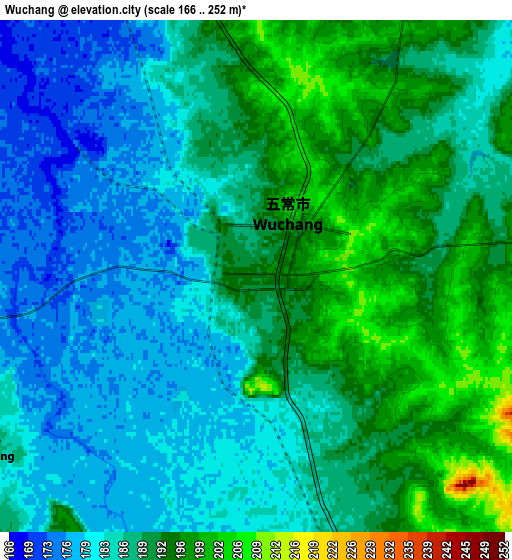
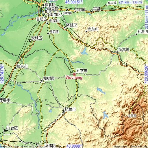
These maps also provides idea of topography and contour of this city, they are displayed at different zoom levels. More info about maps, scale and edge coordinates you can find below images.
| \ | Map #1 | Map #2 | Topo.Map |
| Scale [m] | 169..214 m | 166..252 m | × |
| Scale [ft] | 554..702 ft | 545..827 ft | × |
| Average | 188.9 m = 620 ft | 187.4 m = 615 ft | × |
| Width | 6.92 km = 4.3 mi | 13.84 km = 8.6 mi | 221.5 km = 137.6 mi |
| Height | 6.92 km = 4.3 mi | 13.84 km = 8.6 mi | 221.4 km = 137.6 mi |
| ↑Max Latitude | 44.945392° | 44.976487° | 45.90151° |
| Latitude at center | 44.91428° | 44.91428° | 44.91428° |
| ↓Min Latitude | 44.883151° | 44.852005° | 43.9098° |
| ← Min Longitude | 127.106065° | 127.062119° | 125.74376° |
| Longitude center | 127.15001° | 127.15001° | 127.15001° |
| →Max Longitude | 127.193955° | 127.237901° | 128.55626° |
Nearby cities:
Cities around Wuchang sort by population:
• Harbin elevation 140 m
100.8 km,  337°
337°
• Acheng 139 m
71.5 km,  349°
349°
• Shuangcheng 163 m
83.5 km,  305°
305°
• Yushu 220 m
50.2 km,  255°
255°
• Hulan 128 m
126.4 km, 340°
• Dehui 180 m
122.1 km,  249°
249°
• Jishu 250 m
72 km,  202°
202°
• Shangzhi 185 m
72.8 km,  62°
62°
• Shulan 233 m
57.5 km, 195°
• Binzhou 167 m
96.7 km,  15°
15°
• Yanshou 159 m
110 km, 56°
• Sanchahe 197 m
89.5 km,  273°
273°
Multilingual:
 En español:
Wuchang elevación 193 m.
 En France:
Wuchang élévation 193 m.


Sources and notes:
- [note 1] Map square and city borders are not equal. Map elevation data is calculated only from area inside that square.
- [src 1] Elevation data from geonames database provided with same terms of usage.
- [src 2] The elevation map of Wuchang is generated using elevation data from NASA's 3 arcsec (90m) resolution SRTM data.
- [src 3] Base (background) map © OpenStreetMap contributors tiles are generated by Geofabrik and OpenTopoMap.
Copyright & License:
This Wuchang Elevation Map is licensed under CC BY-SA. You may reuse any part from this page, if you give a proper credit by linking to this URL:
 More info on terms of use page.