Baiyin elevation
Baiyin (Gansu, Baiyin Prefecture), China elevation is 1723 meters and Baiyin elevation in feet is 5653 ft above sea level [src 1]. Baiyin is a seat of a second-order administrative division (feature code) with elevation that is 1165 meters (3822 ft) bigger than average city elevation in China.
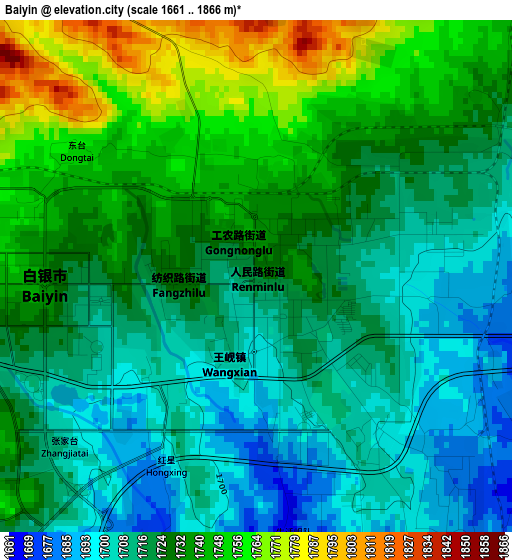
Below is the Elevation map of Baiyin, which displays elevation range with different colors. Scale of the first map is from 1661 to 1866 m (5449 to 6122 ft) with average elevation of 1725.8 meters (=5662 ft) [note 1]
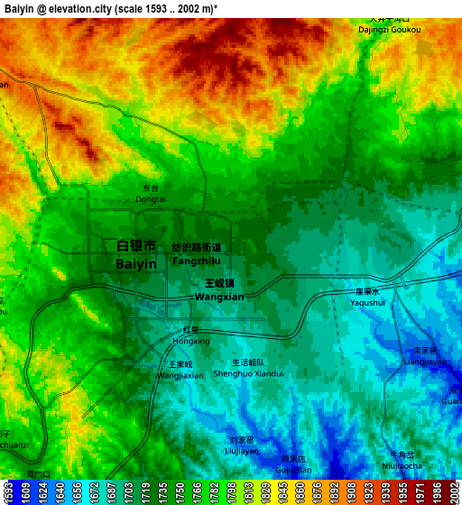
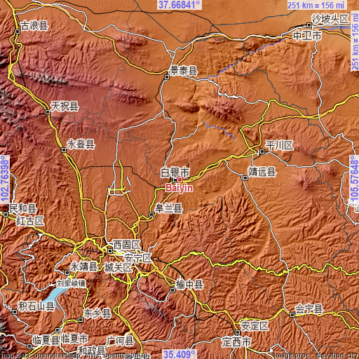
These maps also provides idea of topography and contour of this city, they are displayed at different zoom levels. More info about maps, scale and edge coordinates you can find below images.
| \ | Map #1 | Map #2 | Topo.Map |
| Scale [m] | 1661..1866 m | 1593..2002 m | × |
| Scale [ft] | 5449..6122 ft | 5226..6568 ft | × |
| Average | 1725.8 m = 5662 ft | 1759.4 m = 5772 ft | × |
| Width | 7.85 km = 4.9 mi | 15.7 km = 9.8 mi | 251.2 km = 156.1 mi |
| Height | 7.85 km = 4.9 mi | 15.7 km = 9.8 mi | 251.2 km = 156.1 mi |
| ↑Max Latitude | 36.582256° | 36.617536° | 37.66841° |
| Latitude at center | 36.54696° | 36.54696° | 36.54696° |
| ↓Min Latitude | 36.511648° | 36.476319° | 35.409° |
| ← Min Longitude | 104.126285° | 104.082339° | 102.76398° |
| Longitude center | 104.17023° | 104.17023° | 104.17023° |
| →Max Longitude | 104.214175° | 104.258121° | 105.57648° |
Nearby cities:
Cities around Baiyin sort by population:
• Lanzhou elevation 1521 m
62 km,  208°
208°
• Yongdeng Chengguanzhen 2103 m
83.9 km,  284°
284°
• Yuzhong Chengguanzhen 1981 m
78.5 km,  183°
183°
• Fulilu 1565 m
70.1 km,  225°
225°
• Yitiaoshan 1616 m
68.1 km,  351°
351°
• Xihu 1542 m
63.9 km, 213°
• Anning Xilu 1539 m
63.7 km,  219°
219°
• Zhangyelu 1527 m
62.7 km, 209°
• Xingpinglu 1533 m
60.8 km,  70°
70°
• Wulan 1408 m
45.9 km,  87°
87°
• Gaolan Chengguanzhen 1654 m
31 km, 220°
• Renminlu 1734 m
0.5 km, 352°
Multilingual:
 En español:
Baiyin elevación 1723 m.
 En France:
Baiyin élévation 1723 m.


Sources and notes:
- [note 1] Map square and city borders are not equal. Map elevation data is calculated only from area inside that square.
- [src 1] Elevation data from geonames database provided with same terms of usage.
- [src 2] The elevation map of Baiyin is generated using elevation data from NASA's 3 arcsec (90m) resolution SRTM data.
- [src 3] Base (background) map © OpenStreetMap contributors tiles are generated by Geofabrik and OpenTopoMap.
Copyright & License:
This Baiyin Elevation Map is licensed under CC BY-SA. You may reuse any part from this page, if you give a proper credit by linking to this URL:
 More info on terms of use page.