Beibei elevation
Beibei (Chongqing), China elevation is 237 meters and Beibei elevation in feet is 778 ft above sea level [src 1]. Beibei is a populated place (feature code) with elevation that is 321 meters (1053 ft) smaller than average city elevation in China.
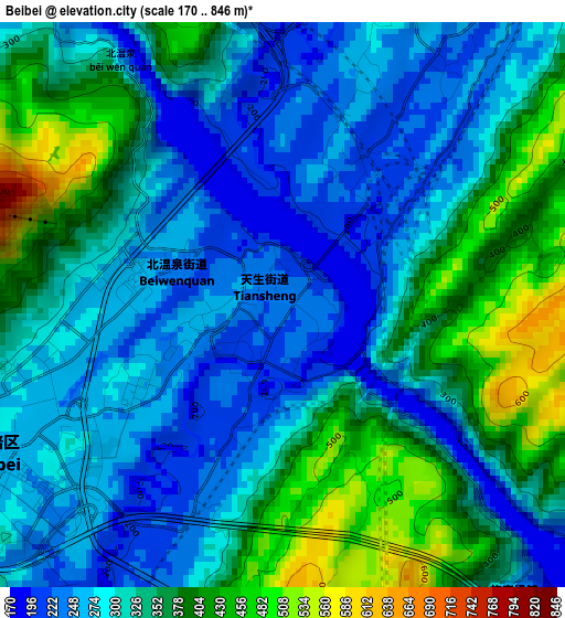
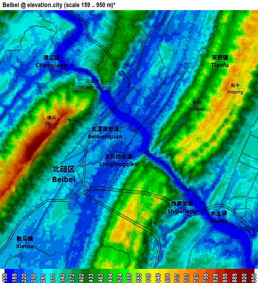
Below is the Elevation map of Beibei, which displays elevation range with different colors. Scale of the first map is from 170 to 846 m (558 to 2776 ft) with average elevation of 322.1 meters (=1057 ft) [note 1]
These maps also provides idea of topography and contour of this city, they are displayed at different zoom levels. More info about maps, scale and edge coordinates you can find below images.
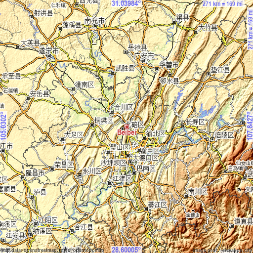
| \ | Map #1 | Map #2 | Topo.Map |
| Scale [m] | 170..846 m | 159..950 m | × |
| Scale [ft] | 558..2776 ft | 522..3117 ft | × |
| Average | 322.1 m = 1057 ft | 360.5 m = 1183 ft | × |
| Width | 8.48 km = 5.3 mi | 16.96 km = 10.5 mi | 271.3 km = 168.6 mi |
| Height | 8.48 km = 5.3 mi | 16.96 km = 10.5 mi | 271.3 km = 168.6 mi |
| ↑Max Latitude | 29.865507° | 29.903608° | 31.03984° |
| Latitude at center | 29.82739° | 29.82739° | 29.82739° |
| ↓Min Latitude | 29.789259° | 29.751113° | 28.60005° |
| ← Min Longitude | 106.392505° | 106.348559° | 105.0302° |
| Longitude center | 106.43645° | 106.43645° | 106.43645° |
| →Max Longitude | 106.480395° | 106.524341° | 107.8427° |
Nearby cities:
Cities around Beibei sort by population:
• Chongqing elevation 225 m
31.5 km,  159°
159°
• Hechuan 222 m
24.7 km,  317°
317°
• Yudong 212 m
49.8 km,  170°
170°
• Xinshancun 282 m
38.2 km, 173°
• Bachuan 279 m
37.3 km,  273°
273°
• Yangjiaping 271 m
36.4 km, 170°
• Nanping 256 m
35 km, 155°
• Bicheng 283 m
33 km,  218°
218°
• Cuntan 245 m
28.2 km,  152°
152°
• Nanjin 223 m
24.1 km, 316°
• Shuangfengqiao 449 m
22 km,  123°
123°
• Beiwenquan 243 m
1.8 km,  292°
292°
Multilingual:
 En español:
Beibei elevación 237 m.
 En France:
Beibei élévation 237 m.


Sources and notes:
- [note 1] Map square and city borders are not equal. Map elevation data is calculated only from area inside that square.
- [src 1] Elevation data from geonames database provided with same terms of usage.
- [src 2] The elevation map of Beibei is generated using elevation data from NASA's 3 arcsec (90m) resolution SRTM data.
- [src 3] Base (background) map © OpenStreetMap contributors tiles are generated by Geofabrik and OpenTopoMap.
Copyright & License:
This Beibei Elevation Map is licensed under CC BY-SA. You may reuse any part from this page, if you give a proper credit by linking to this URL:
 More info on terms of use page.