Longgang elevation
Longgang (Shandong), China elevation is 6 meters and Longgang elevation in feet is 20 ft above sea level [src 1]. Longgang is a seat of a fourth-order administrative division (feature code) with elevation that is 552 meters (1811 ft) smaller than average city elevation in China.
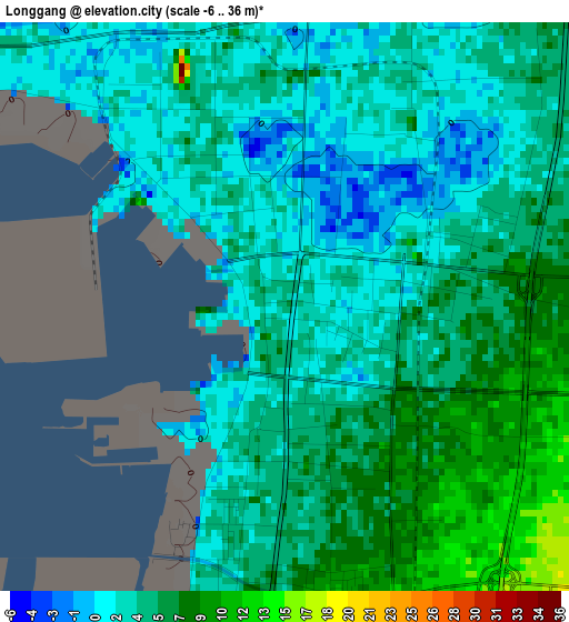
Below is the Elevation map of Longgang, which displays elevation range with different colors. Scale of the first map is from -6 to 36 m (-20 to 118 ft) with average elevation of 4.4 meters (=14 ft) [note 1]
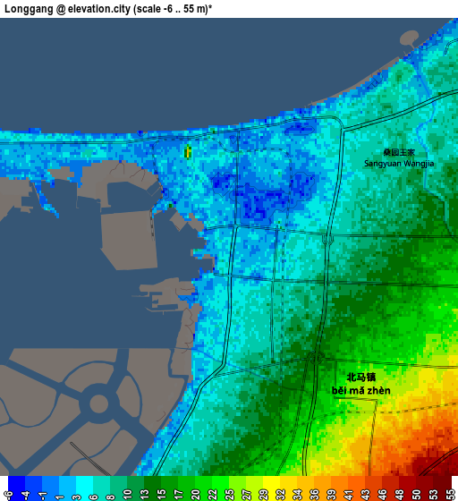
These maps also provides idea of topography and contour of this city, they are displayed at different zoom levels. More info about maps, scale and edge coordinates you can find below images.
| \ | Map #1 | Map #2 | Topo.Map |
| Scale [m] | -6..36 m | -6..55 m | × |
| Scale [ft] | -20..118 ft | -20..180 ft | × |
| Average | 4.4 m = 14 ft | 11.6 m = 38 ft | × |
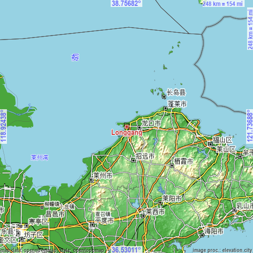
| Width | 7.74 km = 4.8 mi | 15.47 km = 9.6 mi | 247.6 km = 153.9 mi |
| Height | 7.74 km = 4.8 mi | 15.47 km = 9.6 mi | 247.6 km = 153.9 mi |
| ↑Max Latitude | 37.686595° | 37.721364° | 38.75682° |
| Latitude at center | 37.65181° | 37.65181° | 37.65181° |
| ↓Min Latitude | 37.617009° | 37.582191° | 36.53011° |
| ← Min Longitude | 120.286685° | 120.242739° | 118.92438° |
| Longitude center | 120.33063° | 120.33063° | 120.33063° |
| →Max Longitude | 120.374575° | 120.418521° | 121.73688° |
Nearby cities:
Cities around Longgang sort by population:
• Laizhou elevation 43 m
62.6 km,  213°
213°
• Laiyang 40 m
82.4 km,  155°
155°
• Zhaoyuan 74 m
32.7 km,  167°
167°
• Dengzhou 23 m
41.5 km,  65°
65°
• Zhuangyuan 135 m
58.3 km,  131°
131°
• Laixi 54 m
89.8 km, 168°
• Qingyang 12 m
83.5 km,  101°
101°
• Xiangyang 24 m
94.6 km, 98°
• Nanchangshan 20 m
46.8 km,  48°
48°
• Nanchangshan 11 m
45.9 km, 50°
• Donglai 31 m
16.9 km,  91°
91°
• Xinjia 27 m
13.6 km, 87°
Multilingual:
 En español:
Longgang elevación 6 m.
 En France:
Longgang élévation 6 m.


Sources and notes:
- [note 1] Map square and city borders are not equal. Map elevation data is calculated only from area inside that square.
- [src 1] Elevation data from geonames database provided with same terms of usage.
- [src 2] The elevation map of Longgang is generated using elevation data from NASA's 3 arcsec (90m) resolution SRTM data.
- [src 3] Base (background) map © OpenStreetMap contributors tiles are generated by Geofabrik and OpenTopoMap.
Copyright & License:
This Longgang Elevation Map is licensed under CC BY-SA. You may reuse any part from this page, if you give a proper credit by linking to this URL:
 More info on terms of use page.