Maba elevation
Maba (Guangdong), China elevation is 68 meters and Maba elevation in feet is 223 ft above sea level [src 1]. Maba is a seat of a third-order administrative division (feature code) with elevation that is 490 meters (1608 ft) smaller than average city elevation in China.
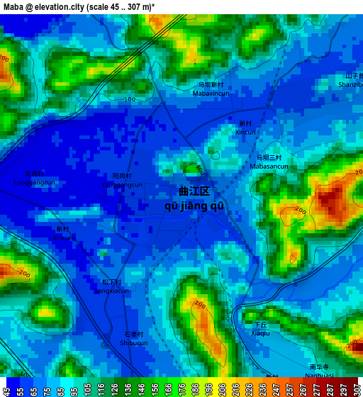
Below is the Elevation map of Maba, which displays elevation range with different colors. Scale of the first map is from 45 to 307 m (148 to 1007 ft) with average elevation of 96.5 meters (=317 ft) [note 1]
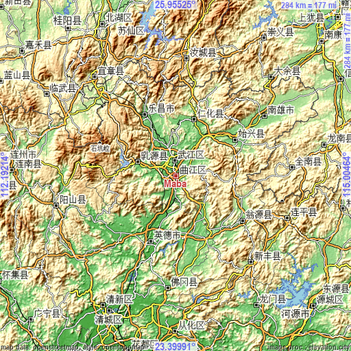
These maps also provides idea of topography and contour of this city, they are displayed at different zoom levels. More info about maps, scale and edge coordinates you can find below images.
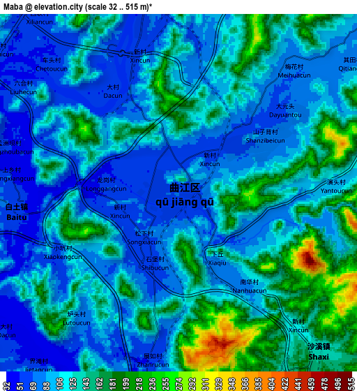
| \ | Map #1 | Map #2 | Topo.Map |
| Scale [m] | 45..307 m | 32..515 m | × |
| Scale [ft] | 148..1007 ft | 105..1690 ft | × |
| Average | 96.5 m = 317 ft | 118.7 m = 389 ft | × |
| Width | 8.88 km = 5.5 mi | 17.76 km = 11 mi | 284.1 km = 176.5 mi |
| Height | 8.88 km = 5.5 mi | 17.76 km = 11 mi | 284.1 km = 176.5 mi |
| ↑Max Latitude | 24.724053° | 24.763964° | 25.95525° |
| Latitude at center | 24.68413° | 24.68413° | 24.68413° |
| ↓Min Latitude | 24.644194° | 24.604245° | 23.39991° |
| ← Min Longitude | 113.554445° | 113.510499° | 112.19214° |
| Longitude center | 113.59839° | 113.59839° | 113.59839° |
| →Max Longitude | 113.642335° | 113.686281° | 115.00464° |
Nearby cities:
Cities around Maba sort by population:
• Shaoguan elevation 69 m
13 km,  353°
353°
• Lecheng 109 m
55.3 km,  333°
333°
• Xiongzhou 119 m
85.6 km,  55°
55°
• Shixing 106 m
55.6 km, 58°
• Longnan 216 m
122 km,  78°
78°
• Nan’an 182 m
110.7 km,  44°
44°
• Yizhang Chengguanzhen 380 m
99.7 km,  321°
321°
• Yuanshan 215 m
96.7 km,  111°
111°
• Rucheng Chengguanzhen 672 m
95.5 km,  7°
7°
• Shijiao 65 m
90.9 km,  184°
184°
• Yingcheng 24 m
60.6 km,  198°
198°
• Renhua 108 m
47.6 km,  18°
18°
Multilingual:
 En español:
Maba elevación 68 m.
 En France:
Maba élévation 68 m.


Sources and notes:
- [note 1] Map square and city borders are not equal. Map elevation data is calculated only from area inside that square.
- [src 1] Elevation data from geonames database provided with same terms of usage.
- [src 2] The elevation map of Maba is generated using elevation data from NASA's 3 arcsec (90m) resolution SRTM data.
- [src 3] Base (background) map © OpenStreetMap contributors tiles are generated by Geofabrik and OpenTopoMap.
Copyright & License:
This Maba Elevation Map is licensed under CC BY-SA. You may reuse any part from this page, if you give a proper credit by linking to this URL:
 More info on terms of use page.