Weinan elevation
Weinan (Shaanxi), China elevation is 354 meters and Weinan elevation in feet is 1161 ft above sea level [src 1]. Weinan is a seat of a second-order administrative division (feature code) with elevation that is 204 meters (669 ft) smaller than average city elevation in China.
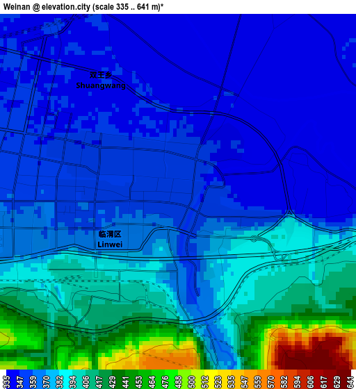
Below is the Elevation map of Weinan, which displays elevation range with different colors. Scale of the first map is from 335 to 641 m (1099 to 2103 ft) with average elevation of 377.1 meters (=1237 ft) [note 1]
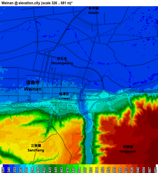
These maps also provides idea of topography and contour of this city, they are displayed at different zoom levels. More info about maps, scale and edge coordinates you can find below images.
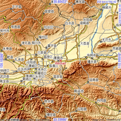
| \ | Map #1 | Map #2 | Topo.Map |
| Scale [m] | 335..641 m | 326..681 m | × |
| Scale [ft] | 1099..2103 ft | 1070..2234 ft | × |
| Average | 377.1 m = 1237 ft | 425.4 m = 1396 ft | × |
| Width | 8.05 km = 5 mi | 16.11 km = 10 mi | 257.7 km = 160.1 mi |
| Height | 8.05 km = 5 mi | 16.11 km = 10 mi | 257.7 km = 160.1 mi |
| ↑Max Latitude | 34.539757° | 34.575948° | 35.65433° |
| Latitude at center | 34.50355° | 34.50355° | 34.50355° |
| ↓Min Latitude | 34.467327° | 34.431089° | 33.33666° |
| ← Min Longitude | 109.464965° | 109.421019° | 108.10266° |
| Longitude center | 109.50891° | 109.50891° | 109.50891° |
| →Max Longitude | 109.552855° | 109.596801° | 110.91516° |
Nearby cities:
Cities around Weinan sort by population:
• Huayin elevation 348 m
51.5 km,  82°
82°
• Lintong 425 m
30.8 km,  243°
243°
• Yanliang 395 m
30.9 km,  304°
304°
• Xincheng 412 m
57.9 km, 242°
• Weiyang 409 m
57.7 km,  245°
245°
• Sanyuan Chengguanzhen 425 m
54.6 km,  283°
283°
• Dali 351 m
51 km,  50°
50°
• Pucheng Chengguanzhen 489 m
50.8 km,  7°
7°
• Languan 505 m
42.4 km,  204°
204°
• Doucun 445 m
40.6 km,  312°
312°
• Luyuan 380 m
39 km, 275°
• Huazhou 350 m
22.8 km,  86°
86°
Multilingual:
 En español:
Weinan elevación 354 m.
 En France:
Weinan élévation 354 m.


Sources and notes:
- [note 1] Map square and city borders are not equal. Map elevation data is calculated only from area inside that square.
- [src 1] Elevation data from geonames database provided with same terms of usage.
- [src 2] The elevation map of Weinan is generated using elevation data from NASA's 3 arcsec (90m) resolution SRTM data.
- [src 3] Base (background) map © OpenStreetMap contributors tiles are generated by Geofabrik and OpenTopoMap.
Copyright & License:
This Weinan Elevation Map is licensed under CC BY-SA. You may reuse any part from this page, if you give a proper credit by linking to this URL:
 More info on terms of use page.