Xiangcheng Chengguanzhen elevation
Xiangcheng Chengguanzhen (Henan), China elevation is 85 meters and Xiangcheng Chengguanzhen elevation in feet is 279 ft above sea level [src 1]. Xiangcheng Chengguanzhen is a seat of a third-order administrative division (feature code) with elevation that is 473 meters (1552 ft) smaller than average city elevation in China.
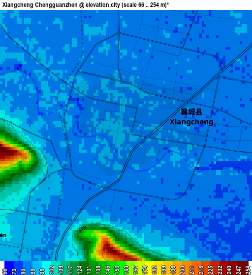
Below is the Elevation map of Xiangcheng Chengguanzhen, which displays elevation range with different colors. Scale of the first map is from 66 to 254 m (217 to 833 ft) with average elevation of 90.2 meters (=296 ft) [note 1]
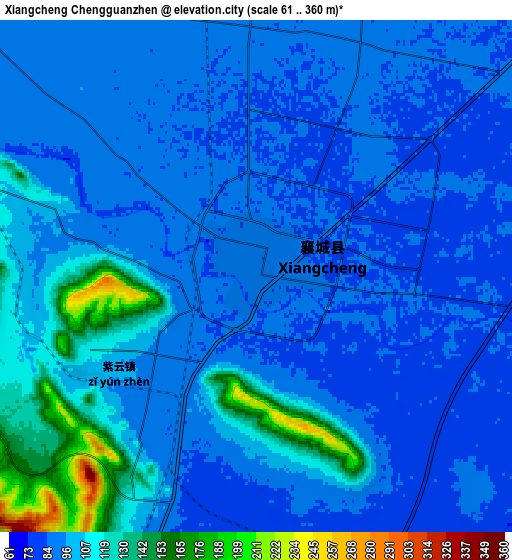
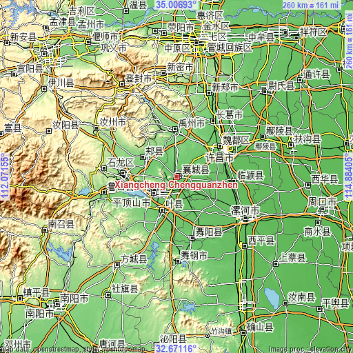
These maps also provides idea of topography and contour of this city, they are displayed at different zoom levels. More info about maps, scale and edge coordinates you can find below images.
| \ | Map #1 | Map #2 | Topo.Map |
| Scale [m] | 66..254 m | 61..360 m | × |
| Scale [ft] | 217..833 ft | 200..1181 ft | × |
| Average | 90.2 m = 296 ft | 98.5 m = 323 ft | × |
| Width | 8.12 km = 5 mi | 16.23 km = 10.1 mi | 259.7 km = 161.4 mi |
| Height | 8.12 km = 5 mi | 16.23 km = 10.1 mi | 259.7 km = 161.4 mi |
| ↑Max Latitude | 33.88352° | 33.919994° | 35.00693° |
| Latitude at center | 33.84703° | 33.84703° | 33.84703° |
| ↓Min Latitude | 33.810524° | 33.774003° | 32.67116° |
| ← Min Longitude | 113.433855° | 113.389909° | 112.07155° |
| Longitude center | 113.4778° | 113.4778° | 113.4778° |
| →Max Longitude | 113.521745° | 113.565691° | 114.88405° |
Nearby cities:
Cities around Xiangcheng Chengguanzhen sort by population:
• Xuchang elevation 71 m
41 km,  59°
59°
• Pingdingshan 88 m
20.3 km,  233°
233°
• Luohe 62 m
61 km,  121°
121°
• Yingchuan 126 m
35.1 km,  357°
357°
• Ganhechen 64 m
59.6 km, 122°
• Yancheng Chengguanzhen 69 m
55.4 km, 121°
• Luyang 129 m
54.4 km,  256°
256°
• Jianshe 97 m
49.2 km,  33°
33°
• Wuquan 97 m
45.6 km,  169°
169°
• Baofeng Chengguanzhen 131 m
38.2 km,  273°
273°
• Jiaxian 119 m
28.3 km,  298°
298°
• Kunyang 90 m
28.1 km,  205°
205°
Multilingual:
 En español:
Xiangcheng Chengguanzhen elevación 85 m.
 En France:
Xiangcheng Chengguanzhen élévation 85 m.
 Auf Deutsch:
Xiangcheng Chengguanzhen höhe über dem Meeresspiegel ist 85 m.
 На русском:
Xiangcheng Chengguanzhen высота над уровнем моря 85 м
Sources and notes:
- [note 1] Map square and city borders are not equal. Map elevation data is calculated only from area inside that square.
- [src 1] Elevation data from geonames database provided with same terms of usage.
- [src 2] The elevation map of Xiangcheng Chengguanzhen is generated using elevation data from NASA's 3 arcsec (90m) resolution SRTM data.
- [src 3] Base (background) map © OpenStreetMap contributors tiles are generated by Geofabrik and OpenTopoMap.
Copyright & License:
This Xiangcheng Chengguanzhen Elevation Map is licensed under CC BY-SA. You may reuse any part from this page, if you give a proper credit by linking to this URL:
 More info on terms of use page.