Yigou elevation
Yigou (Henan), China elevation is 90 meters and Yigou elevation in feet is 295 ft above sea level [src 1]. Yigou is a populated place (feature code) with elevation that is 468 meters (1535 ft) smaller than average city elevation in China.
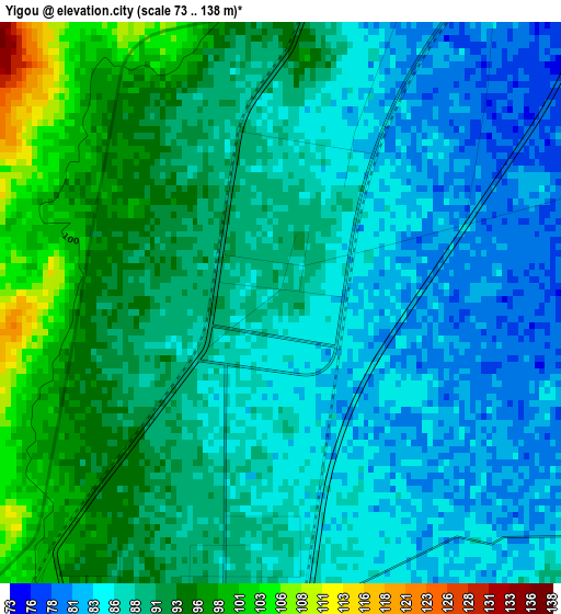
Below is the Elevation map of Yigou, which displays elevation range with different colors. Scale of the first map is from 73 to 138 m (240 to 453 ft) with average elevation of 88.4 meters (=290 ft) [note 1]
These maps also provides idea of topography and contour of this city, they are displayed at different zoom levels. More info about maps, scale and edge coordinates you can find below images.
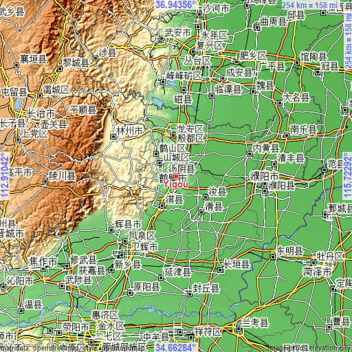
| \ | Map #1 | Map #2 | Topo.Map |
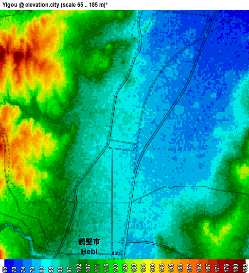
| Scale [m] | 73..138 m | 65..185 m | × |
| Scale [ft] | 240..453 ft | 213..607 ft | × |
| Average | 88.4 m = 290 ft | 99.7 m = 327 ft | × |
| Width | 7.92 km = 4.9 mi | 15.85 km = 9.8 mi | 253.6 km = 157.6 mi |
| Height | 7.92 km = 4.9 mi | 15.85 km = 9.8 mi | 253.6 km = 157.6 mi |
| ↑Max Latitude | 35.847019° | 35.882633° | 36.94356° |
| Latitude at center | 35.81139° | 35.81139° | 35.81139° |
| ↓Min Latitude | 35.775745° | 35.740083° | 34.66284° |
| ← Min Longitude | 114.272725° | 114.228779° | 112.91042° |
| Longitude center | 114.31667° | 114.31667° | 114.31667° |
| →Max Longitude | 114.360615° | 114.404561° | 115.72292° |
Nearby cities:
Cities around Yigou sort by population:
• Anyang elevation 70 m
32.2 km,  10°
10°
• Puyang Chengguanzhen 56 m
64 km,  100°
100°
• Hebi 138 m
14.8 km,  311°
311°
• Daokou 64 m
32.4 km,  148°
148°
• Puyang 56 m
63.4 km,  94°
94°
• Chengguan 92 m
61.1 km,  230°
230°
• Neihuang Chengguanzhen 54 m
55 km,  73°
73°
• Kaiyuan 302 m
52.9 km,  302°
302°
• Chengjiao 71 m
50.8 km,  207°
207°
• Chaoge 73 m
25.7 km, 206°
• Xun Xian Chengguanzhen 61 m
25.5 km,  129°
129°
• Tangyang Chengguanzhen 79 m
12 km,  16°
16°
Multilingual:
 En español:
Yigou elevación 90 m.
 En France:
Yigou élévation 90 m.


Sources and notes:
- [note 1] Map square and city borders are not equal. Map elevation data is calculated only from area inside that square.
- [src 1] Elevation data from geonames database provided with same terms of usage.
- [src 2] The elevation map of Yigou is generated using elevation data from NASA's 3 arcsec (90m) resolution SRTM data.
- [src 3] Base (background) map © OpenStreetMap contributors tiles are generated by Geofabrik and OpenTopoMap.
Copyright & License:
This Yigou Elevation Map is licensed under CC BY-SA. You may reuse any part from this page, if you give a proper credit by linking to this URL:
 More info on terms of use page.