Zhumadian elevation
Zhumadian (Henan), China elevation is 89 meters and Zhumadian elevation in feet is 292 ft above sea level [src 1]. Zhumadian is a populated place (feature code) with elevation that is 469 meters (1539 ft) smaller than average city elevation in China.
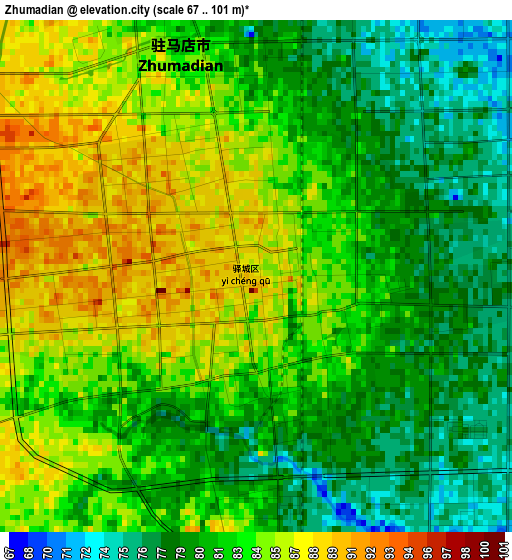
Below is the Elevation map of Zhumadian, which displays elevation range with different colors. Scale of the first map is from 67 to 101 m (220 to 331 ft) with average elevation of 82.2 meters (=270 ft) [note 1]
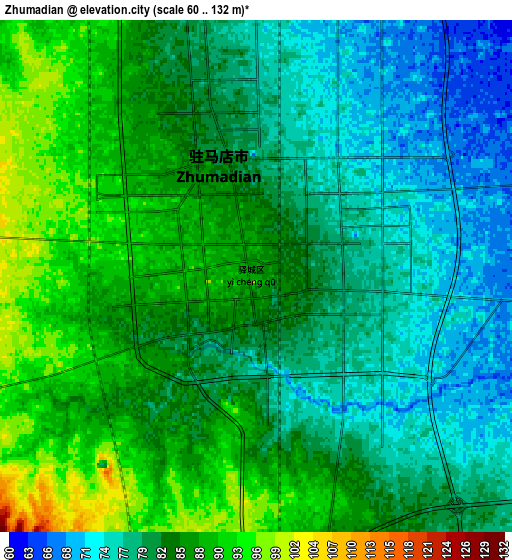
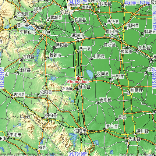
These maps also provides idea of topography and contour of this city, they are displayed at different zoom levels. More info about maps, scale and edge coordinates you can find below images.
| \ | Map #1 | Map #2 | Topo.Map |
| Scale [m] | 67..101 m | 60..132 m | × |
| Scale [ft] | 220..331 ft | 197..433 ft | × |
| Average | 82.2 m = 270 ft | 82.6 m = 271 ft | × |
| Width | 8.2 km = 5.1 mi | 16.4 km = 10.2 mi | 262.3 km = 163 mi |
| Height | 8.2 km = 5.1 mi | 16.4 km = 10.2 mi | 262.3 km = 163 mi |
| ↑Max Latitude | 33.016297° | 33.053138° | 34.15117° |
| Latitude at center | 32.97944° | 32.97944° | 32.97944° |
| ↓Min Latitude | 32.942568° | 32.905681° | 31.79195° |
| ← Min Longitude | 113.985495° | 113.941549° | 112.62319° |
| Longitude center | 114.02944° | 114.02944° | 114.02944° |
| →Max Longitude | 114.073385° | 114.117331° | 115.43569° |
Nearby cities:
Cities around Zhumadian sort by population:
• Luohe elevation 62 m
65 km,  1°
1°
• Minggang 78 m
57.9 km,  178°
178°
• Runing 56 m
30.4 km,  85°
85°
• Dizhuang 63 m
65.2 km, 3°
• Ganhechen 64 m
64.4 km,  359°
359°
• Yakou 143 m
58.8 km,  306°
306°
• Guhuai 50 m
55.7 km, 92°
• Zhenyang 81 m
53.3 km,  141°
141°
• Baicheng 66 m
45.3 km, 358°
• Chongyang 101 m
36.9 km,  32°
32°
• Panlong 99 m
19.7 km, 182°
• Quyang 71 m
18.7 km,  348°
348°
Multilingual:
 En español:
Zhumadian elevación 89 m.
 En France:
Zhumadian élévation 89 m.
 Auf Deutsch:
Zhumadian höhe über dem Meeresspiegel ist 89 m.

Sources and notes:
- [note 1] Map square and city borders are not equal. Map elevation data is calculated only from area inside that square.
- [src 1] Elevation data from geonames database provided with same terms of usage.
- [src 2] The elevation map of Zhumadian is generated using elevation data from NASA's 3 arcsec (90m) resolution SRTM data.
- [src 3] Base (background) map © OpenStreetMap contributors tiles are generated by Geofabrik and OpenTopoMap.
Copyright & License:
This Zhumadian Elevation Map is licensed under CC BY-SA. You may reuse any part from this page, if you give a proper credit by linking to this URL:
 More info on terms of use page.