Cartagena elevation
Cartagena (Valparaíso, San Antonio Province), Chile elevation is 82 meters and Cartagena elevation in feet is 269 ft above sea level [src 1]. Cartagena is a populated place (feature code) with elevation that is 193 meters (633 ft) smaller than average city elevation in Chile.
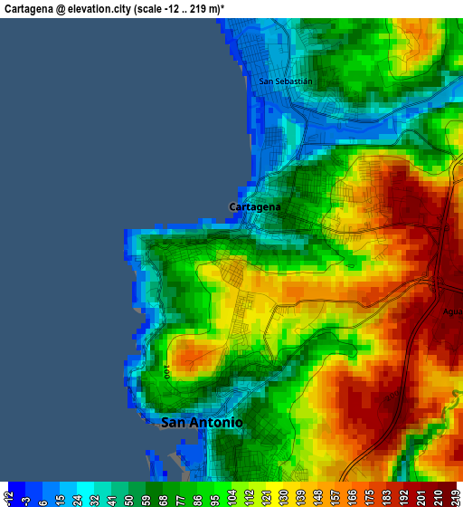
Below is the Elevation map of Cartagena, which displays elevation range with different colors. Scale of the first map is from -12 to 219 m (-39 to 719 ft) with average elevation of 101.1 meters (=332 ft) [note 1]
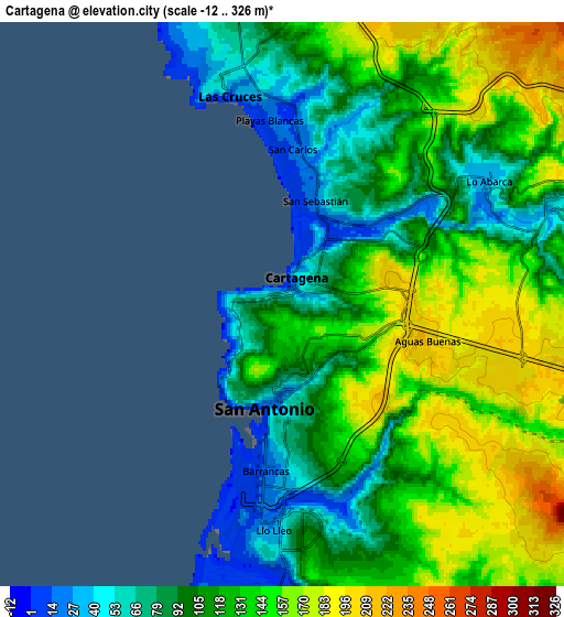
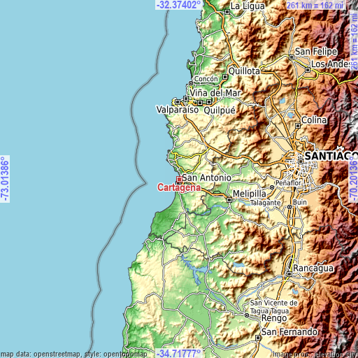
These maps also provides idea of topography and contour of this city, they are displayed at different zoom levels. More info about maps, scale and edge coordinates you can find below images.
| \ | Map #1 | Map #2 | Topo.Map |
| Scale [m] | -12..219 m | -12..326 m | × |
| Scale [ft] | -39..719 ft | -39..1070 ft | × |
| Average | 101.1 m = 332 ft | 119.9 m = 393 ft | × |
| Width | 8.14 km = 5.1 mi | 16.29 km = 10.1 mi | 260.6 km = 161.9 mi |
| Height | 8.14 km = 5.1 mi | 16.29 km = 10.1 mi | 260.6 km = 161.9 mi |
| ↑Max Latitude | -33.51721° | -33.480564° | -32.37402° |
| Latitude at center | -33.55384° | -33.55384° | -33.55384° |
| ↓Min Latitude | -33.590455° | -33.627054° | -34.71777° |
| ← Min Longitude | -71.651555° | -71.695501° | -73.01386° |
| Longitude center | -71.60761° | -71.60761° | -71.60761° |
| →Max Longitude | -71.563665° | -71.519719° | -70.20136° |
Nearby cities:
Cities around Cartagena sort by population:
• Viña del Mar elevation 17 m
59.1 km,  5°
5°
• Valparaíso 23 m
57.6 km,  357°
357°
• Quilpué 113 m
58.4 km,  15°
15°
• Villa Alemana 147 m
60.9 km, 20°
• San Antonio 39 m
4.5 km,  179°
179°
• Peñaflor 395 m
68 km,  94°
94°
• Melipilla 175 m
39.3 km,  112°
112°
• Talagante 344 m
64.2 km,  100°
100°
• Limache 107 m
67.6 km,  27°
27°
• Lampa 498 m
74.2 km,  66°
66°
• El Monte 300 m
59.3 km, 103°
• El Tabo 60 m
12.8 km,  334°
334°
Multilingual:
 En español:
Cartagena elevación 82 m.
 En France:
Carthagène élévation 82 m.
 Auf Deutsch:
Cartagena höhe über dem Meeresspiegel ist 82 m.

Sources and notes:
- [note 1] Map square and city borders are not equal. Map elevation data is calculated only from area inside that square.
- [src 1] Elevation data from geonames database provided with same terms of usage.
- [src 2] The elevation map of Cartagena is generated using elevation data from NASA's 3 arcsec (90m) resolution SRTM data.
- [src 3] Base (background) map © OpenStreetMap contributors tiles are generated by Geofabrik and OpenTopoMap.
Copyright & License:
This Cartagena Elevation Map is licensed under CC BY-SA. You may reuse any part from this page, if you give a proper credit by linking to this URL:
 More info on terms of use page.