Freire elevation
Freire (Araucanía, Provincia de Cautín), Chile elevation is 108 meters and Freire elevation in feet is 354 ft above sea level [src 1]. Freire is a populated place (feature code) with elevation that is 167 meters (548 ft) smaller than average city elevation in Chile.
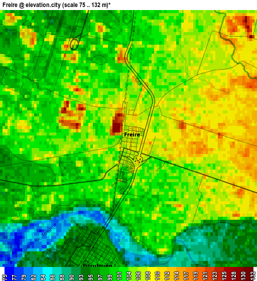
Below is the Elevation map of Freire, which displays elevation range with different colors. Scale of the first map is from 75 to 132 m (246 to 433 ft) with average elevation of 102.3 meters (=336 ft) [note 1]
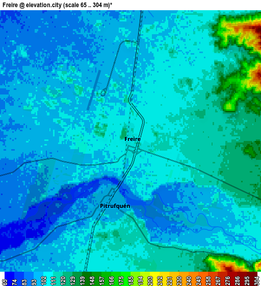
These maps also provides idea of topography and contour of this city, they are displayed at different zoom levels. More info about maps, scale and edge coordinates you can find below images.
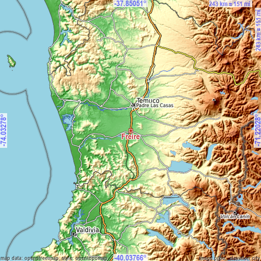
| \ | Map #1 | Map #2 | Topo.Map |
| Scale [m] | 75..132 m | 65..304 m | × |
| Scale [ft] | 246..433 ft | 213..997 ft | × |
| Average | 102.3 m = 336 ft | 106.6 m = 350 ft | × |
| Width | 7.6 km = 4.7 mi | 15.2 km = 9.4 mi | 243.2 km = 151.1 mi |
| Height | 7.6 km = 4.7 mi | 15.2 km = 9.4 mi | 243.2 km = 151.1 mi |
| ↑Max Latitude | -38.918337° | -38.884137° | -37.85051° |
| Latitude at center | -38.95252° | -38.95252° | -38.95252° |
| ↓Min Latitude | -38.986687° | -39.020837° | -40.03766° |
| ← Min Longitude | -72.670475° | -72.714421° | -74.03278° |
| Longitude center | -72.62653° | -72.62653° | -72.62653° |
| →Max Longitude | -72.582585° | -72.538639° | -71.22028° |
Nearby cities:
Cities around Freire sort by population:
• Temuco elevation 114 m
23.8 km,  5°
5°
• Villarrica 232 m
50.5 km,  137°
137°
• Pucón 236 m
68.6 km,  122°
122°
• Victoria 355 m
84 km,  17°
17°
• Lautaro 217 m
49.7 km, 19°
• Nueva Imperial 29 m
36.3 km,  309°
309°
• Panguipulli 140 m
80.9 km,  161°
161°
• Loncoche 114 m
46.1 km,  180°
180°
• Traiguén 180 m
78.2 km,  357°
357°
• Pitrufquén 99 m
3.9 km,  193°
193°
• Carahue 41 m
53.5 km,  300°
300°
• Vilcún 295 m
46.9 km,  47°
47°
Multilingual:
 En español:
Freire elevación 108 m.
 En France:
Freire élévation 108 m.


Sources and notes:
- [note 1] Map square and city borders are not equal. Map elevation data is calculated only from area inside that square.
- [src 1] Elevation data from geonames database provided with same terms of usage.
- [src 2] The elevation map of Freire is generated using elevation data from NASA's 3 arcsec (90m) resolution SRTM data.
- [src 3] Base (background) map © OpenStreetMap contributors tiles are generated by Geofabrik and OpenTopoMap.
Copyright & License:
This Freire Elevation Map is licensed under CC BY-SA. You may reuse any part from this page, if you give a proper credit by linking to this URL:
 More info on terms of use page.