Aboisso elevation
Aboisso (Comoé), Ivory Coast elevation is 12 meters and Aboisso elevation in feet is 39 ft above sea level [src 1]. Aboisso is a seat of a second-order administrative division (feature code) with elevation that is 217 meters (712 ft) smaller than average city elevation in Ivory Coast.
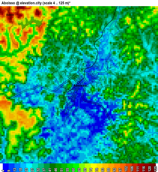
Below is the Elevation map of Aboisso, which displays elevation range with different colors. Scale of the first map is from 4 to 125 m (13 to 410 ft) with average elevation of 41.7 meters (=137 ft) [note 1]
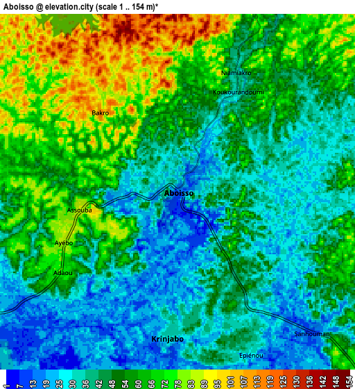
These maps also provides idea of topography and contour of this city, they are displayed at different zoom levels. More info about maps, scale and edge coordinates you can find below images.
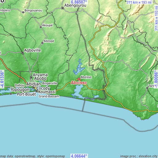
| \ | Map #1 | Map #2 | Topo.Map |
| Scale [m] | 4..125 m | 1..154 m | × |
| Scale [ft] | 13..410 ft | 3..505 ft | × |
| Average | 41.7 m = 137 ft | 50.7 m = 166 ft | × |
| Width | 9.73 km = 6 mi | 19.46 km = 12.1 mi | 311.3 km = 193.4 mi |
| Height | 9.73 km = 6 mi | 19.46 km = 12.1 mi | 311.3 km = 193.4 mi |
| ↑Max Latitude | 5.511534° | 5.555274° | 6.86587° |
| Latitude at center | 5.46779° | 5.46779° | 5.46779° |
| ↓Min Latitude | 5.424043° | 5.380293° | 4.06644° |
| ← Min Longitude | -3.251055° | -3.295001° | -4.61336° |
| Longitude center | -3.20711° | -3.20711° | -3.20711° |
| →Max Longitude | -3.163165° | -3.119219° | -1.80086° |
Nearby cities:
Cities around Aboisso sort by population:
• Abidjan elevation 10 m
90.9 km,  258°
258°
• Abobo 105 m
89.7 km,  266°
266°
• Anyama 95 m
93.5 km, 271°
• Grand-Bassam 7 m
65.4 km,  244°
244°
• Bingerville 59 m
76.1 km, 260°
• Bonoua 30 m
48.2 km, 243°
• Adiaké 40 m
22.9 km,  208°
208°
• Ayamé 82 m
16.3 km,  19°
19°
• Yakassé-Attobrou 144 m
93.3 km,  328°
328°
• Béttié 113 m
71.2 km,  341°
341°
• Alépé 13 m
50.6 km, 274°
• Tiapoum 14 m
42.1 km,  151°
151°
Multilingual:
 En español:
Aboisso elevación 12 m.
 En France:
Aboisso élévation 12 m.


Sources and notes:
- [note 1] Map square and city borders are not equal. Map elevation data is calculated only from area inside that square.
- [src 1] Elevation data from geonames database provided with same terms of usage.
- [src 2] The elevation map of Aboisso is generated using elevation data from NASA's 3 arcsec (90m) resolution SRTM data.
- [src 3] Base (background) map © OpenStreetMap contributors tiles are generated by Geofabrik and OpenTopoMap.
Copyright & License:
This Aboisso Elevation Map is licensed under CC BY-SA. You may reuse any part from this page, if you give a proper credit by linking to this URL:
 More info on terms of use page.