Adzopé elevation
Adzopé (Lagunes), Ivory Coast elevation is 109 meters and Adzopé elevation in feet is 358 ft above sea level [src 1]. Adzopé is a seat of a second-order administrative division (feature code) with elevation that is 120 meters (394 ft) smaller than average city elevation in Ivory Coast.
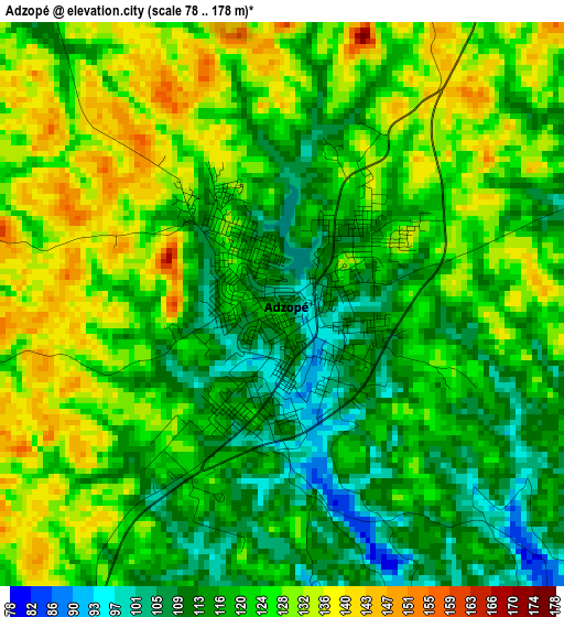
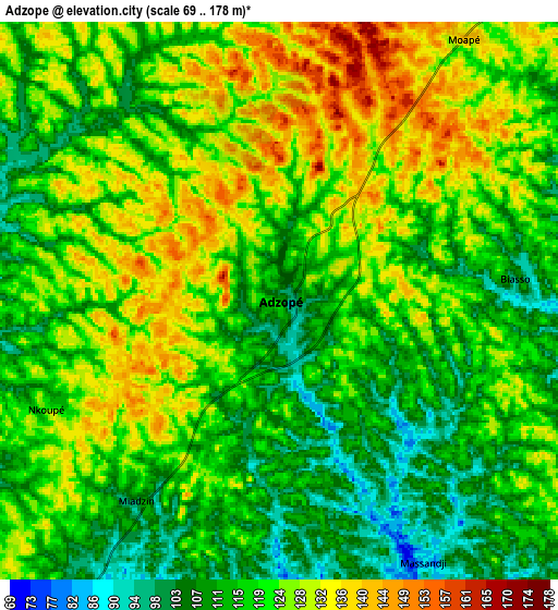
Below is the Elevation map of Adzopé, which displays elevation range with different colors. Scale of the first map is from 78 to 178 m (256 to 584 ft) with average elevation of 121.9 meters (=400 ft) [note 1]
These maps also provides idea of topography and contour of this city, they are displayed at different zoom levels. More info about maps, scale and edge coordinates you can find below images.
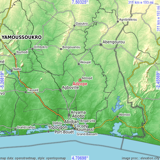
| \ | Map #1 | Map #2 | Topo.Map |
| Scale [m] | 78..178 m | 69..178 m | × |
| Scale [ft] | 256..584 ft | 226..584 ft | × |
| Average | 121.9 m = 400 ft | 119.8 m = 393 ft | × |
| Width | 9.72 km = 6 mi | 19.43 km = 12.1 mi | 310.9 km = 193.2 mi |
| Height | 9.72 km = 6 mi | 19.43 km = 12.1 mi | 310.9 km = 193.2 mi |
| ↑Max Latitude | 6.150634° | 6.194325° | 7.50325° |
| Latitude at center | 6.10694° | 6.10694° | 6.10694° |
| ↓Min Latitude | 6.063242° | 6.019541° | 4.70698° |
| ← Min Longitude | -3.905885° | -3.949831° | -5.26819° |
| Longitude center | -3.86194° | -3.86194° | -3.86194° |
| →Max Longitude | -3.817995° | -3.774049° | -2.45569° |
Nearby cities:
Cities around Adzopé sort by population:
• Abobo elevation 105 m
78.7 km,  192°
192°
• Abengourou 197 m
80.2 km,  30°
30°
• Anyama 95 m
71.3 km,  197°
197°
• Agboville 35 m
43.6 km,  242°
242°
• Arrah 143 m
64.1 km,  349°
349°
• Akoupé 142 m
31 km, 354°
• Bongouanou 213 m
71.4 km,  328°
328°
• Affery 106 m
25.7 km,  337°
337°
• Alépé 13 m
70.9 km,  161°
161°
• M’Batto 124 m
68.2 km,  306°
306°
• Béttié 113 m
50.3 km,  93°
93°
• Yakassé-Attobrou 144 m
24.7 km,  70°
70°
Multilingual:
 En español:
Adzopé elevación 109 m.
 En France:
Adzopé élévation 109 m.


Sources and notes:
- [note 1] Map square and city borders are not equal. Map elevation data is calculated only from area inside that square.
- [src 1] Elevation data from geonames database provided with same terms of usage.
- [src 2] The elevation map of Adzopé is generated using elevation data from NASA's 3 arcsec (90m) resolution SRTM data.
- [src 3] Base (background) map © OpenStreetMap contributors tiles are generated by Geofabrik and OpenTopoMap.
Copyright & License:
This Adzopé Elevation Map is licensed under CC BY-SA. You may reuse any part from this page, if you give a proper credit by linking to this URL:
 More info on terms of use page.