Béoumi elevation
Béoumi (Vallée du Bandama), Ivory Coast elevation is 226 meters and Béoumi elevation in feet is 741 ft above sea level [src 1]. Béoumi is a seat of a third-order administrative division (feature code) with elevation that is 3 meters (10 ft) smaller than average city elevation in Ivory Coast.
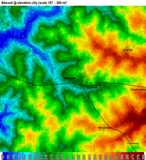
Below is the Elevation map of Béoumi, which displays elevation range with different colors. Scale of the first map is from 187 to 280 m (614 to 919 ft) with average elevation of 229.4 meters (=753 ft) [note 1]
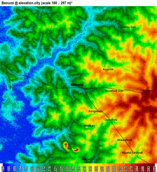
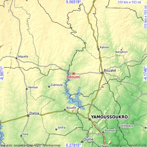
These maps also provides idea of topography and contour of this city, they are displayed at different zoom levels. More info about maps, scale and edge coordinates you can find below images.
| \ | Map #1 | Map #2 | Topo.Map |
| Scale [m] | 187..280 m | 180..297 m | × |
| Scale [ft] | 614..919 ft | 591..974 ft | × |
| Average | 229.4 m = 753 ft | 228 m = 748 ft | × |
| Width | 9.68 km = 6 mi | 19.37 km = 12 mi | 309.9 km = 192.6 mi |
| Height | 9.69 km = 6 mi | 19.37 km = 12 mi | 309.9 km = 192.6 mi |
| ↑Max Latitude | 7.7175° | 7.761045° | 9.06519° |
| Latitude at center | 7.67395° | 7.67395° | 7.67395° |
| ↓Min Latitude | 7.630396° | 7.586838° | 6.27815° |
| ← Min Longitude | -5.624795° | -5.668741° | -6.9871° |
| Longitude center | -5.58085° | -5.58085° | -5.58085° |
| →Max Longitude | -5.536905° | -5.492959° | -4.1746° |
Nearby cities:
Cities around Béoumi sort by population:
• Bouaké elevation 339 m
60.7 km,  87°
87°
• Yamoussoukro 214 m
100.6 km,  160°
160°
• Bouaflé 208 m
78.1 km,  193°
193°
• Katiola 326 m
73.8 km,  45°
45°
• Zuénoula 207 m
58.4 km,  242°
242°
• Vavoua 276 m
104.1 km,  251°
251°
• Mankono 335 m
79.5 km,  302°
302°
• Sakassou 231 m
40 km,  127°
127°
• Botro 261 m
35.8 km,  56°
56°
• Didiévi 172 m
96.7 km, 128°
• Tiébissou 194 m
69.5 km,  145°
145°
• Kounahiri 301 m
30.9 km,  294°
294°
Multilingual:
 En español:
Béoumi elevación 226 m.
 En France:
Béoumi élévation 226 m.


Sources and notes:
- [note 1] Map square and city borders are not equal. Map elevation data is calculated only from area inside that square.
- [src 1] Elevation data from geonames database provided with same terms of usage.
- [src 2] The elevation map of Béoumi is generated using elevation data from NASA's 3 arcsec (90m) resolution SRTM data.
- [src 3] Base (background) map © OpenStreetMap contributors tiles are generated by Geofabrik and OpenTopoMap.
Copyright & License:
This Béoumi Elevation Map is licensed under CC BY-SA. You may reuse any part from this page, if you give a proper credit by linking to this URL:
 More info on terms of use page.