Sakassou elevation
Sakassou (Vallée du Bandama), Ivory Coast elevation is 231 meters and Sakassou elevation in feet is 758 ft above sea level [src 1]. Sakassou is a seat of a third-order administrative division (feature code) with elevation that is 2 meters (7 ft) bigger than average city elevation in Ivory Coast.
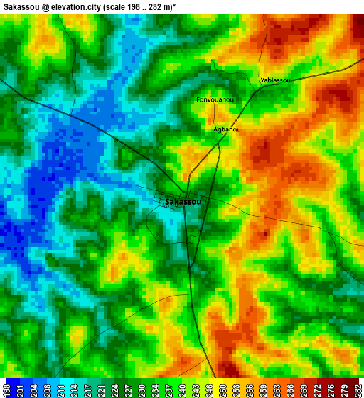
Below is the Elevation map of Sakassou, which displays elevation range with different colors. Scale of the first map is from 198 to 282 m (650 to 925 ft) with average elevation of 234.7 meters (=770 ft) [note 1]
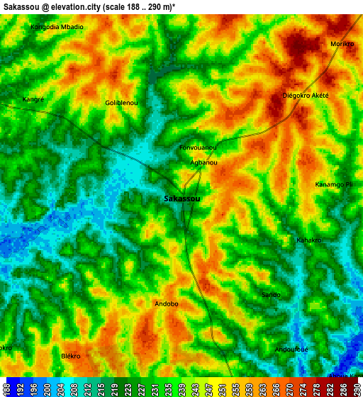
These maps also provides idea of topography and contour of this city, they are displayed at different zoom levels. More info about maps, scale and edge coordinates you can find below images.
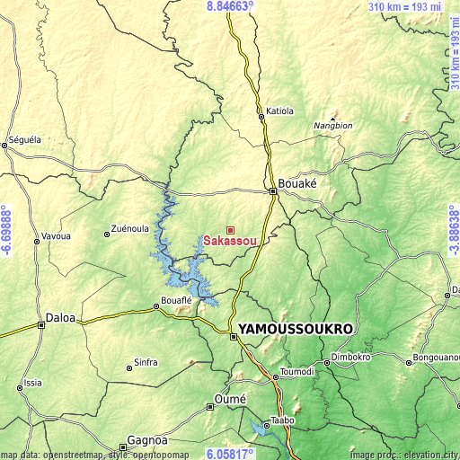
| \ | Map #1 | Map #2 | Topo.Map |
| Scale [m] | 198..282 m | 188..290 m | × |
| Scale [ft] | 650..925 ft | 617..951 ft | × |
| Average | 234.7 m = 770 ft | 236.5 m = 776 ft | × |
| Width | 9.69 km = 6 mi | 19.38 km = 12 mi | 310 km = 192.6 mi |
| Height | 9.69 km = 6 mi | 19.38 km = 12 mi | 310.1 km = 192.7 mi |
| ↑Max Latitude | 7.498192° | 7.541759° | 8.84663° |
| Latitude at center | 7.45462° | 7.45462° | 7.45462° |
| ↓Min Latitude | 7.411044° | 7.367464° | 6.05817° |
| ← Min Longitude | -5.336575° | -5.380521° | -6.69888° |
| Longitude center | -5.29263° | -5.29263° | -5.29263° |
| →Max Longitude | -5.248685° | -5.204739° | -3.88638° |
Nearby cities:
Cities around Sakassou sort by population:
• Bouaké elevation 339 m
39.3 km,  47°
47°
• Yamoussoukro 214 m
70.5 km,  178°
178°
• Bouaflé 208 m
71.7 km,  223°
223°
• Katiola 326 m
78.8 km,  15°
15°
• Zuénoula 207 m
83.6 km,  268°
268°
• Béoumi 226 m
40 km,  307°
307°
• Botro 261 m
44.3 km,  357°
357°
• Attiégouakro 212 m
78.2 km,  165°
165°
• Kounahiri 301 m
70.5 km,  302°
302°
• Kouassi-Kouassikro 238 m
69 km,  100°
100°
• Didiévi 172 m
56.6 km,  129°
129°
• Tiébissou 194 m
33.8 km, 167°
Multilingual:
 En español:
Sakassou elevación 231 m.
 En France:
Sakassou élévation 231 m.
 Auf Deutsch:
Sakassou höhe über dem Meeresspiegel ist 231 m.

Sources and notes:
- [note 1] Map square and city borders are not equal. Map elevation data is calculated only from area inside that square.
- [src 1] Elevation data from geonames database provided with same terms of usage.
- [src 2] The elevation map of Sakassou is generated using elevation data from NASA's 3 arcsec (90m) resolution SRTM data.
- [src 3] Base (background) map © OpenStreetMap contributors tiles are generated by Geofabrik and OpenTopoMap.
Copyright & License:
This Sakassou Elevation Map is licensed under CC BY-SA. You may reuse any part from this page, if you give a proper credit by linking to this URL:
 More info on terms of use page.