Duekoué elevation
Duekoué (Montagnes), Ivory Coast elevation is 231 meters and Duekoué elevation in feet is 758 ft above sea level [src 1]. Duekoué is a seat of a second-order administrative division (feature code) with elevation that is 2 meters (7 ft) bigger than average city elevation in Ivory Coast.
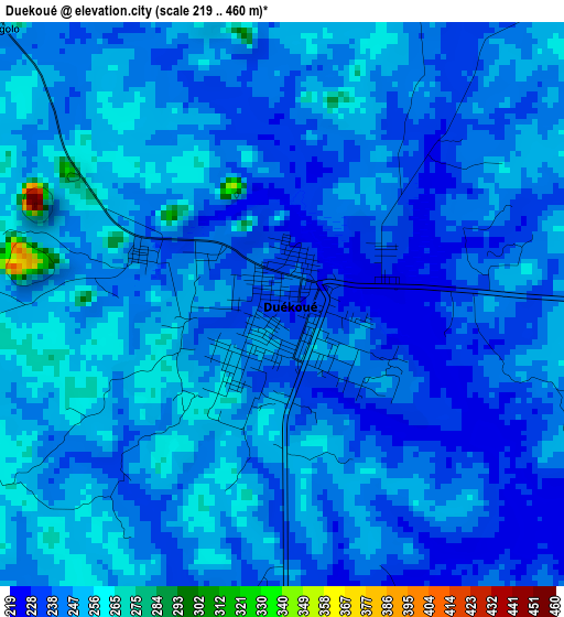
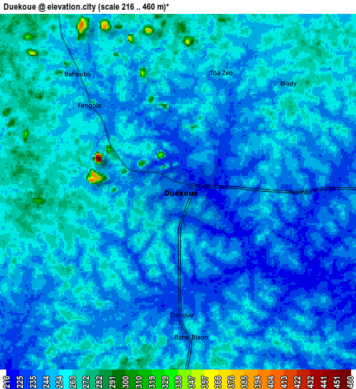
Below is the Elevation map of Duekoué, which displays elevation range with different colors. Scale of the first map is from 219 to 460 m (719 to 1509 ft) with average elevation of 244.2 meters (=801 ft) [note 1]
These maps also provides idea of topography and contour of this city, they are displayed at different zoom levels. More info about maps, scale and edge coordinates you can find below images.
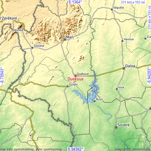
| \ | Map #1 | Map #2 | Topo.Map |
| Scale [m] | 219..460 m | 216..460 m | × |
| Scale [ft] | 719..1509 ft | 709..1509 ft | × |
| Average | 244.2 m = 801 ft | 249.4 m = 818 ft | × |
| Width | 9.7 km = 6 mi | 19.41 km = 12.1 mi | 310.5 km = 192.9 mi |
| Height | 9.7 km = 6 mi | 19.41 km = 12.1 mi | 310.6 km = 193 mi |
| ↑Max Latitude | 6.785659° | 6.829295° | 8.1364° |
| Latitude at center | 6.74202° | 6.74202° | 6.74202° |
| ↓Min Latitude | 6.698377° | 6.654729° | 5.34362° |
| ← Min Longitude | -7.393125° | -7.437071° | -8.75543° |
| Longitude center | -7.34918° | -7.34918° | -7.34918° |
| →Max Longitude | -7.305235° | -7.261289° | -5.94293° |
Nearby cities:
Cities around Duekoué sort by population:
• Daloa elevation 262 m
100.4 km,  81°
81°
• Man 329 m
77.9 km,  343°
343°
• Issia 211 m
88.8 km,  108°
108°
• Guiglo 212 m
27.2 km,  215°
215°
• Bangolo 264 m
33.7 km,  333°
333°
• Taï 166 m
97.3 km,  186°
186°
• Zouan-Hounien 266 m
96.7 km,  281°
281°
• Bloléquin 255 m
74.7 km,  255°
255°
• Facobly 322 m
71.9 km,  357°
357°
• Buyo 229 m
64.9 km,  143°
143°
• Kouibly 307 m
58.5 km,  12°
12°
• Zoukougbeu 244 m
53.6 km,  87°
87°
Multilingual:
 En español:
Duekoué elevación 231 m.
 En France:
Duekoué élévation 231 m.


Sources and notes:
- [note 1] Map square and city borders are not equal. Map elevation data is calculated only from area inside that square.
- [src 1] Elevation data from geonames database provided with same terms of usage.
- [src 2] The elevation map of Duekoué is generated using elevation data from NASA's 3 arcsec (90m) resolution SRTM data.
- [src 3] Base (background) map © OpenStreetMap contributors tiles are generated by Geofabrik and OpenTopoMap.
Copyright & License:
This Duekoué Elevation Map is licensed under CC BY-SA. You may reuse any part from this page, if you give a proper credit by linking to this URL:
 More info on terms of use page.