Urdorf / Bodenfeld elevation
Urdorf / Bodenfeld (Zurich, Bezirk Dietikon), Switzerland elevation is 410 meters and Urdorf / Bodenfeld elevation in feet is 1345 ft above sea level [src 1]. Urdorf / Bodenfeld is a section of populated place (feature code) with elevation that is 138 meters (453 ft) smaller than average city elevation in Switzerland.
Below is the Elevation map of Urdorf / Bodenfeld, which displays elevation range with different colors. Scale of the first map is from 379 to 655 m (1243 to 2149 ft) with average elevation of 467.2 meters (=1533 ft) [note 1]
These maps also provides idea of topography and contour of this city, they are displayed at different zoom levels. More info about maps, scale and edge coordinates you can find below images.
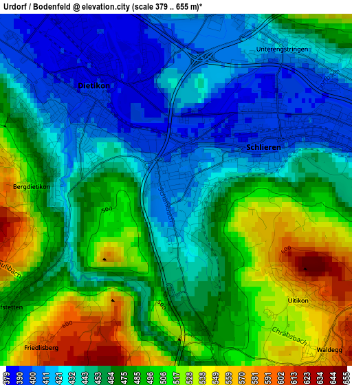
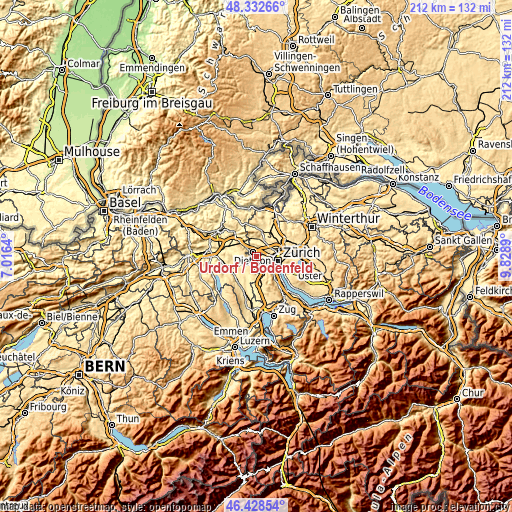
| \ | Map #1 | Topo.Map |
| Scale [m] | 379..655 m | × |
| Scale [ft] | 1243..2149 ft | × |
| Average | 467.2 m = 1533 ft | × |
| Width | 6.62 km = 4.1 mi | 211.7 km = 131.5 mi |
| Height | 6.62 km = 4.1 mi | 211.7 km = 131.5 mi |
| ↑Max Latitude | 47.418943° | 48.33266° |
| Latitude at center | 47.3892° | 47.3892° |
| ↓Min Latitude | 47.35944° | 46.42854° |
| ← Min Longitude | 8.378705° | 7.0164° |
| Longitude center | 8.42265° | 8.42265° |
| →Max Longitude | 8.466595° | 9.8289° |
Nearby cities:
Cities around Urdorf / Bodenfeld sort by population:
• Schlieren elevation 399 m
2.1 km,  66°
66°
• Urdorf 424 m
0.5 km,  152°
152°
• Dietikon / Hofacker 393 m
1 km,  330°
330°
• Schlieren / Spital 410 m
0.9 km,  42°
42°
• Dietikon / Kreuzacker 407 m
1.9 km,  304°
304°
• Dietikon / Guggenbühl 389 m
1.6 km,  318°
318°
• Urdorf / Moos 426 m
0.5 km,  82°
82°
• Dietikon / Schönenwerd 396 m
0.9 km,  14°
14°
• Schlieren / Freiestrasse 398 m
1.6 km,  62°
62°
• Schlieren / Zentrum 397 m
2.1 km, 63°
• Schlieren / Kamp 416 m
1.7 km, 73°
• Urdorf / Oberurdorf 421 m
0.9 km,  176°
176°
Multilingual:
 En español:
Urdorf / Bodenfeld elevación 410 m.
 En France:
Urdorf / Bodenfeld élévation 410 m.
 Auf Deutsch:
Urdorf / Bodenfeld höhe über dem Meeresspiegel ist 410 m.
 На русском:
Urdorf / Bodenfeld высота над уровнем моря 410 м
Sources and notes:
- [note 1] Map square and city borders are not equal. Map elevation data is calculated only from area inside that square.
- [src 1] Elevation data from geonames database provided with same terms of usage.
- [src 2] The elevation map of Urdorf / Bodenfeld is generated using elevation data from NASA's 3 arcsec (90m) resolution SRTM data.
- [src 3] Base (background) map © OpenStreetMap contributors tiles are generated by Geofabrik and OpenTopoMap.
Copyright & License:
This Urdorf / Bodenfeld Elevation Map is licensed under CC BY-SA. You may reuse any part from this page, if you give a proper credit by linking to this URL:
 More info on terms of use page.