Urdorf elevation
Urdorf (Zurich, Bezirk Dietikon), Switzerland elevation is 424 meters and Urdorf elevation in feet is 1391 ft above sea level [src 1]. Urdorf is a populated place (feature code) with elevation that is 124 meters (407 ft) smaller than average city elevation in Switzerland.
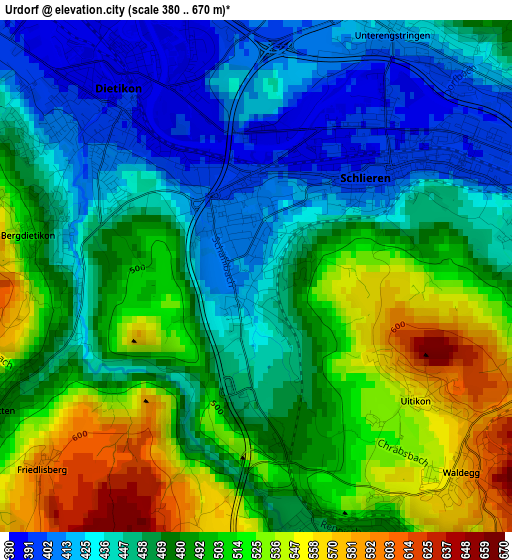
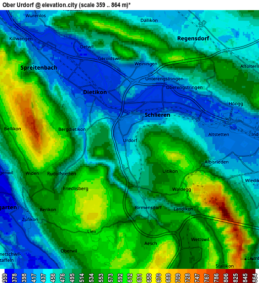
Below is the Elevation map of Urdorf, which displays elevation range with different colors. Scale of the first map is from 380 to 670 m (1247 to 2198 ft) with average elevation of 476.9 meters (=1565 ft) [note 1]
These maps also provides idea of topography and contour of this city, they are displayed at different zoom levels. More info about maps, scale and edge coordinates you can find below images.
| \ | Map #1 | Map #2 | Topo.Map |
| Scale [m] | 380..670 m | 359..864 m | × |
| Scale [ft] | 1247..2198 ft | 1178..2835 ft | × |
| Average | 476.9 m = 1565 ft | 505.8 m = 1659 ft | × |
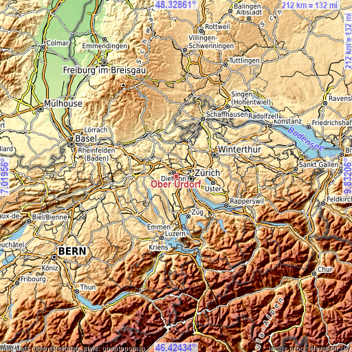
| Width | 6.62 km = 4.1 mi | 13.23 km = 8.2 mi | 211.7 km = 131.5 mi |
| Height | 6.62 km = 4.1 mi | 13.23 km = 8.2 mi | 211.7 km = 131.5 mi |
| ↑Max Latitude | 47.414816° | 47.444544° | 48.32861° |
| Latitude at center | 47.38507° | 47.38507° | 47.38507° |
| ↓Min Latitude | 47.355308° | 47.325529° | 46.42434° |
| ← Min Longitude | 8.381865° | 8.337919° | 7.01956° |
| Longitude center | 8.42581° | 8.42581° | 8.42581° |
| →Max Longitude | 8.469755° | 8.513701° | 9.83206° |
Nearby cities:
Cities around Urdorf sort by population:
• Schlieren elevation 399 m
2.1 km,  51°
51°
• Dietikon / Hofacker 393 m
1.5 km,  331°
331°
• Schlieren / Spital 410 m
1.1 km,  17°
17°
• Schlieren / Engstingerquartier 392 m
2.4 km,  33°
33°
• Urdorf / Bodenfeld 410 m
0.5 km, 332°
• Dietikon / Guggenbühl 389 m
2.1 km,  321°
321°
• Urdorf / Moos 426 m
0.6 km, 23°
• Dietikon / Schönenwerd 396 m
1.3 km,  359°
359°
• Schlieren / Freiestrasse 398 m
1.7 km, 45°
• Schlieren / Zentrum 397 m
2.2 km, 49°
• Schlieren / Kamp 416 m
1.7 km,  56°
56°
• Urdorf / Oberurdorf 421 m
0.5 km,  200°
200°
Multilingual:
 En español:
Urdorf elevación 424 m.
 En France:
Urdorf élévation 424 m.


Sources and notes:
- [note 1] Map square and city borders are not equal. Map elevation data is calculated only from area inside that square.
- [src 1] Elevation data from geonames database provided with same terms of usage.
- [src 2] The elevation map of Urdorf is generated using elevation data from NASA's 3 arcsec (90m) resolution SRTM data.
- [src 3] Base (background) map © OpenStreetMap contributors tiles are generated by Geofabrik and OpenTopoMap.
Copyright & License:
This Urdorf Elevation Map is licensed under CC BY-SA. You may reuse any part from this page, if you give a proper credit by linking to this URL:
 More info on terms of use page.