Horgen / Allmend elevation
Horgen / Allmend (Zurich, Bezirk Horgen), Switzerland elevation is 515 meters and Horgen / Allmend elevation in feet is 1690 ft above sea level [src 1]. Horgen / Allmend is a section of populated place (feature code) with elevation that is 33 meters (108 ft) smaller than average city elevation in Switzerland.
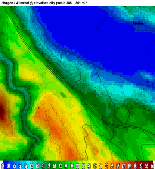
Below is the Elevation map of Horgen / Allmend, which displays elevation range with different colors. Scale of the first map is from 388 to 861 m (1273 to 2825 ft) with average elevation of 539.1 meters (=1769 ft) [note 1]
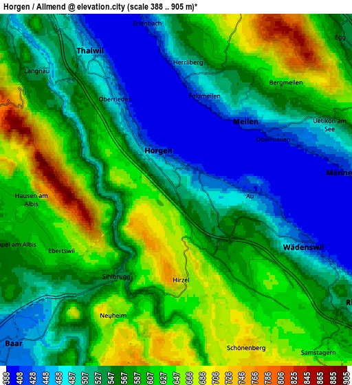
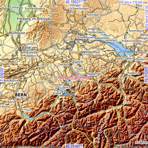
These maps also provides idea of topography and contour of this city, they are displayed at different zoom levels. More info about maps, scale and edge coordinates you can find below images.
| \ | Map #1 | Map #2 | Topo.Map |
| Scale [m] | 388..861 m | 388..905 m | × |
| Scale [ft] | 1273..2825 ft | 1273..2969 ft | × |
| Average | 539.1 m = 1769 ft | 565.8 m = 1856 ft | × |
| Width | 6.63 km = 4.1 mi | 13.27 km = 8.2 mi | 212.3 km = 131.9 mi |
| Height | 6.63 km = 4.1 mi | 13.27 km = 8.2 mi | 212.3 km = 131.9 mi |
| ↑Max Latitude | 47.277113° | 47.30692° | 48.19331° |
| Latitude at center | 47.24729° | 47.24729° | 47.24729° |
| ↓Min Latitude | 47.21745° | 47.187593° | 46.28407° |
| ← Min Longitude | 8.562655° | 8.518709° | 7.20035° |
| Longitude center | 8.6066° | 8.6066° | 8.6066° |
| →Max Longitude | 8.650545° | 8.694491° | 10.01285° |
Nearby cities:
Cities around Horgen / Allmend sort by population:
• Horgen elevation 419 m
1.5 km,  334°
334°
• Horgen / Horgen (Dorfkern) 449 m
1 km,  338°
338°
• Au 478 m
2.9 km,  102°
102°
• Meilen 464 m
4.1 km,  47°
47°
• Oberrieden 464 m
3.7 km,  324°
324°
• Feldmeilen 444 m
3.7 km,  17°
17°
• Horgen / Scheller-Stockerstrasse 422 m
2.5 km, 325°
• Au / Mittel-Dorf 460 m
3 km, 99°
• Horgen / Oberdorf 487 m
1.8 km,  314°
314°
• Oberrieden / Mitte 448 m
3.4 km, 324°
• Wädenswil / Hangenmoos 507 m
3.8 km,  113°
113°
• Au / Unter-Dorf 442 m
2 km,  89°
89°
Multilingual:
 En español:
Horgen / Allmend elevación 515 m.
 En France:
Horgen / Allmend élévation 515 m.
 Auf Deutsch:
Horgen / Allmend höhe über dem Meeresspiegel ist 515 m.

Sources and notes:
- [note 1] Map square and city borders are not equal. Map elevation data is calculated only from area inside that square.
- [src 1] Elevation data from geonames database provided with same terms of usage.
- [src 2] The elevation map of Horgen / Allmend is generated using elevation data from NASA's 3 arcsec (90m) resolution SRTM data.
- [src 3] Base (background) map © OpenStreetMap contributors tiles are generated by Geofabrik and OpenTopoMap.
Copyright & License:
This Horgen / Allmend Elevation Map is licensed under CC BY-SA. You may reuse any part from this page, if you give a proper credit by linking to this URL:
 More info on terms of use page.