Rümlang / Rümlang (Dorfkern) elevation
Rümlang / Rümlang (Dorfkern) (Zurich, Bezirk Dielsdorf), Switzerland elevation is 445 meters and Rümlang / Rümlang (Dorfkern) elevation in feet is 1460 ft above sea level [src 1]. Rümlang / Rümlang (Dorfkern) is a section of populated place (feature code) with elevation that is 103 meters (338 ft) smaller than average city elevation in Switzerland.
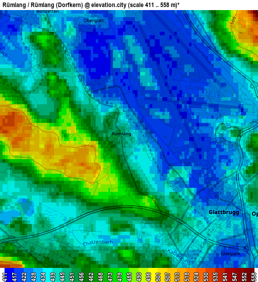
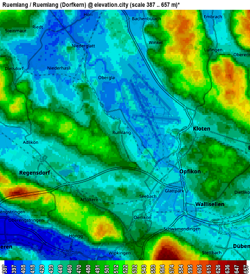
Below is the Elevation map of Rümlang / Rümlang (Dorfkern), which displays elevation range with different colors. Scale of the first map is from 411 to 558 m (1348 to 1831 ft) with average elevation of 444.7 meters (=1459 ft) [note 1]
These maps also provides idea of topography and contour of this city, they are displayed at different zoom levels. More info about maps, scale and edge coordinates you can find below images.
| \ | Map #1 | Map #2 | Topo.Map |
| Scale [m] | 411..558 m | 387..657 m | × |
| Scale [ft] | 1348..1831 ft | 1270..2156 ft | × |
| Average | 444.7 m = 1459 ft | 461.5 m = 1514 ft | × |
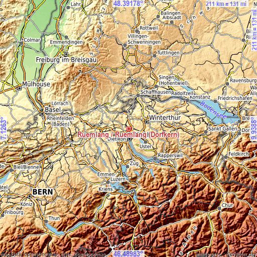
| Width | 6.61 km = 4.1 mi | 13.22 km = 8.2 mi | 211.5 km = 131.4 mi |
| Height | 6.61 km = 4.1 mi | 13.22 km = 8.2 mi | 211.5 km = 131.4 mi |
| ↑Max Latitude | 47.479109° | 47.508802° | 48.39178° |
| Latitude at center | 47.4494° | 47.4494° | 47.4494° |
| ↓Min Latitude | 47.419674° | 47.389931° | 46.48983° |
| ← Min Longitude | 8.488605° | 8.444659° | 7.1263° |
| Longitude center | 8.53255° | 8.53255° | 8.53255° |
| →Max Longitude | 8.576495° | 8.620441° | 9.9388° |
Nearby cities:
Cities around Rümlang / Rümlang (Dorfkern) sort by population:
• Zürich (Kreis 11) elevation 445 m
3 km,  195°
195°
• Zürich (Kreis 11) / Seebach 436 m
3.3 km,  159°
159°
• Rümlang 448 m
0.2 km,  299°
299°
• Oberglatt 430 m
3.1 km,  340°
340°
• Glattbrugg 431 m
3 km,  131°
131°
• Kloten / Holberg 465 m
3.3 km,  95°
95°
• Glattbrugg / Rohr/Platten-Balsberg 429 m
2.9 km,  118°
118°
• Glattbrugg / Wydacker/Bettacker/Lättenwiesen 434 m
3.4 km, 131°
• Oberglatt / Oberglatt (Dorfkern) 430 m
3.1 km, 341°
• Kloten / Balsberg 462 m
3.3 km, 103°
• Oberglatt / Bahnhofquartier 428 m
2.9 km,  328°
328°
• Zürich (Kreis 11) / Schwandenholz 441 m
2.9 km, 197°
Multilingual:
 En español:
Rümlang / Rümlang (Dorfkern) elevación 445 m.
 En France:
Rümlang / Rümlang (Dorfkern) élévation 445 m.
 Auf Deutsch:
Rümlang / Rümlang (Dorfkern) höhe über dem Meeresspiegel ist 445 m.
 На русском:
Rümlang / Rümlang (Dorfkern) высота над уровнем моря 445 м
Sources and notes:
- [note 1] Map square and city borders are not equal. Map elevation data is calculated only from area inside that square.
- [src 1] Elevation data from geonames database provided with same terms of usage.
- [src 2] The elevation map of Rümlang / Rümlang (Dorfkern) is generated using elevation data from NASA's 3 arcsec (90m) resolution SRTM data.
- [src 3] Base (background) map © OpenStreetMap contributors tiles are generated by Geofabrik and OpenTopoMap.
Copyright & License:
This Rümlang / Rümlang (Dorfkern) Elevation Map is licensed under CC BY-SA. You may reuse any part from this page, if you give a proper credit by linking to this URL:
 More info on terms of use page.