Chêne-Bougeries elevation
Chêne-Bougeries (Geneva), Switzerland elevation is 423 meters and Chêne-Bougeries elevation in feet is 1388 ft above sea level [src 1]. Chêne-Bougeries is a populated place (feature code) with elevation that is 125 meters (410 ft) smaller than average city elevation in Switzerland.
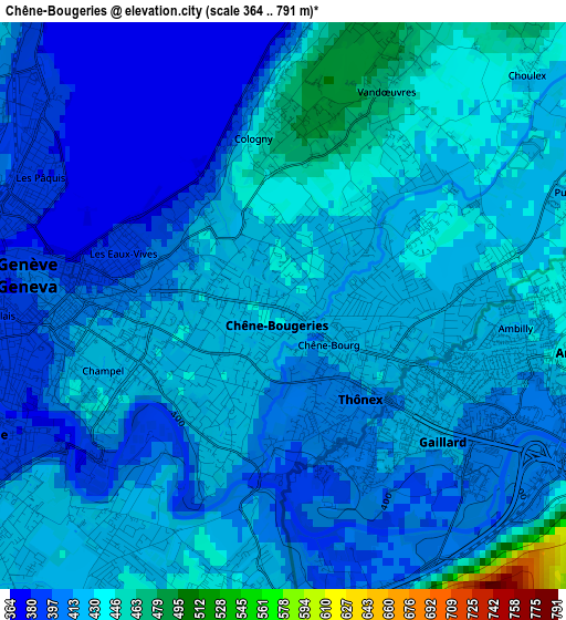
Below is the Elevation map of Chêne-Bougeries, which displays elevation range with different colors. Scale of the first map is from 364 to 791 m (1194 to 2595 ft) with average elevation of 416.9 meters (=1368 ft) [note 1]
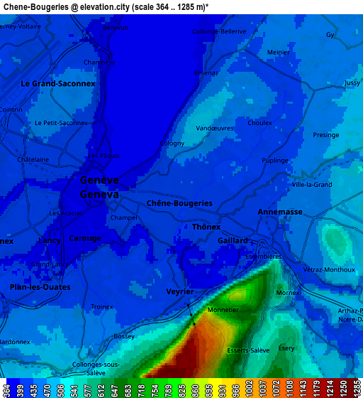
These maps also provides idea of topography and contour of this city, they are displayed at different zoom levels. More info about maps, scale and edge coordinates you can find below images.
| \ | Map #1 | Map #2 | Topo.Map |
| Scale [m] | 364..791 m | 364..1285 m | × |
| Scale [ft] | 1194..2595 ft | 1194..4216 ft | × |
| Average | 416.9 m = 1368 ft | 460.2 m = 1510 ft | × |
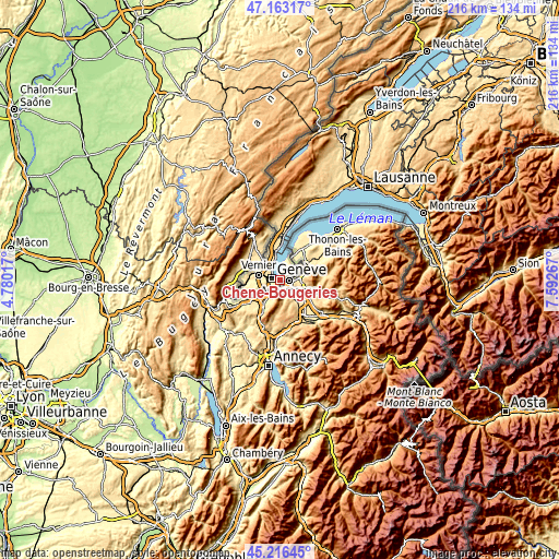
| Width | 6.76 km = 4.2 mi | 13.53 km = 8.4 mi | 216.5 km = 134.5 mi |
| Height | 6.76 km = 4.2 mi | 13.53 km = 8.4 mi | 216.4 km = 134.5 mi |
| ↑Max Latitude | 46.228839° | 46.259231° | 47.16317° |
| Latitude at center | 46.19843° | 46.19843° | 46.19843° |
| ↓Min Latitude | 46.168004° | 46.137562° | 45.21645° |
| ← Min Longitude | 6.142475° | 6.098529° | 4.78017° |
| Longitude center | 6.18642° | 6.18642° | 6.18642° |
| →Max Longitude | 6.230365° | 6.274311° | 7.59267° |
Nearby cities:
Cities around Chêne-Bougeries sort by population:
• Genève elevation 400 m
3.2 km,  277°
277°
• Lancy 421 m
5.6 km,  260°
260°
• Carouge 388 m
4.1 km,  241°
241°
• Thônex 408 m
1.5 km,  139°
139°
• Plan-les-Ouates 407 m
6.4 km, 237°
• Veyrier 424 m
3.5 km,  182°
182°
• Le Grand-Saconnex 450 m
6.3 km,  306°
306°
• Chêne-Bourg 422 m
0.7 km,  120°
120°
• Vandœuvres 461 m
2.9 km,  25°
25°
• Troinex 424 m
4.9 km,  217°
217°
• Puplinge 431 m
3.7 km,  68°
68°
• Meinier 442 m
6.5 km, 34°
Multilingual:
 En español:
Chêne-Bougeries elevación 423 m.
 En France:
Chêne-Bougeries élévation 423 m.
 Auf Deutsch:
Chêne-Bougeries höhe über dem Meeresspiegel ist 423 m.

Sources and notes:
- [note 1] Map square and city borders are not equal. Map elevation data is calculated only from area inside that square.
- [src 1] Elevation data from geonames database provided with same terms of usage.
- [src 2] The elevation map of Chêne-Bougeries is generated using elevation data from NASA's 3 arcsec (90m) resolution SRTM data.
- [src 3] Base (background) map © OpenStreetMap contributors tiles are generated by Geofabrik and OpenTopoMap.
Copyright & License:
This Chêne-Bougeries Elevation Map is licensed under CC BY-SA. You may reuse any part from this page, if you give a proper credit by linking to this URL:
 More info on terms of use page.