Genève elevation
Genève (Geneva), Switzerland elevation is 400 meters and Genève elevation in feet is 1312 ft above sea level [src 1]. Genève is a seat of a first-order administrative division (feature code) with elevation that is 148 meters (486 ft) smaller than average city elevation in Switzerland.
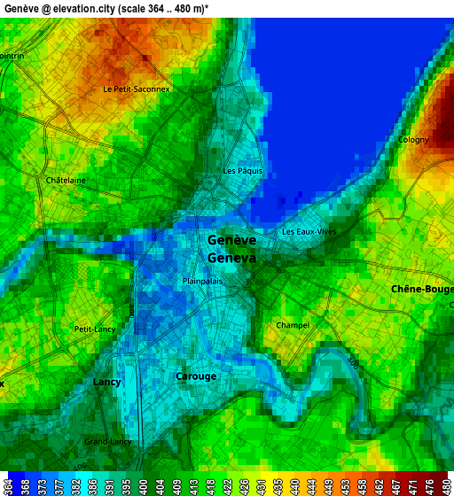
Below is the Elevation map of Genève, which displays elevation range with different colors. Scale of the first map is from 364 to 480 m (1194 to 1575 ft) with average elevation of 405.4 meters (=1330 ft) [note 1]
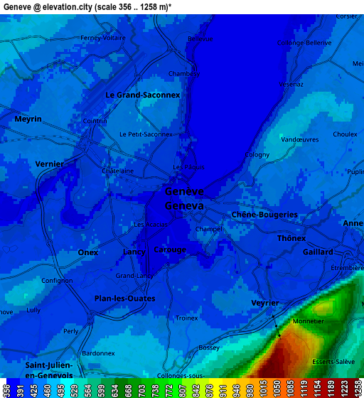
These maps also provides idea of topography and contour of this city, they are displayed at different zoom levels. More info about maps, scale and edge coordinates you can find below images.
| \ | Map #1 | Map #2 | Topo.Map |
| Scale [m] | 364..480 m | 356..1258 m | × |
| Scale [ft] | 1194..1575 ft | 1168..4127 ft | × |
| Average | 405.4 m = 1330 ft | 443.3 m = 1454 ft | × |
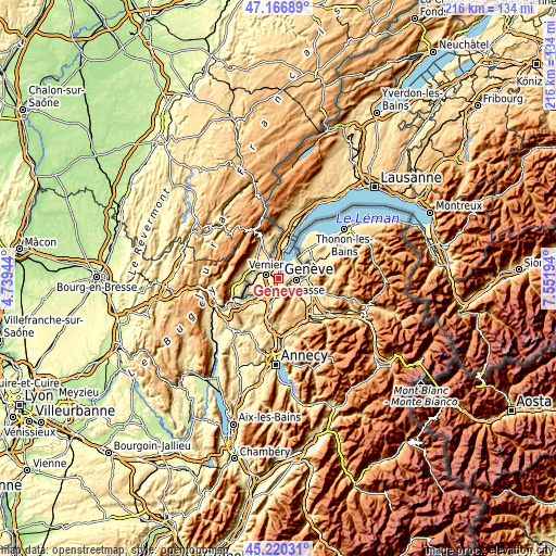
| Width | 6.76 km = 4.2 mi | 13.53 km = 8.4 mi | 216.4 km = 134.5 mi |
| Height | 6.76 km = 4.2 mi | 13.53 km = 8.4 mi | 216.4 km = 134.5 mi |
| ↑Max Latitude | 46.232627° | 46.263017° | 47.16689° |
| Latitude at center | 46.20222° | 46.20222° | 46.20222° |
| ↓Min Latitude | 46.171796° | 46.141356° | 45.22031° |
| ← Min Longitude | 6.101745° | 6.057799° | 4.73944° |
| Longitude center | 6.14569° | 6.14569° | 6.14569° |
| →Max Longitude | 6.189635° | 6.233581° | 7.55194° |
Nearby cities:
Cities around Genève sort by population:
• Lancy elevation 421 m
2.8 km,  240°
240°
• Carouge 388 m
2.4 km,  191°
191°
• Onex 426 m
3.9 km, 238°
• Thônex 408 m
4.4 km,  110°
110°
• Plan-les-Ouates 407 m
4.4 km,  210°
210°
• Chêne-Bougeries 423 m
3.2 km,  97°
97°
• Veyrier 424 m
4.9 km,  142°
142°
• Le Grand-Saconnex 450 m
3.8 km,  329°
329°
• Chêne-Bourg 422 m
3.8 km, 101°
• Les Avanchets 430 m
3.6 km,  306°
306°
• Vandœuvres 461 m
4.9 km,  63°
63°
• Troinex 424 m
4.3 km,  178°
178°
Multilingual:
 En español:
Ginebra elevación 400 m.
 En France:
Genève élévation 400 m.


Sources and notes:
- [note 1] Map square and city borders are not equal. Map elevation data is calculated only from area inside that square.
- [src 1] Elevation data from geonames database provided with same terms of usage.
- [src 2] The elevation map of Genève is generated using elevation data from NASA's 3 arcsec (90m) resolution SRTM data.
- [src 3] Base (background) map © OpenStreetMap contributors tiles are generated by Geofabrik and OpenTopoMap.
Copyright & License:
This Genève Elevation Map is licensed under CC BY-SA. You may reuse any part from this page, if you give a proper credit by linking to this URL:
 More info on terms of use page.