Begnins elevation
Begnins (Vaud, Nyon District), Switzerland elevation is 550 meters and Begnins elevation in feet is 1804 ft above sea level [src 1]. Begnins is a populated place (feature code) with elevation that is 2 meters (7 ft) bigger than average city elevation in Switzerland.
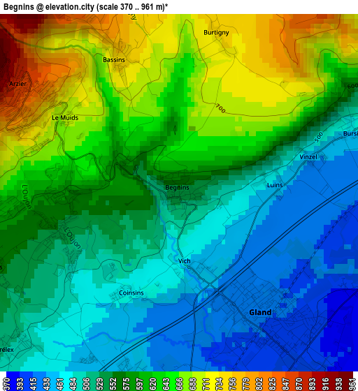
Below is the Elevation map of Begnins, which displays elevation range with different colors. Scale of the first map is from 370 to 961 m (1214 to 3153 ft) with average elevation of 570.2 meters (=1871 ft) [note 1]
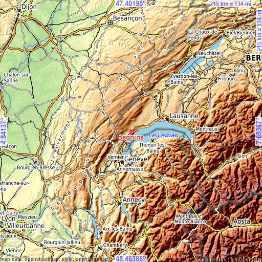
These maps also provides idea of topography and contour of this city, they are displayed at different zoom levels. More info about maps, scale and edge coordinates you can find below images.
| \ | Map #1 | Topo.Map |
| Scale [m] | 370..961 m | × |
| Scale [ft] | 1214..3153 ft | × |
| Average | 570.2 m = 1871 ft | × |
| Width | 6.73 km = 4.2 mi | 215.5 km = 133.9 mi |
| Height | 6.73 km = 4.2 mi | 215.5 km = 133.9 mi |
| ↑Max Latitude | 46.471794° | 47.40195° |
| Latitude at center | 46.44152° | 46.44152° |
| ↓Min Latitude | 46.411229° | 45.46386° |
| ← Min Longitude | 6.203675° | 4.84137° |
| Longitude center | 6.24762° | 6.24762° |
| →Max Longitude | 6.291565° | 7.65387° |
Nearby cities:
Cities around Begnins sort by population:
• Nyon elevation 401 m
6.5 km,  185°
185°
• Gland 416 m
2.9 km,  143°
143°
• Rolle 389 m
6.9 km,  74°
74°
• Prangins 413 m
5.2 km,  178°
178°
• Arzier 869 m
3.6 km,  303°
303°
• Saint-Cergue 1043 m
6.9 km,  274°
274°
• Genolier 546 m
2.4 km,  253°
253°
• Perroy 413 m
8.6 km, 70°
• Le Vaud 814 m
4.1 km,  347°
347°
• Trélex 499 m
4.2 km,  226°
226°
• Saint-George 940 m
8.1 km,  6°
6°
• Chéserex 502 m
7.3 km, 229°
Multilingual:
 En español:
Begnins elevación 550 m.
 En France:
Begnins élévation 550 m.


Sources and notes:
- [note 1] Map square and city borders are not equal. Map elevation data is calculated only from area inside that square.
- [src 1] Elevation data from geonames database provided with same terms of usage.
- [src 2] The elevation map of Begnins is generated using elevation data from NASA's 3 arcsec (90m) resolution SRTM data.
- [src 3] Base (background) map © OpenStreetMap contributors tiles are generated by Geofabrik and OpenTopoMap.
Copyright & License:
This Begnins Elevation Map is licensed under CC BY-SA. You may reuse any part from this page, if you give a proper credit by linking to this URL:
 More info on terms of use page.