Bellinzona elevation
Bellinzona (Ticino, Bellinzona District), Switzerland elevation is 230 meters and Bellinzona elevation in feet is 755 ft above sea level [src 1]. Bellinzona is a seat of a first-order administrative division (feature code) with elevation that is 318 meters (1043 ft) smaller than average city elevation in Switzerland.
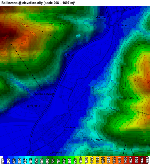
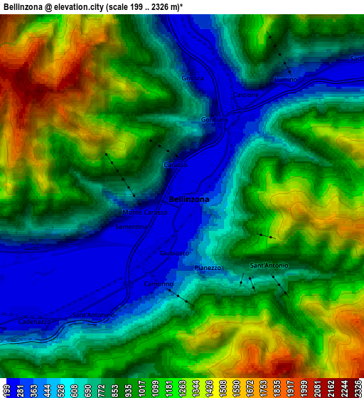
Below is the Elevation map of Bellinzona, which displays elevation range with different colors. Scale of the first map is from 208 to 1697 m (682 to 5568 ft) with average elevation of 567.5 meters (=1862 ft) [note 1]
These maps also provides idea of topography and contour of this city, they are displayed at different zoom levels. More info about maps, scale and edge coordinates you can find below images.
| \ | Map #1 | Map #2 | Topo.Map |
| Scale [m] | 208..1697 m | 199..2326 m | × |
| Scale [ft] | 682..5568 ft | 653..7631 ft | × |
| Average | 567.5 m = 1862 ft | 904.7 m = 2968 ft | × |
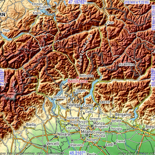
| Width | 6.76 km = 4.2 mi | 13.53 km = 8.4 mi | 216.5 km = 134.5 mi |
| Height | 6.76 km = 4.2 mi | 13.53 km = 8.4 mi | 216.5 km = 134.5 mi |
| ↑Max Latitude | 46.223192° | 46.253587° | 47.15762° |
| Latitude at center | 46.19278° | 46.19278° | 46.19278° |
| ↓Min Latitude | 46.162351° | 46.131905° | 45.2107° |
| ← Min Longitude | 8.973085° | 8.929139° | 7.61078° |
| Longitude center | 9.01703° | 9.01703° | 9.01703° |
| →Max Longitude | 9.060975° | 9.104921° | 10.42328° |
Nearby cities:
Cities around Bellinzona sort by population:
• Giubiasco elevation 244 m
2.4 km,  197°
197°
• Gordola 248 m
11.6 km,  264°
264°
• Sementina 242 m
2.2 km,  242°
242°
• Camorino 252 m
3.2 km, 195°
• Monte Carasso 238 m
1.6 km, 243°
• Claro 294 m
7.2 km,  3°
3°
• Cadenazzo 211 m
7.1 km,  229°
229°
• Lodrino 271 m
12.3 km,  346°
346°
• Cugnasco 226 m
8 km, 255°
• Lumino 259 m
5.5 km,  41°
41°
• Buseno 764 m
11.4 km, 37°
• Santa Maria in Calanca 949 m
12.5 km,  51°
51°
Multilingual:
 En español:
Bellinzona elevación 230 m.
 En France:
Bellinzone élévation 230 m.
 Auf Deutsch:
Bellinzona höhe über dem Meeresspiegel ist 230 m.

Sources and notes:
- [note 1] Map square and city borders are not equal. Map elevation data is calculated only from area inside that square.
- [src 1] Elevation data from geonames database provided with same terms of usage.
- [src 2] The elevation map of Bellinzona is generated using elevation data from NASA's 3 arcsec (90m) resolution SRTM data.
- [src 3] Base (background) map © OpenStreetMap contributors tiles are generated by Geofabrik and OpenTopoMap.
Copyright & License:
This Bellinzona Elevation Map is licensed under CC BY-SA. You may reuse any part from this page, if you give a proper credit by linking to this URL:
 More info on terms of use page.