Gordola elevation
Gordola (Ticino, Locarno District), Switzerland elevation is 248 meters and Gordola elevation in feet is 814 ft above sea level [src 1]. Gordola is a populated place (feature code) with elevation that is 300 meters (984 ft) smaller than average city elevation in Switzerland.
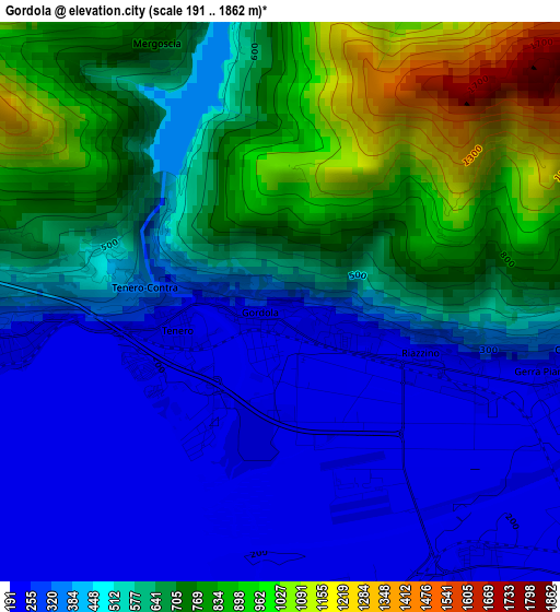
Below is the Elevation map of Gordola, which displays elevation range with different colors. Scale of the first map is from 191 to 1862 m (627 to 6109 ft) with average elevation of 547.8 meters (=1797 ft) [note 1]
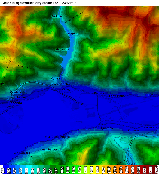
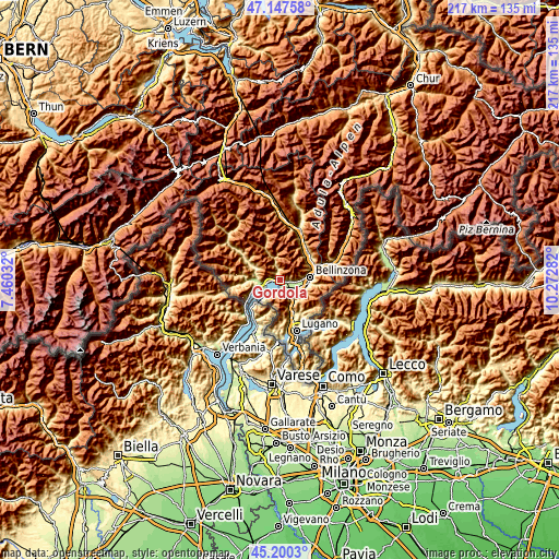
These maps also provides idea of topography and contour of this city, they are displayed at different zoom levels. More info about maps, scale and edge coordinates you can find below images.
| \ | Map #1 | Map #2 | Topo.Map |
| Scale [m] | 191..1862 m | 166..2392 m | × |
| Scale [ft] | 627..6109 ft | 545..7848 ft | × |
| Average | 547.8 m = 1797 ft | 830.3 m = 2724 ft | × |
| Width | 6.77 km = 4.2 mi | 13.53 km = 8.4 mi | 216.5 km = 134.5 mi |
| Height | 6.77 km = 4.2 mi | 13.53 km = 8.4 mi | 216.5 km = 134.5 mi |
| ↑Max Latitude | 46.212978° | 46.243379° | 47.14758° |
| Latitude at center | 46.18256° | 46.18256° | 46.18256° |
| ↓Min Latitude | 46.152125° | 46.121674° | 45.2003° |
| ← Min Longitude | 8.822625° | 8.778679° | 7.46032° |
| Longitude center | 8.86657° | 8.86657° | 8.86657° |
| →Max Longitude | 8.910515° | 8.954461° | 10.27282° |
Nearby cities:
Cities around Gordola sort by population:
• Locarno elevation 206 m
5.3 km,  255°
255°
• Minusio 243 m
4 km, 262°
• Losone 239 m
8.4 km, 259°
• Ascona 202 m
7.8 km,  246°
246°
• Muralto 221 m
5.1 km, 258°
• Sementina 242 m
9.6 km,  89°
89°
• Monte Carasso 238 m
10.2 km, 87°
• Cadenazzo 211 m
7.1 km,  118°
118°
• Magadino 197 m
3.8 km,  192°
192°
• Cugnasco 226 m
4 km,  102°
102°
• Lavertezzo 543 m
8.8 km,  345°
345°
• Verscio 272 m
10.3 km,  271°
271°
Multilingual:
 En español:
Gordola elevación 248 m.
 En France:
Gordola élévation 248 m.


Sources and notes:
- [note 1] Map square and city borders are not equal. Map elevation data is calculated only from area inside that square.
- [src 1] Elevation data from geonames database provided with same terms of usage.
- [src 2] The elevation map of Gordola is generated using elevation data from NASA's 3 arcsec (90m) resolution SRTM data.
- [src 3] Base (background) map © OpenStreetMap contributors tiles are generated by Geofabrik and OpenTopoMap.
Copyright & License:
This Gordola Elevation Map is licensed under CC BY-SA. You may reuse any part from this page, if you give a proper credit by linking to this URL:
 More info on terms of use page.