Belp elevation
Belp (Bern, Bern-Mittelland District), Switzerland elevation is 519 meters and Belp elevation in feet is 1703 ft above sea level [src 1]. Belp is a populated place (feature code) with elevation that is 29 meters (95 ft) smaller than average city elevation in Switzerland.
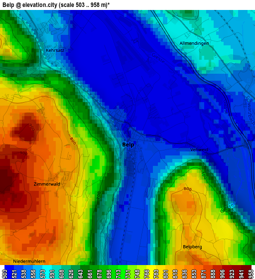
Below is the Elevation map of Belp, which displays elevation range with different colors. Scale of the first map is from 503 to 958 m (1650 to 3143 ft) with average elevation of 646.8 meters (=2122 ft) [note 1]
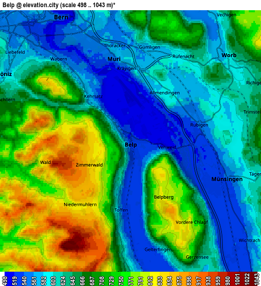
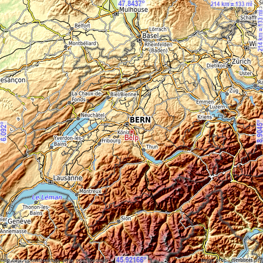
These maps also provides idea of topography and contour of this city, they are displayed at different zoom levels. More info about maps, scale and edge coordinates you can find below images.
| \ | Map #1 | Map #2 | Topo.Map |
| Scale [m] | 503..958 m | 498..1043 m | × |
| Scale [ft] | 1650..3143 ft | 1634..3422 ft | × |
| Average | 646.8 m = 2122 ft | 665.5 m = 2183 ft | × |
| Width | 6.68 km = 4.2 mi | 13.36 km = 8.3 mi | 213.7 km = 132.8 mi |
| Height | 6.68 km = 4.2 mi | 13.36 km = 8.3 mi | 213.7 km = 132.8 mi |
| ↑Max Latitude | 46.921313° | 46.951319° | 47.8437° |
| Latitude at center | 46.89129° | 46.89129° | 46.89129° |
| ↓Min Latitude | 46.86125° | 46.831193° | 45.92166° |
| ← Min Longitude | 7.454305° | 7.410359° | 6.092° |
| Longitude center | 7.49825° | 7.49825° | 7.49825° |
| →Max Longitude | 7.542195° | 7.586141° | 8.9045° |
Nearby cities:
Cities around Belp sort by population:
• Köniz elevation 577 m
7.3 km,  300°
300°
• Muri 558 m
4.5 km,  348°
348°
• Worb 585 m
6.5 km,  48°
48°
• Münsingen 539 m
5.2 km,  113°
113°
• Kehrsatz 572 m
3 km,  315°
315°
• Hermiswil 855 m
6.9 km,  193°
193°
• Rubigen 549 m
3.6 km,  76°
76°
• Toffen 531 m
3.5 km, 187°
• Ostermundigen 550 m
7.3 km,  355°
355°
• Rümligen 570 m
6.8 km,  181°
181°
• Tägertschi 605 m
6.8 km,  104°
104°
• Niedermuhlern 839 m
4.4 km,  213°
213°
Multilingual:
 En español:
Belp elevación 519 m.
 En France:
Belp élévation 519 m.


Sources and notes:
- [note 1] Map square and city borders are not equal. Map elevation data is calculated only from area inside that square.
- [src 1] Elevation data from geonames database provided with same terms of usage.
- [src 2] The elevation map of Belp is generated using elevation data from NASA's 3 arcsec (90m) resolution SRTM data.
- [src 3] Base (background) map © OpenStreetMap contributors tiles are generated by Geofabrik and OpenTopoMap.
Copyright & License:
This Belp Elevation Map is licensed under CC BY-SA. You may reuse any part from this page, if you give a proper credit by linking to this URL:
 More info on terms of use page.