Bülach elevation
Bülach (Zurich, Bezirk Bülach), Switzerland elevation is 419 meters and Bülach elevation in feet is 1375 ft above sea level [src 1]. Bülach is a seat of a second-order administrative division (feature code) with elevation that is 129 meters (423 ft) smaller than average city elevation in Switzerland.
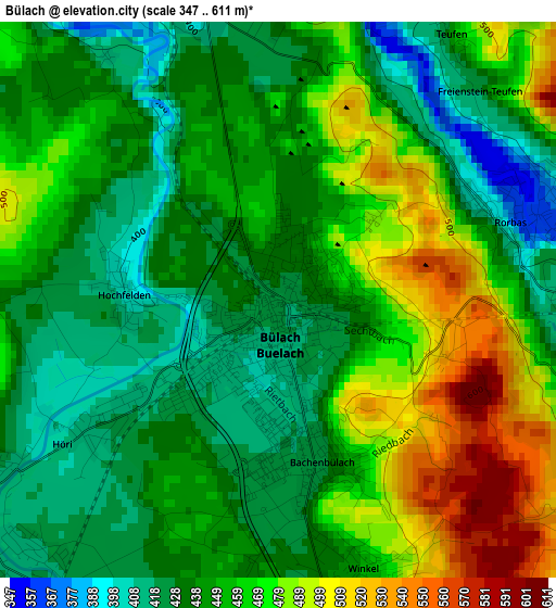
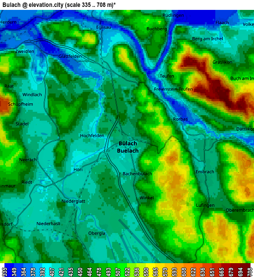
Below is the Elevation map of Bülach, which displays elevation range with different colors. Scale of the first map is from 347 to 611 m (1138 to 2005 ft) with average elevation of 453 meters (=1486 ft) [note 1]
These maps also provides idea of topography and contour of this city, they are displayed at different zoom levels. More info about maps, scale and edge coordinates you can find below images.
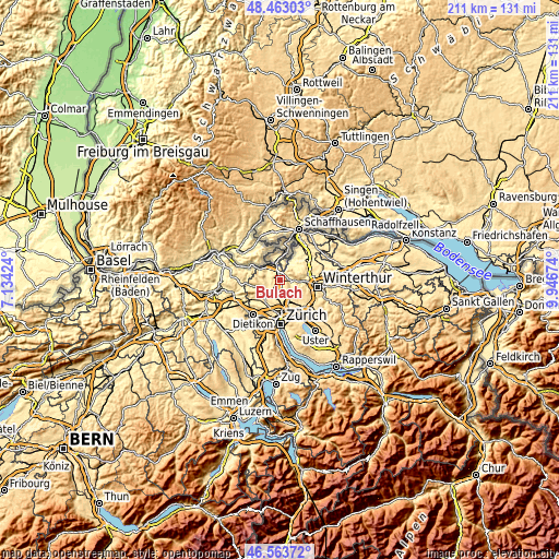
| \ | Map #1 | Map #2 | Topo.Map |
| Scale [m] | 347..611 m | 335..708 m | × |
| Scale [ft] | 1138..2005 ft | 1099..2323 ft | × |
| Average | 453 m = 1486 ft | 457.2 m = 1500 ft | × |
| Width | 6.6 km = 4.1 mi | 13.2 km = 8.2 mi | 211.2 km = 131.2 mi |
| Height | 6.6 km = 4.1 mi | 13.2 km = 8.2 mi | 211.2 km = 131.2 mi |
| ↑Max Latitude | 47.551638° | 47.58129° | 48.46303° |
| Latitude at center | 47.52197° | 47.52197° | 47.52197° |
| ↓Min Latitude | 47.492285° | 47.462583° | 46.56372° |
| ← Min Longitude | 8.496545° | 8.452599° | 7.13424° |
| Longitude center | 8.54049° | 8.54049° | 8.54049° |
| →Max Longitude | 8.584435° | 8.628381° | 9.94674° |
Nearby cities:
Cities around Bülach sort by population:
• Embrach elevation 425 m
4.4 km,  114°
114°
• Bachenbülach 427 m
2.1 km,  169°
169°
• Embrach / Embrach (Dorfkern) 427 m
4.5 km,  116°
116°
• Bülach / Seematt 424 m
0.7 km,  139°
139°
• Bülach / Gstückt 455 m
0.6 km,  75°
75°
• Rorbas 384 m
2.8 km,  69°
69°
• Freienstein 382 m
3.5 km, 69°
• Embrach / Kellersacker 430 m
3.9 km,  102°
102°
• Hochfelden 401 m
1.9 km,  272°
272°
• Bülach / Soligänter 430 m
0.5 km,  5°
5°
• Niederglatt / Niederglatt (Dorfkern) 419 m
4.6 km,  220°
220°
• Höri 419 m
2.6 km,  233°
233°
Multilingual:
 En español:
Bülach elevación 419 m.
 En France:
Bülach élévation 419 m.


Sources and notes:
- [note 1] Map square and city borders are not equal. Map elevation data is calculated only from area inside that square.
- [src 1] Elevation data from geonames database provided with same terms of usage.
- [src 2] The elevation map of Bülach is generated using elevation data from NASA's 3 arcsec (90m) resolution SRTM data.
- [src 3] Base (background) map © OpenStreetMap contributors tiles are generated by Geofabrik and OpenTopoMap.
Copyright & License:
This Bülach Elevation Map is licensed under CC BY-SA. You may reuse any part from this page, if you give a proper credit by linking to this URL:
 More info on terms of use page.