Effretikon elevation
Effretikon (Zurich, Bezirk Pfäffikon), Switzerland elevation is 506 meters and Effretikon elevation in feet is 1660 ft above sea level [src 1]. Effretikon is a section of populated place (feature code) with elevation that is 42 meters (138 ft) smaller than average city elevation in Switzerland.
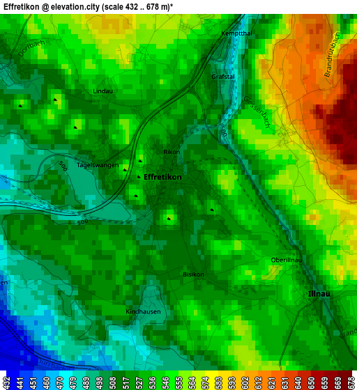
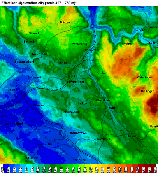
Below is the Elevation map of Effretikon, which displays elevation range with different colors. Scale of the first map is from 432 to 678 m (1417 to 2224 ft) with average elevation of 531.5 meters (=1744 ft) [note 1]
These maps also provides idea of topography and contour of this city, they are displayed at different zoom levels. More info about maps, scale and edge coordinates you can find below images.
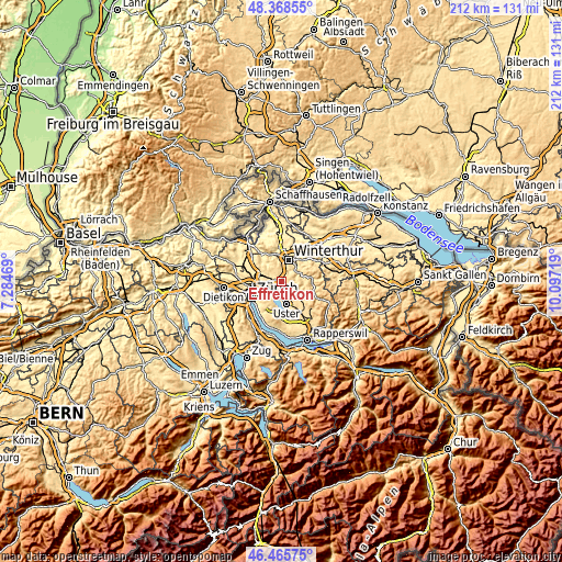
| \ | Map #1 | Map #2 | Topo.Map |
| Scale [m] | 432..678 m | 427..750 m | × |
| Scale [ft] | 1417..2224 ft | 1401..2461 ft | × |
| Average | 531.5 m = 1744 ft | 529.6 m = 1738 ft | × |
| Width | 6.61 km = 4.1 mi | 13.22 km = 8.2 mi | 211.6 km = 131.5 mi |
| Height | 6.61 km = 4.1 mi | 13.22 km = 8.2 mi | 211.6 km = 131.5 mi |
| ↑Max Latitude | 47.455473° | 47.485178° | 48.36855° |
| Latitude at center | 47.42575° | 47.42575° | 47.42575° |
| ↓Min Latitude | 47.396011° | 47.366254° | 46.46575° |
| ← Min Longitude | 8.646995° | 8.603049° | 7.28469° |
| Longitude center | 8.69094° | 8.69094° | 8.69094° |
| →Max Longitude | 8.734885° | 8.778831° | 10.09719° |
Nearby cities:
Cities around Effretikon sort by population:
• Hegnau elevation 451 m
4 km,  203°
203°
• Hegnau / Sunnebüel-Eich 460 m
3.8 km,  193°
193°
• Illnau 509 m
2.8 km,  125°
125°
• Volketswil / Volketswil (Dorf) 470 m
4 km,  180°
180°
• Effretikon / Watt 535 m
0.6 km,  65°
65°
• Nürensdorf 513 m
4 km,  308°
308°
• Wangen 442 m
3.8 km,  245°
245°
• Illnau / Unter-Illnau 506 m
3.3 km, 126°
• Effretikon / Rappenhalde-Bannhalde 519 m
0.5 km,  116°
116°
• Tagelswangen 515 m
1.5 km,  292°
292°
• Effretikon / Rikon 514 m
0.7 km,  328°
328°
• Kindhausen / Kindhausen (Dorf) 494 m
2.2 km, 195°
Multilingual:
 En español:
Effretikon elevación 506 m.
 En France:
Effretikon élévation 506 m.
 Auf Deutsch:
Effretikon höhe über dem Meeresspiegel ist 506 m.

Sources and notes:
- [note 1] Map square and city borders are not equal. Map elevation data is calculated only from area inside that square.
- [src 1] Elevation data from geonames database provided with same terms of usage.
- [src 2] The elevation map of Effretikon is generated using elevation data from NASA's 3 arcsec (90m) resolution SRTM data.
- [src 3] Base (background) map © OpenStreetMap contributors tiles are generated by Geofabrik and OpenTopoMap.
Copyright & License:
This Effretikon Elevation Map is licensed under CC BY-SA. You may reuse any part from this page, if you give a proper credit by linking to this URL:
 More info on terms of use page.