Illnau elevation
Illnau (Zurich, Bezirk Pfäffikon), Switzerland elevation is 509 meters and Illnau elevation in feet is 1670 ft above sea level [src 1]. Illnau is a populated place (feature code) with elevation that is 39 meters (128 ft) smaller than average city elevation in Switzerland.
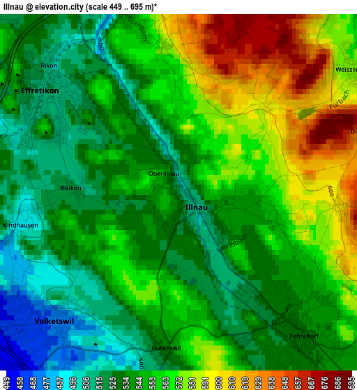
Below is the Elevation map of Illnau, which displays elevation range with different colors. Scale of the first map is from 449 to 695 m (1473 to 2280 ft) with average elevation of 550 meters (=1804 ft) [note 1]
These maps also provides idea of topography and contour of this city, they are displayed at different zoom levels. More info about maps, scale and edge coordinates you can find below images.
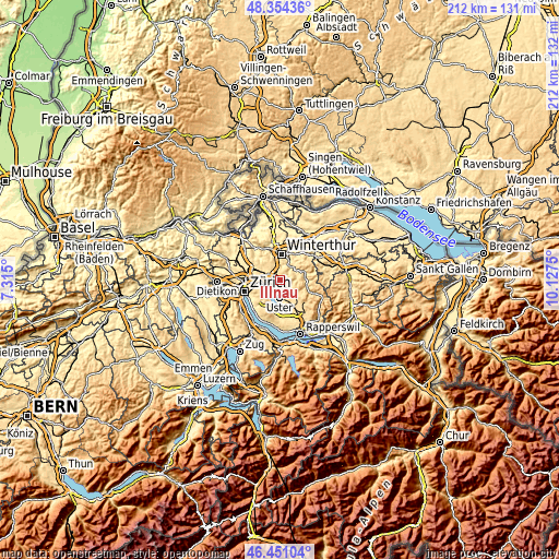
| \ | Map #1 | Topo.Map |
| Scale [m] | 449..695 m | × |
| Scale [ft] | 1473..2280 ft | × |
| Average | 550 m = 1804 ft | × |
| Width | 6.61 km = 4.1 mi | 211.6 km = 131.5 mi |
| Height | 6.61 km = 4.1 mi | 211.6 km = 131.5 mi |
| ↑Max Latitude | 47.441031° | 48.35436° |
| Latitude at center | 47.4113° | 47.4113° |
| ↓Min Latitude | 47.381552° | 46.45104° |
| ← Min Longitude | 8.677305° | 7.315° |
| Longitude center | 8.72125° | 8.72125° |
| →Max Longitude | 8.765195° | 10.1275° |
Nearby cities:
Cities around Illnau sort by population:
• Effretikon elevation 506 m
2.8 km,  305°
305°
• Fehraltorf 531 m
3.5 km,  139°
139°
• Hegnau / Sunnebüel-Eich 460 m
3.8 km,  236°
236°
• Volketswil / Volketswil (Dorf) 470 m
3.3 km,  224°
224°
• Effretikon / Watt 535 m
2.5 km,  316°
316°
• Illnau / Unter-Illnau 506 m
0.5 km, 136°
• Weisslingen 599 m
4.1 km,  58°
58°
• Effretikon / Rappenhalde-Bannhalde 519 m
2.3 km, 306°
• Tagelswangen 515 m
4.2 km,  300°
300°
• Gutenswil 531 m
3.1 km,  185°
185°
• Effretikon / Rikon 514 m
3.4 km, 309°
• Kindhausen / Kindhausen (Dorf) 494 m
2.9 km,  259°
259°
Multilingual:
 En español:
Illnau elevación 509 m.
 En France:
Illnau élévation 509 m.


Sources and notes:
- [note 1] Map square and city borders are not equal. Map elevation data is calculated only from area inside that square.
- [src 1] Elevation data from geonames database provided with same terms of usage.
- [src 2] The elevation map of Illnau is generated using elevation data from NASA's 3 arcsec (90m) resolution SRTM data.
- [src 3] Base (background) map © OpenStreetMap contributors tiles are generated by Geofabrik and OpenTopoMap.
Copyright & License:
This Illnau Elevation Map is licensed under CC BY-SA. You may reuse any part from this page, if you give a proper credit by linking to this URL:
 More info on terms of use page.