Hochdorf elevation
Hochdorf (Lucerne, Hochdorf District), Switzerland elevation is 491 meters and Hochdorf elevation in feet is 1611 ft above sea level [src 1]. Hochdorf is a seat of a second-order administrative division (feature code) with elevation that is 57 meters (187 ft) smaller than average city elevation in Switzerland.
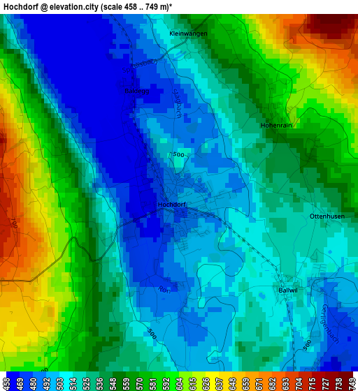
Below is the Elevation map of Hochdorf, which displays elevation range with different colors. Scale of the first map is from 458 to 749 m (1503 to 2457 ft) with average elevation of 538 meters (=1765 ft) [note 1]
These maps also provides idea of topography and contour of this city, they are displayed at different zoom levels. More info about maps, scale and edge coordinates you can find below images.
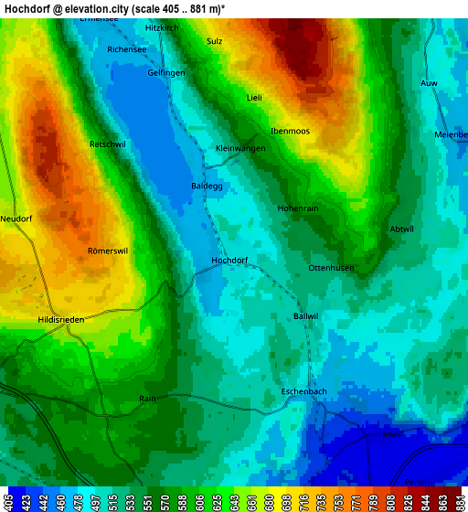
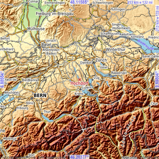
| \ | Map #1 | Map #2 | Topo.Map |
| Scale [m] | 458..749 m | 405..881 m | × |
| Scale [ft] | 1503..2457 ft | 1329..2890 ft | × |
| Average | 538 m = 1765 ft | 568.8 m = 1866 ft | × |
| Width | 6.64 km = 4.1 mi | 13.29 km = 8.3 mi | 212.6 km = 132.1 mi |
| Height | 6.64 km = 4.1 mi | 13.29 km = 8.3 mi | 212.6 km = 132.1 mi |
| ↑Max Latitude | 47.198278° | 47.228128° | 48.11585° |
| Latitude at center | 47.16841° | 47.16841° | 47.16841° |
| ↓Min Latitude | 47.138526° | 47.108624° | 46.20377° |
| ← Min Longitude | 8.247845° | 8.203899° | 6.88554° |
| Longitude center | 8.29179° | 8.29179° | 8.29179° |
| →Max Longitude | 8.335735° | 8.379681° | 9.69804° |
Nearby cities:
Cities around Hochdorf sort by population:
• Sempach elevation 516 m
8.4 km,  244°
244°
• Sins 425 m
8.2 km,  70°
70°
• Beromünster 637 m
8.6 km,  299°
299°
• Ballwil 502 m
2.8 km,  125°
125°
• Hitzkirch 499 m
6.5 km,  341°
341°
• Inwil 427 m
6.4 km,  138°
138°
• Hohenrain 604 m
2.4 km,  55°
55°
• Hildisrieden 681 m
5.4 km,  248°
248°
• Römerswil 723 m
3.5 km,  270°
270°
• Auw 485 m
7.3 km,  49°
49°
• Oberrüti 415 m
7.8 km,  91°
91°
• Neudorf 675 m
6.3 km,  278°
278°
Multilingual:
 En español:
Hochdorf elevación 491 m.
 En France:
Hochdorf élévation 491 m.
 Auf Deutsch:
Hochdorf höhe über dem Meeresspiegel ist 491 m.

Sources and notes:
- [note 1] Map square and city borders are not equal. Map elevation data is calculated only from area inside that square.
- [src 1] Elevation data from geonames database provided with same terms of usage.
- [src 2] The elevation map of Hochdorf is generated using elevation data from NASA's 3 arcsec (90m) resolution SRTM data.
- [src 3] Base (background) map © OpenStreetMap contributors tiles are generated by Geofabrik and OpenTopoMap.
Copyright & License:
This Hochdorf Elevation Map is licensed under CC BY-SA. You may reuse any part from this page, if you give a proper credit by linking to this URL:
 More info on terms of use page.