Hüttwilen elevation
Hüttwilen (Thurgau, Frauenfeld District), Switzerland elevation is 465 meters and Hüttwilen elevation in feet is 1526 ft above sea level [src 1]. Hüttwilen is a populated place (feature code) with elevation that is 83 meters (272 ft) smaller than average city elevation in Switzerland.
Below is the Elevation map of Hüttwilen, which displays elevation range with different colors. Scale of the first map is from 377 to 679 m (1237 to 2228 ft) with average elevation of 507.2 meters (=1664 ft) [note 1]
These maps also provides idea of topography and contour of this city, they are displayed at different zoom levels. More info about maps, scale and edge coordinates you can find below images.
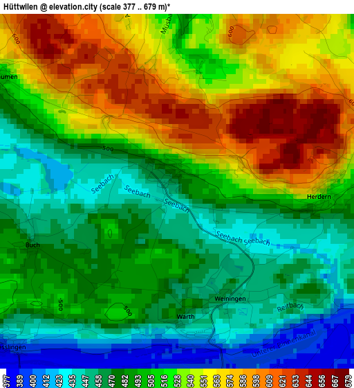
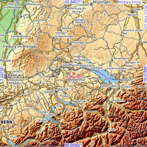
| \ | Map #1 | Topo.Map |
| Scale [m] | 377..679 m | × |
| Scale [ft] | 1237..2228 ft | × |
| Average | 507.2 m = 1664 ft | × |
| Width | 6.59 km = 4.1 mi | 210.8 km = 131 mi |
| Height | 6.59 km = 4.1 mi | 210.8 km = 131 mi |
| ↑Max Latitude | 47.63636° | 48.54627° |
| Latitude at center | 47.60674° | 47.60674° |
| ↓Min Latitude | 47.577103° | 46.65002° |
| ← Min Longitude | 8.829485° | 7.46718° |
| Longitude center | 8.87343° | 8.87343° |
| →Max Longitude | 8.917375° | 10.27968° |
Nearby cities:
Cities around Hüttwilen sort by population:
• Frauenfeld elevation 418 m
5.8 km,  160°
160°
• Gachnang 451 m
7.6 km,  191°
191°
• Steckborn 402 m
10.6 km,  51°
51°
• Stein am Rhein 408 m
5.9 km,  349°
349°
• Müllheim 411 m
9.8 km,  93°
93°
• Matzingen 445 m
10.7 km, 155°
• Pfyn 410 m
6.2 km,  100°
100°
• Wagenhausen 405 m
6.2 km,  342°
342°
• Eschenz 406 m
4.6 km,  1°
1°
• Homburg 606 m
10.5 km,  72°
72°
• Sulz 455 m
9.8 km,  220°
220°
• Thundorf 546 m
9.6 km,  134°
134°
Multilingual:
 En español:
Hüttwilen elevación 465 m.
 En France:
Hüttwilen élévation 465 m.
 Auf Deutsch:
Hüttwilen höhe über dem Meeresspiegel ist 465 m.

Sources and notes:
- [note 1] Map square and city borders are not equal. Map elevation data is calculated only from area inside that square.
- [src 1] Elevation data from geonames database provided with same terms of usage.
- [src 2] The elevation map of Hüttwilen is generated using elevation data from NASA's 3 arcsec (90m) resolution SRTM data.
- [src 3] Base (background) map © OpenStreetMap contributors tiles are generated by Geofabrik and OpenTopoMap.
Copyright & License:
This Hüttwilen Elevation Map is licensed under CC BY-SA. You may reuse any part from this page, if you give a proper credit by linking to this URL:
 More info on terms of use page.