Le Locle elevation
Le Locle (Neuchâtel, Le Locle District), Switzerland elevation is 934 meters and Le Locle elevation in feet is 3064 ft above sea level [src 1]. Le Locle is a seat of a second-order administrative division (feature code) with elevation that is 386 meters (1266 ft) bigger than average city elevation in Switzerland.
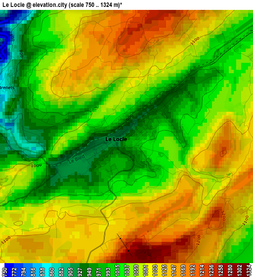
Below is the Elevation map of Le Locle, which displays elevation range with different colors. Scale of the first map is from 750 to 1324 m (2461 to 4344 ft) with average elevation of 1063.2 meters (=3488 ft) [note 1]
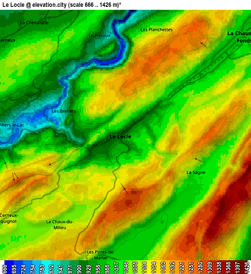
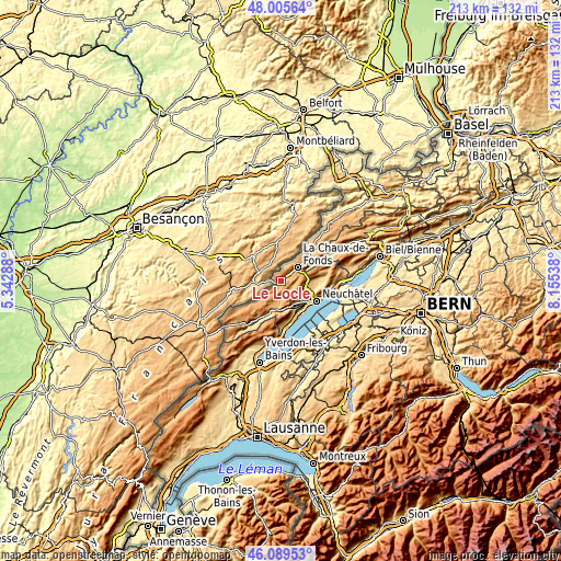
These maps also provides idea of topography and contour of this city, they are displayed at different zoom levels. More info about maps, scale and edge coordinates you can find below images.
| \ | Map #1 | Map #2 | Topo.Map |
| Scale [m] | 750..1324 m | 666..1426 m | × |
| Scale [ft] | 2461..4344 ft | 2185..4678 ft | × |
| Average | 1063.2 m = 3488 ft | 1071.5 m = 3515 ft | × |
| Width | 6.66 km = 4.1 mi | 13.32 km = 8.3 mi | 213.1 km = 132.4 mi |
| Height | 6.66 km = 4.1 mi | 13.32 km = 8.3 mi | 213 km = 132.4 mi |
| ↑Max Latitude | 47.086121° | 47.116035° | 48.00564° |
| Latitude at center | 47.05619° | 47.05619° | 47.05619° |
| ↓Min Latitude | 47.026242° | 46.996278° | 46.08953° |
| ← Min Longitude | 6.705185° | 6.661239° | 5.34288° |
| Longitude center | 6.74913° | 6.74913° | 6.74913° |
| →Max Longitude | 6.793075° | 6.837021° | 8.15538° |
Nearby cities:
Cities around Le Locle sort by population:
• La Chaux-de-Fonds elevation 995 m
7.6 km,  50°
50°
• Peseux 539 m
13.1 km,  125°
125°
• Boudry 446 m
13.6 km,  150°
150°
• Cernier 825 m
11.5 km,  88°
88°
• Chézard-Saint-Martin 744 m
14 km, 85°
• Fontainemelon 884 m
10.4 km, 90°
• Auvernier 434 m
13.3 km, 132°
• Les Geneveys-sur-Coffrane 856 m
9 km,  120°
120°
• Les Ponts-de-Martel 1007 m
6.7 km,  192°
192°
• Travers 732 m
14 km,  203°
203°
• Les Brenets 848 m
3.6 km,  290°
290°
• Rochefort 775 m
9.8 km, 152°
Multilingual:
 En español:
Le Locle elevación 934 m.
 En France:
Le Locle élévation 934 m.
 Auf Deutsch:
Le Locle höhe über dem Meeresspiegel ist 934 m.

Sources and notes:
- [note 1] Map square and city borders are not equal. Map elevation data is calculated only from area inside that square.
- [src 1] Elevation data from geonames database provided with same terms of usage.
- [src 2] The elevation map of Le Locle is generated using elevation data from NASA's 3 arcsec (90m) resolution SRTM data.
- [src 3] Base (background) map © OpenStreetMap contributors tiles are generated by Geofabrik and OpenTopoMap.
Copyright & License:
This Le Locle Elevation Map is licensed under CC BY-SA. You may reuse any part from this page, if you give a proper credit by linking to this URL:
 More info on terms of use page.