Peseux elevation
Peseux (Neuchâtel, Boudry District), Switzerland elevation is 539 meters and Peseux elevation in feet is 1768 ft above sea level [src 1]. Peseux is a populated place (feature code) with elevation that is 9 meters (30 ft) smaller than average city elevation in Switzerland.
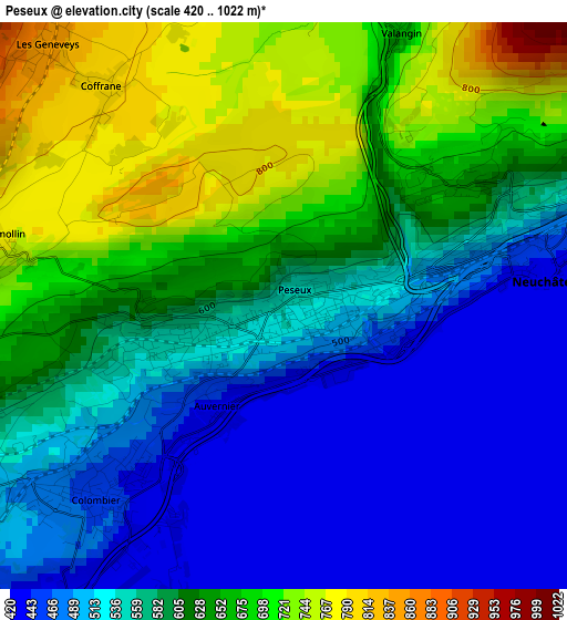
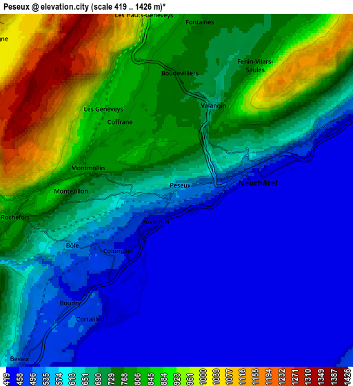
Below is the Elevation map of Peseux, which displays elevation range with different colors. Scale of the first map is from 420 to 1022 m (1378 to 3353 ft) with average elevation of 587.6 meters (=1928 ft) [note 1]
These maps also provides idea of topography and contour of this city, they are displayed at different zoom levels. More info about maps, scale and edge coordinates you can find below images.
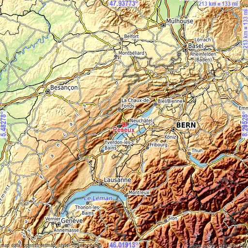
| \ | Map #1 | Map #2 | Topo.Map |
| Scale [m] | 420..1022 m | 419..1426 m | × |
| Scale [ft] | 1378..3353 ft | 1375..4678 ft | × |
| Average | 587.6 m = 1928 ft | 668 m = 2192 ft | × |
| Width | 6.67 km = 4.1 mi | 13.33 km = 8.3 mi | 213.3 km = 132.5 mi |
| Height | 6.67 km = 4.1 mi | 13.33 km = 8.3 mi | 213.3 km = 132.5 mi |
| ↑Max Latitude | 47.017009° | 47.046962° | 47.93773° |
| Latitude at center | 46.98704° | 46.98704° | 46.98704° |
| ↓Min Latitude | 46.957054° | 46.927051° | 46.01913° |
| ← Min Longitude | 6.845085° | 6.801139° | 5.48278° |
| Longitude center | 6.88903° | 6.88903° | 6.88903° |
| →Max Longitude | 6.932975° | 6.976921° | 8.29528° |
Nearby cities:
Cities around Peseux sort by population:
• Neuchâtel elevation 441 m
3.2 km,  80°
80°
• Boudry 446 m
5.7 km,  223°
223°
• Cortaillod 487 m
5.9 km,  214°
214°
• Marin-Epagnier 446 m
8.8 km,  72°
72°
• Bevaix 472 m
8.5 km, 221°
• Saint-Blaise 456 m
8.2 km, 67°
• Cernier 825 m
8 km,  6°
6°
• Fontainemelon 884 m
7.6 km,  358°
358°
• Auvernier 434 m
1.5 km, 210°
• Les Geneveys-sur-Coffrane 856 m
4.2 km,  317°
317°
• Grand-Savagnier 747 m
8.7 km,  35°
35°
• Rochefort 775 m
6.2 km,  260°
260°
Multilingual:
 En español:
Peseux elevación 539 m.
 En France:
Peseux élévation 539 m.


Sources and notes:
- [note 1] Map square and city borders are not equal. Map elevation data is calculated only from area inside that square.
- [src 1] Elevation data from geonames database provided with same terms of usage.
- [src 2] The elevation map of Peseux is generated using elevation data from NASA's 3 arcsec (90m) resolution SRTM data.
- [src 3] Base (background) map © OpenStreetMap contributors tiles are generated by Geofabrik and OpenTopoMap.
Copyright & License:
This Peseux Elevation Map is licensed under CC BY-SA. You may reuse any part from this page, if you give a proper credit by linking to this URL:
 More info on terms of use page.