Lyss elevation
Lyss (Bern, Seeland District), Switzerland elevation is 445 meters and Lyss elevation in feet is 1460 ft above sea level [src 1]. Lyss is a populated place (feature code) with elevation that is 103 meters (338 ft) smaller than average city elevation in Switzerland.
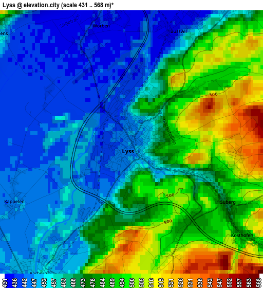
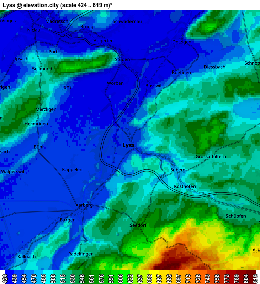
Below is the Elevation map of Lyss, which displays elevation range with different colors. Scale of the first map is from 431 to 568 m (1414 to 1864 ft) with average elevation of 470 meters (=1542 ft) [note 1]
These maps also provides idea of topography and contour of this city, they are displayed at different zoom levels. More info about maps, scale and edge coordinates you can find below images.
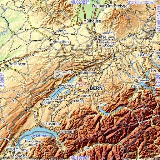
| \ | Map #1 | Map #2 | Topo.Map |
| Scale [m] | 431..568 m | 424..819 m | × |
| Scale [ft] | 1414..1864 ft | 1391..2687 ft | × |
| Average | 470 m = 1542 ft | 496.1 m = 1628 ft | × |
| Width | 6.66 km = 4.1 mi | 13.31 km = 8.3 mi | 213 km = 132.4 mi |
| Height | 6.66 km = 4.1 mi | 13.31 km = 8.3 mi | 213 km = 132.4 mi |
| ↑Max Latitude | 47.104021° | 47.133924° | 48.02323° |
| Latitude at center | 47.0741° | 47.0741° | 47.0741° |
| ↓Min Latitude | 47.044163° | 47.014208° | 46.10776° |
| ← Min Longitude | 7.262605° | 7.218659° | 5.9003° |
| Longitude center | 7.30655° | 7.30655° | 7.30655° |
| →Max Longitude | 7.350495° | 7.394441° | 8.7128° |
Nearby cities:
Cities around Lyss sort by population:
• Nidau elevation 437 m
7.6 km,  318°
318°
• Aarberg 458 m
4 km,  215°
215°
• Brügg 434 m
5.9 km,  339°
339°
• Schüpfen 532 m
6.8 km,  127°
127°
• Seedorf 566 m
4.4 km,  174°
174°
• Grossaffoltern 508 m
3.9 km,  104°
104°
• Orpund 437 m
7.2 km,  0°
0°
• Worben 439 m
3.3 km, 344°
• Kallnach 464 m
8 km, 222°
• Bellmund 504 m
6 km,  309°
309°
• Radelfingen 501 m
6.4 km,  204°
204°
• Kappelen 447 m
3.3 km,  241°
241°
Multilingual:
 En español:
Lyss elevación 445 m.
 En France:
Lyss élévation 445 m.


Sources and notes:
- [note 1] Map square and city borders are not equal. Map elevation data is calculated only from area inside that square.
- [src 1] Elevation data from geonames database provided with same terms of usage.
- [src 2] The elevation map of Lyss is generated using elevation data from NASA's 3 arcsec (90m) resolution SRTM data.
- [src 3] Base (background) map © OpenStreetMap contributors tiles are generated by Geofabrik and OpenTopoMap.
Copyright & License:
This Lyss Elevation Map is licensed under CC BY-SA. You may reuse any part from this page, if you give a proper credit by linking to this URL:
 More info on terms of use page.